File:Steiermark Perthes 1855.jpg
Jump to navigation
Jump to search
Size of this preview: 727 × 599 pixels. Other resolutions: 291 × 240 pixels | 582 × 480 pixels | 932 × 768 pixels | 1,242 × 1,024 pixels | 2,485 × 2,048 pixels | 6,358 × 5,241 pixels.
Original file (6,358 × 5,241 pixels, file size: 36.55 MB, MIME type: image/jpeg)
Captions
Captions
Add a one-line explanation of what this file represents
Summary
[edit]
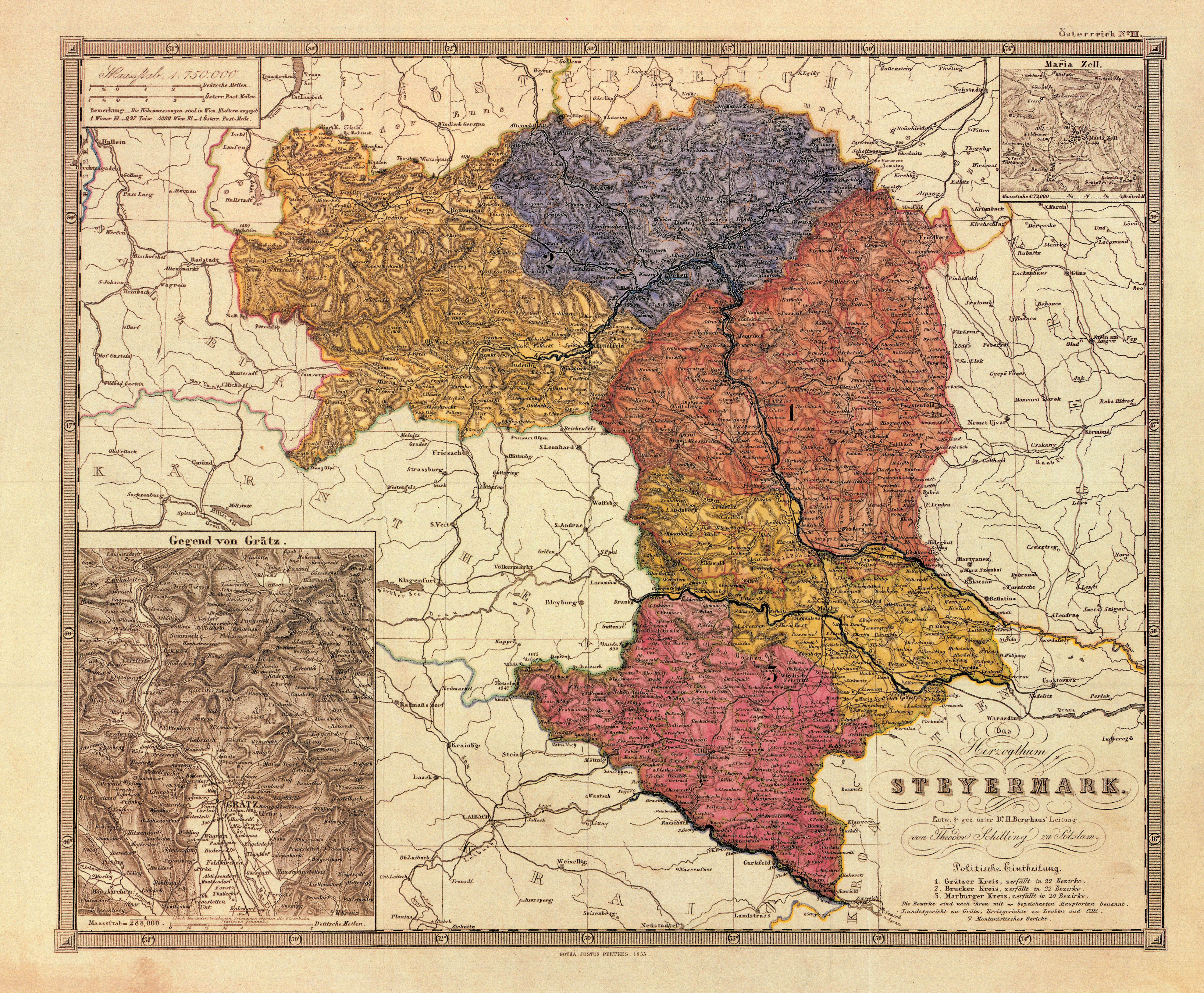
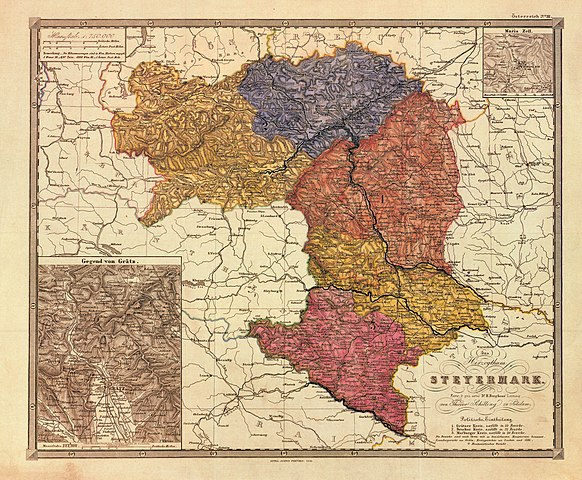
| Description | historische Landkarte: Das Herzogthum Steyermark. Entworfen und gezeichnet unter Dr. H. Berghaus' Leitung von Theodor Schilling zu Potsdam. Gotha. Justus Perthes 1855. Die Karte bezeichnet zwar farbig die fünf Kreise der Steiermark (Judenburger, Brucker, Grazer, Marburger und Cillier Kreis), führt aber (rechts unten) nur die drei Kreise der Kreisregierungen ab 1848 an: Die Zuständigkeitsbereiche dieser Verwaltungsbehörden umfassten (2) den Brucker und Judenburger Kreis, den (1) Grazer und nördlichen Teil des Marburger Kreises und (3) den südlichen Teil des Marburger Kreises und den Kreis Cilli (vgl. die Platzierung der jeweiligen Zahl, die sich nicht auf die farbige Auszeichnung, sondern auf die Zuständigkeitsbereiche bezieht). Auf diese Einteilung sind auch die Gerichtssprengel (Landesgericht Graz, Kreisgerichte Leoben und Cilli) zurückzuführen. Quelle: Walter Brunner: Landkarte des Herzogtums Steiermark mit den fünf Kreisen. Original im Steiermärkischen Landesarchiv. In: Helfried Valentinitsch [Hrsg.]: Steiermark Edition, Teil Grenzmark - Herzogtum - Bundesland. Blatt STE 01007. Archiv Verlag. Wien 1990 ff. |
| Date | |
| Source | steiermärkisches Landesarchiv |
| Author | Theodor Schilling, Verlag Perthes, Potsdam |
| Permission (Reusing this file) |
freies Werk aus 1855 nach Ablauf der Schutzfristen |
Licensing
[edit]
|
This work is in the public domain in its country of origin and other countries and areas where the copyright term is the author's life plus 70 years or fewer. | |
| This file has been identified as being free of known restrictions under copyright law, including all related and neighboring rights. | |
File history
Click on a date/time to view the file as it appeared at that time.
| Date/Time | Thumbnail | Dimensions | User | Comment | |
|---|---|---|---|---|---|
| current | 20:38, 30 June 2010 | | 6,358 × 5,241 (36.55 MB) | Josef Moser (talk | contribs) | {{Information |Description=historische Landkarte: Das Herzogthum Steyermark. Entworfen und gezeichnet unter Dr. H. Berghaus' Leitung von Theodor Schilling zu Potsdam. Gotha. Justus Perthes 1855 |Source= steiermärkisches Landesarchiv |Date= 1855 |Author= |
You cannot overwrite this file.
File usage on Commons
The following page uses this file:
File usage on other wikis
The following other wikis use this file:
- Usage on de.wikipedia.org
- Usage on en.wikipedia.org
- Usage on pl.wikipedia.org
- Usage on ru.wikipedia.org
- Usage on sl.wikipedia.org
- Usage on www.wikidata.org
Metadata
Categories:
- Maps of the Duchy of Styria
- Innerösterreich
- History of Graz
- Maps of Bezirk Deutschlandsberg
- Bezirk Leibnitz
- Bezirk Voitsberg
- Bezirk Weiz
- Bezirk Graz-Umgebung
- Maps of Bezirk Hartberg-Fürstenfeld
- Bezirk Bruck-Mürzzuschlag
- Bezirk Leoben
- Bezirk Liezen
- Bezirk Murau
- Bezirk Südoststeiermark
- Bezirk Murtal
- Old maps of Styria
- Steiermärkisches Landesarchiv, Graz - Maps