File:Stare Czarnowo (gmina) location map.png
Jump to navigation
Jump to search

Size of this preview: 800 × 578 pixels. Other resolutions: 320 × 231 pixels | 640 × 462 pixels | 908 × 656 pixels.
Original file (908 × 656 pixels, file size: 103 KB, MIME type: image/png)
Captions
Captions
Add a one-line explanation of what this file represents
| Description |
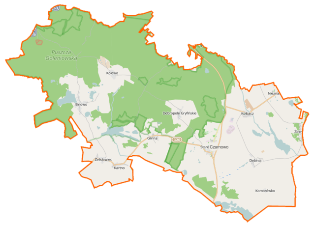
Polski: Mapa gminy Stare Czarnowo, Polska
English: Map of Gmina Stare Czarnowo, Poland |
|||||||||
| Date | ||||||||||
| Source | You may find a page on the OpenStreetMap wiki page for Stare Czarnowo (gmina) | |||||||||
| Creator |
OpenStreetMap contributors OpenStreetMap contributors |
|||||||||
| Permission (Reusing this file) |
OpenStreetMap data is available under the Open Database License (details). Map tiles are licensed under the Creative Commons Attribution-ShareAlike 2.0 license (CC-BY-SA 2.0).
This file is licensed under the Creative Commons Attribution-Share Alike 2.0 Generic license.
|
|||||||||
| Geotemporal data | ||||||||||
| Bounding box |
|
|||||||||
| Georeferencing | If inappropriate please set warp_status = skip to hide. | |||||||||
File history
Click on a date/time to view the file as it appeared at that time.
| Date/Time | Thumbnail | Dimensions | User | Comment | |
|---|---|---|---|---|---|
| current | 18:02, 17 March 2015 | | 908 × 656 (103 KB) | VanWiel (talk | contribs) | {{OpenStreetMap | name = Stare Czarnowo (gmina) | location = Stare Czarnowo (gmina) | description = {{pl|Mapa gminy Stare Czarnowo, Polska}} {{en|Map of Gmina Stare Czarnowo, Poland}} | top = 53.3692 | bott... |
You cannot overwrite this file.
File usage on Commons
There are no pages that use this file.
File usage on other wikis
The following other wikis use this file:
- Usage on fr.wikipedia.org
- Usage on pl.wikipedia.org
- Stare Czarnowo (gmina)
- Szczeciński Park Krajobrazowy „Puszcza Bukowa”
- Stare Czarnowo
- Kołbacz
- Binowo
- Dobropole Gryfińskie
- Glinna (województwo zachodniopomorskie)
- Kołowo
- Żelewo
- Żelisławiec
- Dębina (województwo zachodniopomorskie)
- Kartno (województwo zachodniopomorskie)
- Komorówko (województwo zachodniopomorskie)
- RTCN Kołowo
- Lisica (Wzgórza Bukowe)
- Nieznań
- Głaz Grońskiego
- Modrzewko
- Binówko
- Węglino
- Gliniec (województwo zachodniopomorskie)
- Ogród Dendrologiczny w Glinnej
- Będogoszcz
- Kołówko
- Małolesie
- Krzekna
- Opactwo Cystersów w Kołbaczu
- Rezerwat przyrody Bukowe Zdroje im. Profesora Tadeusza Dominika
- Glinna Wielka
- Glinna Wąska
View more global usage of this file.
_location_map.png)
_location_map.png&oldid=489065851)