File:Standorte der HTL St. Pölten.svg
Jump to navigation
Jump to search

Size of this PNG preview of this SVG file: 374 × 599 pixels. Other resolutions: 150 × 240 pixels | 300 × 480 pixels | 480 × 768 pixels | 639 × 1,024 pixels | 1,279 × 2,048 pixels | 990 × 1,585 pixels.
Original file (SVG file, nominally 990 × 1,585 pixels, file size: 7.04 MB)
Captions
Captions
Add a one-line explanation of what this file represents
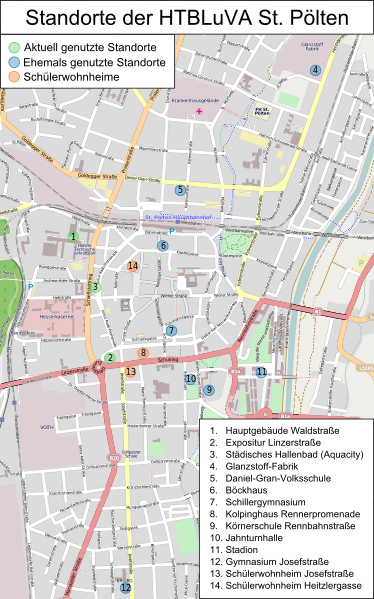
| Description | Karte der Standorte der HTL St. Pölten |
| Date | |
| Source | Own work, Grundkarte von openstreetmap.org |
| Author | OpenStreetMap und Mitwirkende (Karte), Alexander Wagner (Markierungen und Legende) |
This file is licensed under the Creative Commons Attribution-Share Alike 1.0 Generic license.
- You are free:
- to share – to copy, distribute and transmit the work
- to remix – to adapt the work
- Under the following conditions:
- attribution – You must give appropriate credit, provide a link to the license, and indicate if changes were made. You may do so in any reasonable manner, but not in any way that suggests the licensor endorses you or your use.
- share alike – If you alter, transform, or build upon this work, you must distribute the resulting work under the same license as the original.
File history
Click on a date/time to view the file as it appeared at that time.
| Date/Time | Thumbnail | Dimensions | User | Comment | |
|---|---|---|---|---|---|
| current | 14:19, 19 June 2010 | | 990 × 1,585 (7.04 MB) | AleXXw (talk | contribs) | Kleinigkeiten |
| 12:57, 19 June 2010 |  | 990 × 1,585 (7.03 MB) | AleXXw (talk | contribs) | Texte in Pfade umgewandelt | |
| 12:53, 19 June 2010 |  | 990 × 1,585 (6.73 MB) | AleXXw (talk | contribs) | {{Information |Description=Karte der Standorte der HTL St. Pölten |Source={{own}}, Grundkarte von [http://openstreetmap.org openstreetmap.org] |Date=2010-06-19 |Author=AleXXw |Permission= |other_versions= }} |
You cannot overwrite this file.
File usage on Commons
There are no pages that use this file.
File usage on other wikis
The following other wikis use this file:
- Usage on de.wikipedia.org