File:St Paul's tram stop, Chris Allen, 4284736.jpg
Jump to navigation
Jump to search

Size of this preview: 799 × 600 pixels. Other resolutions: 320 × 240 pixels | 640 × 480 pixels | 850 × 638 pixels.
Original file (850 × 638 pixels, file size: 173 KB, MIME type: image/jpeg)
Captions
Captions
Add a one-line explanation of what this file represents
| Description |
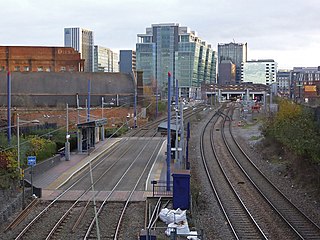
English: St Paul's tram stop
The bulk of Snow Hill is seen beyond. |
||
| Date | |||
| Source | geograph.org.uk | ||
| Author | Chris Allen | ||
| Permission (Reusing this file) |
This file is licensed under the Creative Commons Attribution-Share Alike 2.0 Generic license. Attribution: Chris Allen
|
||
| Attribution (required by the license) | Chris Allen / St Paul's tram stop / | ||

| Camera location | | View this and other nearby images on: OpenStreetMap |
|---|
_heading:135.00&language=en)
| Object location | | View this and other nearby images on: OpenStreetMap |
|---|
_heading:135.00&language=en)
File history
Click on a date/time to view the file as it appeared at that time.
| Date/Time | Thumbnail | Dimensions | User | Comment | |
|---|---|---|---|---|---|
| current | 20:52, 9 June 2016 | | 850 × 638 (173 KB) | G-13114 (talk | contribs) | {{Information |description={{en|1=St Paul's tram stop The bulk of Snow Hill is seen beyond.}} |date=2015-12-20 |source= [http://www.geograph.org.uk geograph.org.uk] |author= Chris Allen |permission= {{Geograph|4284736|Chris Allen}} |other_versions... |
You cannot overwrite this file.
File usage on Commons
The following 2 pages use this file:
File usage on other wikis
The following other wikis use this file:
- Usage on en.wikipedia.org
- Usage on www.wikidata.org