File:St John, Failsworth.jpg
Jump to navigation
Jump to search
Size of this preview: 401 × 599 pixels. Other resolutions: 160 × 240 pixels | 321 × 480 pixels | 514 × 768 pixels | 685 × 1,024 pixels | 1,371 × 2,048 pixels | 2,592 × 3,872 pixels.
Original file (2,592 × 3,872 pixels, file size: 4.05 MB, MIME type: image/jpeg)
Captions
Captions
Add a one-line explanation of what this file represents
Summary
[edit]
| Description |
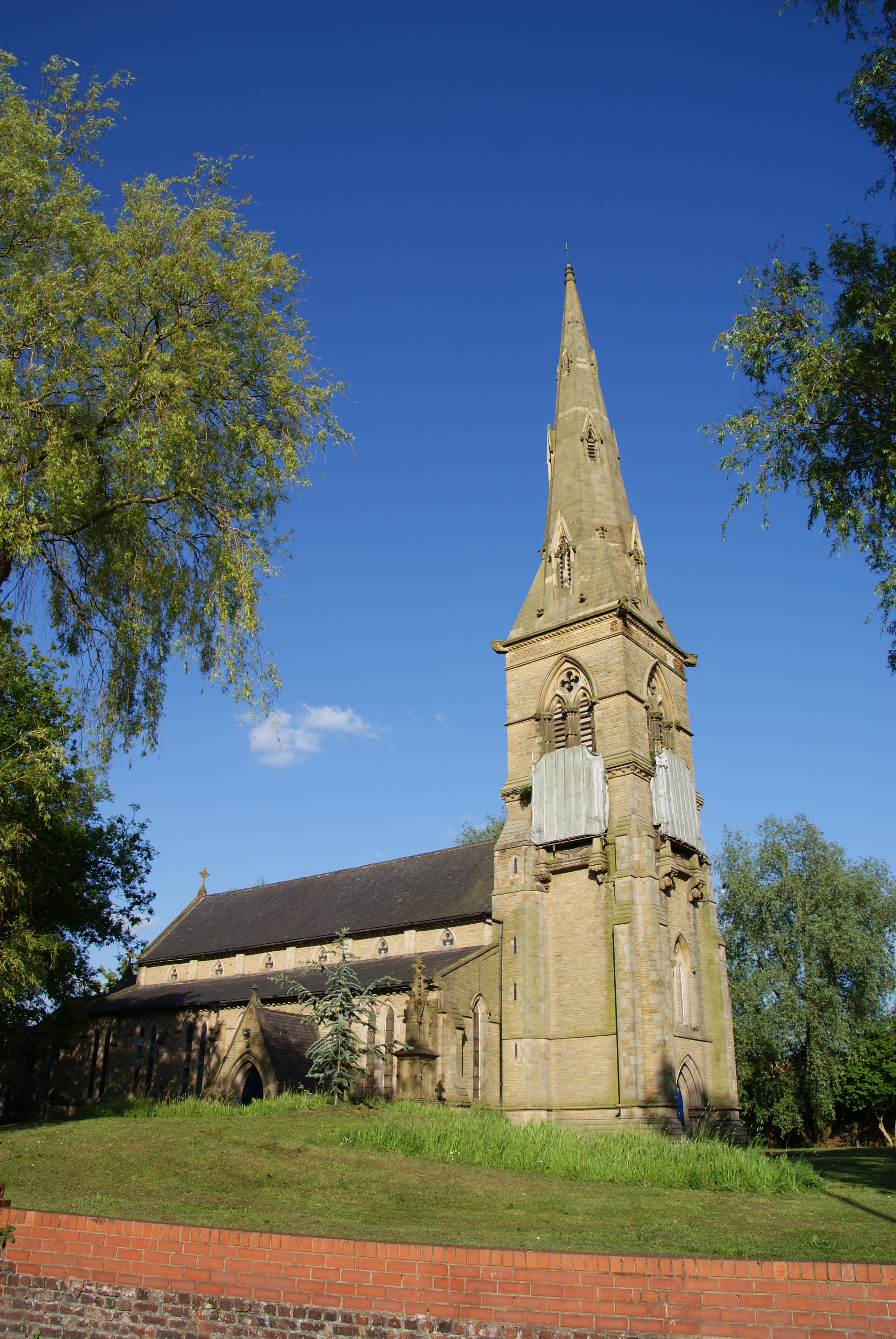
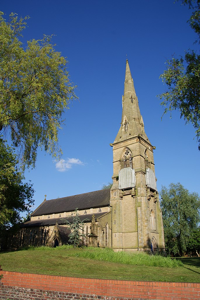
English: St John the Evangelist's parish church, Oldham Road, Failsworth, Greater Manchester, seen from the west |
| Date | |
| Source | Geograph.org.uk |
| Author | Bill Boaden |
| Attribution (required by the license) | Bill Boaden / St John the Evangelist, Failsworth / |
| Camera location | | View this and other nearby images on: OpenStreetMap |
|---|
Licensing
[edit]

|
This image was taken from the Geograph project collection. See this photograph's page on the Geograph website for the photographer's contact details. The copyright on this image is owned by Bill Boaden and is licensed for reuse under the Creative Commons Attribution-ShareAlike 2.0 license.
|
This file is licensed under the Creative Commons Attribution-Share Alike 2.0 Generic license.
Attribution: Bill Boaden
- You are free:
- to share – to copy, distribute and transmit the work
- to remix – to adapt the work
- Under the following conditions:
- attribution – You must give appropriate credit, provide a link to the license, and indicate if changes were made. You may do so in any reasonable manner, but not in any way that suggests the licensor endorses you or your use.
- share alike – If you remix, transform, or build upon the material, you must distribute your contributions under the same or compatible license as the original.
File history
Click on a date/time to view the file as it appeared at that time.
| Date/Time | Thumbnail | Dimensions | User | Comment | |
|---|---|---|---|---|---|
| current | 18:08, 30 August 2020 | | 2,592 × 3,872 (4.05 MB) | Geograph Update Bot (talk | contribs) | Higher-resolution version from Geograph. |
| 21:48, 9 November 2012 |  | 428 × 640 (81 KB) | Peter I. Vardy (talk | contribs) | User created page with UploadWizard |
You cannot overwrite this file.
File usage on Commons
The following page uses this file:
File usage on other wikis
The following other wikis use this file:
- Usage on en.wikipedia.org
- Usage on www.wikidata.org
Metadata
Categories:
- 1840s church towers in England
- Broach spires in Greater Manchester
- Buttresses in Greater Manchester
- Church spires in Greater Manchester
- Clerestories in Greater Manchester
- Gothic Revival church towers in Greater Manchester
- Gothic Revival spires in Greater Manchester
- St John the Evangelist's Church, Failsworth