File:St Bartholomews Parish on 1757 map of South Carolina.jpeg
Jump to navigation
Jump to search
Size of this preview: 558 × 600 pixels. Other resolutions: 223 × 240 pixels | 447 × 480 pixels | 715 × 768 pixels | 1,070 × 1,150 pixels.
Original file (1,070 × 1,150 pixels, file size: 315 KB, MIME type: image/jpeg)
Captions
Captions
Add a one-line explanation of what this file represents
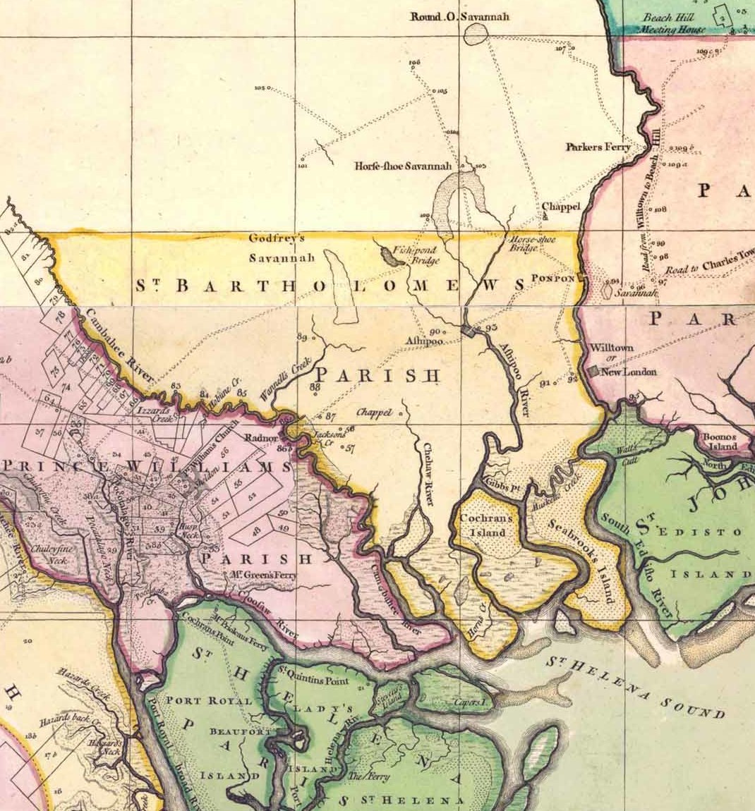
| Description | "A Map of South Carolina and a Part of Georgia" | ||||
| Date | |||||
| Source | Historical Maps of Alabama collection, University of Alabama Department of Geography | ||||
| Author | John William Gerard de Brahm | ||||
| Permission (Reusing this file) |
|
||||
| Other versions | |||||

File history
Click on a date/time to view the file as it appeared at that time.
| Date/Time | Thumbnail | Dimensions | User | Comment | |
|---|---|---|---|---|---|
| current | 09:39, 29 December 2020 | | 1,070 × 1,150 (315 KB) | AlanyaSeeburg (talk | contribs) | File:1757 map of South Carolina.jpeg cropped 82 % horizontally, 82 % vertically using CropTool with precise mode. |
You cannot overwrite this file.
File usage on Commons
The following page uses this file:
File usage on other wikis
The following other wikis use this file:
- Usage on de.wikipedia.org