File:St. Paul's (aka Seanor) Lutheran Church, Hempfield Township, Westmoreland County, Pennsylvania - 20201127.jpg
Jump to navigation
Jump to search

Size of this preview: 800 × 600 pixels. Other resolutions: 320 × 240 pixels | 640 × 480 pixels | 1,024 × 768 pixels | 1,280 × 959 pixels | 2,560 × 1,919 pixels | 3,534 × 2,649 pixels.
Original file (3,534 × 2,649 pixels, file size: 4.03 MB, MIME type: image/jpeg)
Captions
Captions
Add a one-line explanation of what this file represents
Summary
[edit]_Lutheran_Church,_Hempfield_Township,_Westmoreland_County,_Pennsylvania_-_20201127.jpg&action=edit§ion=1)
| Description |
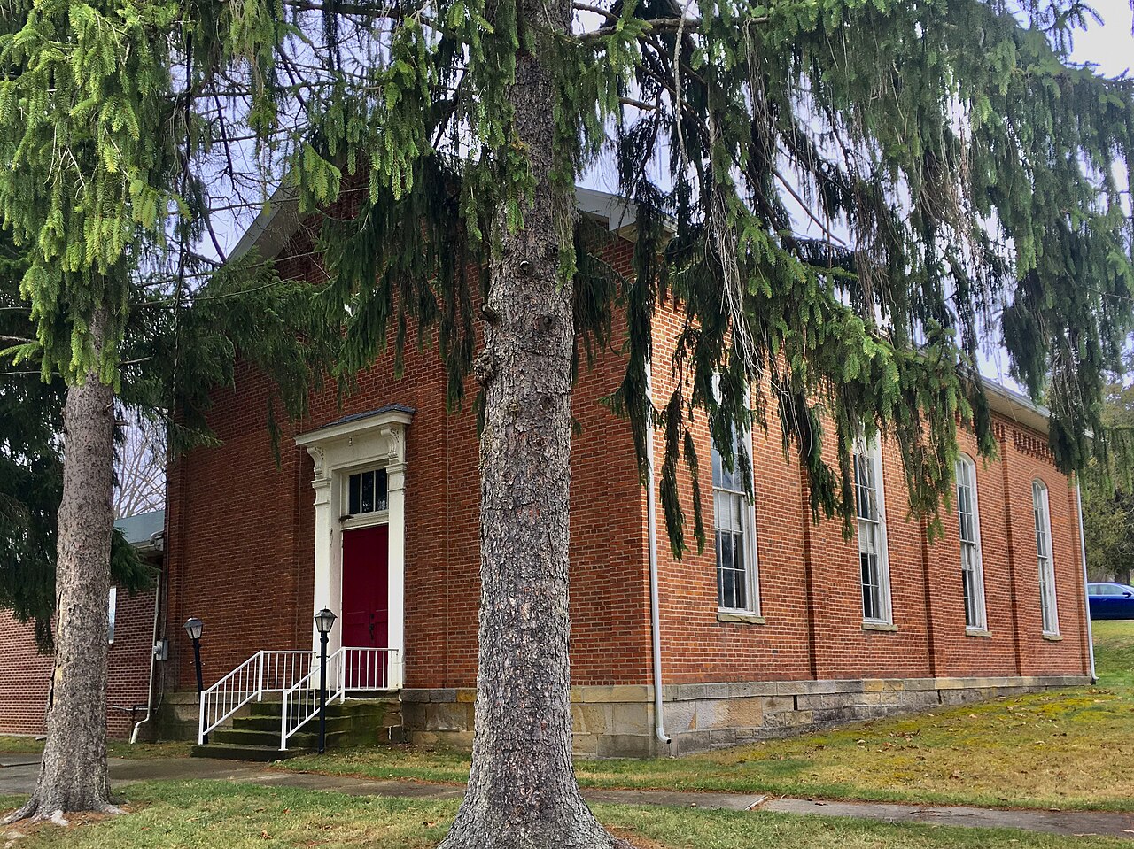
English: St. Paul's Lutheran Church, 215 Seanor Church Road at Glenn Fox Road, Hempfield Township, Westmoreland County, Pennsylvania, November 2020. Originally known as Seanor's Church (named for the previous owner of the land on which the church stands), the congregation traces its history back to about 1773, and originally worshiped in a rough-hewn log cabin located on the same site. The present church, a modest-scale brick building sporting restrained Neo-Renaissance detailing (principally around the front entrance, though the corbel table that rakes under the front gable of the roof and along the eaves on the lateral elevations is impressive too) dates to 1875, whereupon it took on its current name. The cemetery behind the church is notable as the site of the Seanor Church War Memorial, a 25-foot granite obelisk dedicated to the memory of congregants who served in the American Revolution and the Civil War. |
| Date | Taken on 27 November 2020, 13:40:12 |
| Source | Own work |
| Author | Andre Carrotflower |
| Camera location | | View this and other nearby images on: OpenStreetMap |
|---|
_Lutheran_Church,_Hempfield_Township,_Westmoreland_County,_Pennsylvania_-_20201127.jpg¶ms=040.234814_N_-079.637672_E_globe:Earth_type:camera_heading:275.97&language=en)
Licensing
[edit]_Lutheran_Church,_Hempfield_Township,_Westmoreland_County,_Pennsylvania_-_20201127.jpg&action=edit§ion=2)
I, the copyright holder of this work, hereby publish it under the following license:
This file is licensed under the Creative Commons Attribution-Share Alike 4.0 International license.
- You are free:
- to share – to copy, distribute and transmit the work
- to remix – to adapt the work
- Under the following conditions:
- attribution – You must give appropriate credit, provide a link to the license, and indicate if changes were made. You may do so in any reasonable manner, but not in any way that suggests the licensor endorses you or your use.
- share alike – If you remix, transform, or build upon the material, you must distribute your contributions under the same or compatible license as the original.
File history
Click on a date/time to view the file as it appeared at that time.
| Date/Time | Thumbnail | Dimensions | User | Comment | |
|---|---|---|---|---|---|
| current | 06:33, 10 January 2021 | | 3,534 × 2,649 (4.03 MB) | Andre Carrotflower (talk | contribs) | Uploaded own work with UploadWizard |
You cannot overwrite this file.
File usage on Commons
The following page uses this file:
_Lutheran_Church,_Hempfield_Twp,_Pennsylvania_-_20201127.jpg&redirect=no)
Metadata
_Lutheran_Church,_Hempfield_Township,_Westmoreland_County,_Pennsylvania_-_20201127.jpg&oldid=830840042)
Categories:
- November 2020 in Pennsylvania
- Churches in the United States photographed in 2020
- Churches in Pennsylvania built in 1875
- 1870s brick churches
- Brick churches in Pennsylvania
- Churches in Westmoreland County, Pennsylvania
- Neo-Renaissance architecture in Pennsylvania
- Churches of the North American Lutheran Church in Pennsylvania
- Hempfield Township, Westmoreland County, Pennsylvania