File:St. Clair County Illinois 1825.png
Jump to navigation
Jump to search
No higher resolution available.
St._Clair_County_Illinois_1825.png (288 × 405 pixels, file size: 9 KB, MIME type: image/png)
Captions
Captions
Add a one-line explanation of what this file represents
| Description |
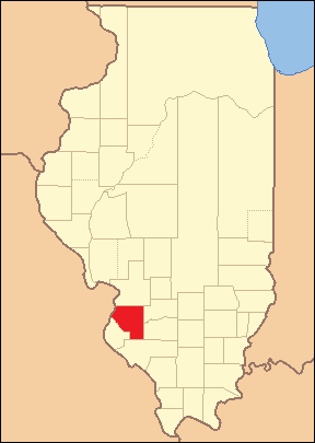
Locator Map of St. Clair County, Illinois, 1825-1827. Based on: Illinois Secretary of State. Origin and Evolution of Illinois Counties. March 2010. p. 46. http://www.cyberdriveillinois.com/publications/pdf_publications/ipub15.pdf |
| Date | (UTC) |
| Source | |
| Author |
|
I, the copyright holder of this work, hereby publish it under the following licenses:
This file is licensed under the Creative Commons Attribution-Share Alike 2.5 Generic license.
- You are free:
- to share – to copy, distribute and transmit the work
- to remix – to adapt the work
- Under the following conditions:
- attribution – You must give appropriate credit, provide a link to the license, and indicate if changes were made. You may do so in any reasonable manner, but not in any way that suggests the licensor endorses you or your use.
- share alike – If you remix, transform, or build upon the material, you must distribute your contributions under the same or compatible license as the original.
| This file is licensed under the Creative Commons Attribution-Share Alike 3.0 Unported license. | ||
| ||
| This licensing tag was added to this file as part of the GFDL licensing update. |

|
Permission is granted to copy, distribute and/or modify this document under the terms of the GNU Free Documentation License, Version 1.2 or any later version published by the Free Software Foundation; with no Invariant Sections, no Front-Cover Texts, and no Back-Cover Texts. A copy of the license is included in the section entitled GNU Free Documentation License. |
You may select the license of your choice.
This image or file is a work of a United States Census Bureau employee, taken or made as part of that person's official duties. As a work of the U.S. federal government, the image is in the public domain.
|
 |
Original upload log
[edit]
This image is a derivative work of the following images:
- File:Illinois_Locator_Map.PNG licensed with Cc-by-sa-2.5, Cc-by-sa-3.0-migrated, GFDL, PD-USGov-DOC-Census
- 2007-04-25T04:02:40Z Ruhrfisch 288x405 (12719 Bytes) {{Information| |Description= Locator Map of Illinois, United States |Source= taken from US Census website [http://factfinder.census.gov/] and modified by [[User:Ruhrfisch]] |Date= March 2007 |Author= US Census, Ruhrfisch |Pe
- 2007-03-28T03:45:05Z Ruhrfisch 288x405 (12872 Bytes) {{Information| |Description= Locator Map of Illinois, United States |Source= taken from US Census website [http://factfinder.census.gov/] and modified by [[User:Ruhrfisch]] |Date= March 2007 |Author= US Census, Ruhrfisch |Pe
- 2007-03-28T03:12:42Z Ruhrfisch 242x412 (11353 Bytes) {{Information| |Description= Locator Map of Illinois, United States |Source= taken from US Census website [http://factfinder.census.gov/] and modified by [[User:Ruhrfisch]] |Date= March 2007 |Author= US Census, Ruhrfisch |Pe
Uploaded with derivativeFX
File history
Click on a date/time to view the file as it appeared at that time.
| Date/Time | Thumbnail | Dimensions | User | Comment | |
|---|---|---|---|---|---|
| current | 15:46, 21 June 2010 | | 288 × 405 (9 KB) | Fishal (talk | contribs) | {{Information |Description=Locator Map of St. Clair County, Illinois, 1825-1827. Based on: Illinois Secretary of State. ''Origin and Evolution of Illinois Counties''. March 2010. p. 46. http://www.cyberdriveillinois.com/publications/pdf_publications/ |
You cannot overwrite this file.
File usage on Commons
The following page uses this file:
- File:St. Clair County Illnois 1825.png (file redirect)
File usage on other wikis
The following other wikis use this file:
- Usage on en.wikipedia.org
- Usage on fa.wikipedia.org
- Usage on ja.wikipedia.org