File:St-ulrich-map.png
Jump to navigation
Jump to search
No higher resolution available.
St-ulrich-map.png (400 × 240 pixels, file size: 3 KB, MIME type: image/png)
Captions
Captions
Add a one-line explanation of what this file represents
Summary
[edit]
| Description |
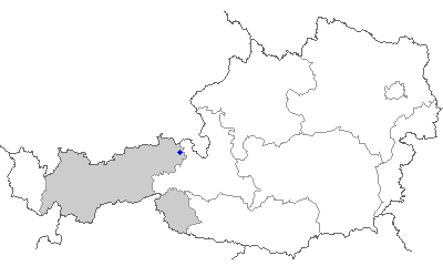
English: map of Tirol, position of St. Ulrich.a.P. |
| Source | [1] |
| Author |
Licensing
[edit]

|
This library is free software; you can redistribute it and/or modify it under the terms of the GNU Lesser General Public License as published by the Free Software Foundation; either version 2.1 of the License, or (at your option) any later version. This library is distributed in the hope that it will be useful, but without any warranty; without even the implied warranty of merchantability or fitness for a particular purpose. See version 2.1 and version 3 of the GNU Lesser General Public License for more details. |
File history
Click on a date/time to view the file as it appeared at that time.
| Date/Time | Thumbnail | Dimensions | User | Comment | |
|---|---|---|---|---|---|
| current | 10:45, 23 April 2006 | | 400 × 240 (3 KB) | Stefanski (talk | contribs) | *source: [http://www.innweb.at/map/] *map of Tirol, position of St. Ulrich.a.P. |
You cannot overwrite this file.
File usage on Commons
There are no pages that use this file.