File:Srbija St Nemanje kraj XII v-es.svg
Jump to navigation
Jump to search

Size of this PNG preview of this SVG file: 738 × 600 pixels. Other resolutions: 296 × 240 pixels | 591 × 480 pixels | 945 × 768 pixels | 1,260 × 1,024 pixels | 2,521 × 2,048 pixels | 1,349 × 1,096 pixels.
Original file (SVG file, nominally 1,349 × 1,096 pixels, file size: 358 KB)
Captions
Captions
Add a one-line explanation of what this file represents
Summary
[edit]
| Description |
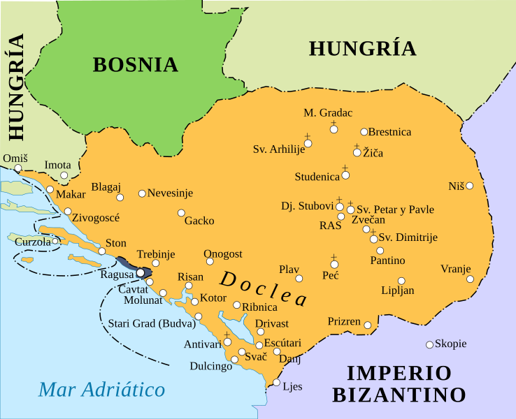
English: Serbia during the rule of Prince Stefan Nemanja. Español: Serbia durante el reinado del pŕincipe Esteba Nemanja. |
| Date | |
| Source | |
| Author |
|
Licensing
[edit]
I, the copyright holder of this work, hereby publish it under the following license:
This file is licensed under the Creative Commons Attribution-Share Alike 3.0 Unported license.
- You are free:
- to share – to copy, distribute and transmit the work
- to remix – to adapt the work
- Under the following conditions:
- attribution – You must give appropriate credit, provide a link to the license, and indicate if changes were made. You may do so in any reasonable manner, but not in any way that suggests the licensor endorses you or your use.
- share alike – If you remix, transform, or build upon the material, you must distribute your contributions under the same or compatible license as the original.
File history
Click on a date/time to view the file as it appeared at that time.
| Date/Time | Thumbnail | Dimensions | User | Comment | |
|---|---|---|---|---|---|
| current | 14:15, 30 October 2019 | | 1,349 × 1,096 (358 KB) | Rowanwindwhistler (talk | contribs) | Real text added (hidden), borders added, new colours, new font. |
| 13:49, 28 December 2015 |  | 1,349 × 1,096 (314 KB) | Rowanwindwhistler (talk | contribs) | Colours changed, text moved | |
| 18:28, 31 March 2014 |  | 1,349 × 1,096 (291 KB) | Rowanwindwhistler (talk | contribs) | Sea name corrected | |
| 18:14, 31 March 2014 |  | 1,349 × 1,096 (291 KB) | Rowanwindwhistler (talk | contribs) | User created page with UploadWizard |
You cannot overwrite this file.
File usage on Commons
The following 2 pages use this file:
File usage on other wikis
The following other wikis use this file:
- Usage on es.wikipedia.org
Metadata
Categories:
- Spanish-language SVG maps showing history of Europe
- Maps of the Grand Principality of Serbia
- Stefan Nemanja
- Maps of the history of Budva in the Middle Ages
- Maps of the history of Kotor in the Middle Ages
- Maps of the history of Risan in the Middle Ages
- Maps of Duklja
- Maps of medieval Bosnian and neighboring states
- Maps of Zeta in the Grand Principality of Serbia