File:Spring (152799411).jpeg
Jump to navigation
Jump to search

Size of this preview: 800 × 533 pixels. Other resolutions: 320 × 213 pixels | 640 × 427 pixels | 1,024 × 683 pixels | 1,280 × 853 pixels | 2,048 × 1,365 pixels.
Original file (2,048 × 1,365 pixels, file size: 2.31 MB, MIME type: image/jpeg)
Captions
Captions
Add a one-line explanation of what this file represents
Summary
[edit].jpeg&action=edit§ion=1)
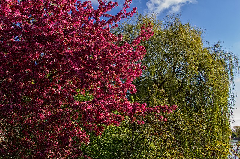
| Spring | |
|---|---|
| Photographer | |
| Title |
Spring |
| Description |
500px provided description: Landshut is a town in Bavaria in the south-east of Germany, belonging to both Eastern and Southern Bavaria. Situated on the banks of the River Isar, Landshut is the capital of Lower Bavaria, one of the seven administrative regions of the Free State of Bavaria. It is also the seat of the surrounding district, and with a population of more than 60,000. Landshut is the largest city in Lower Bavaria, followed by Passau and Straubing, and Eastern Bavaria's second biggest cityOwing to its characteristic coat of arms, the town is also often called "Three Helmets City" (German: Dreihelmenstadt). Furthermore, the town is popularly known for the Landshuter Hochzeit (Landshut Wedding), a full-tilt medieval festival.(Source:Wikipedia) [#yellow ,#trees ,#sky ,#red ,#city ,#beauty ,#sunset ,#spring ,#water ,#nature ,#travel ,#blue ,#sun ,#light ,#clouds ,#tree ,#beautiful ,#green ,#canon ,#germany ,#places ,#bayern ,#natural light ,#bavaria ,#nature photography ,#nature photograph ,#landshut ,#nature pics ,#canon100d ,#attila photographie] |
| Date | 5 May 2016, 12:31:21 (UTC) |
| Source | Imported from 500px (archived version) by the Archive Team. (detail page) |
| Permission (Reusing this file) |
This file is licensed under the Creative Commons Attribution 3.0 Unported license.
|
| Camera location | | View this and other nearby images on: OpenStreetMap |
|---|
.jpeg¶ms=048.544192_N_0012.146853_E_globe:Earth_type:camera__&language=en)
File history
Click on a date/time to view the file as it appeared at that time.
| Date/Time | Thumbnail | Dimensions | User | Comment | |
|---|---|---|---|---|---|
| current | 13:23, 19 October 2018 | | 2,048 × 1,365 (2.31 MB) | Rodrigo.Argenton (talk | contribs) | Photo Spring imported from 500px with import-500px |
You cannot overwrite this file.
File usage on Commons
The following page uses this file:
.jpeg)
.jpeg&oldid=566820286)