File:Speed limit confusion, Bulmore Road - geograph.org.uk - 1775593.jpg
Jump to navigation
Jump to search
No higher resolution available.
Speed_limit_confusion,_Bulmore_Road_-_geograph.org.uk_-_1775593.jpg (640 × 480 pixels, file size: 110 KB, MIME type: image/jpeg)
Captions
Captions
Add a one-line explanation of what this file represents
Summary
[edit]
| Description |
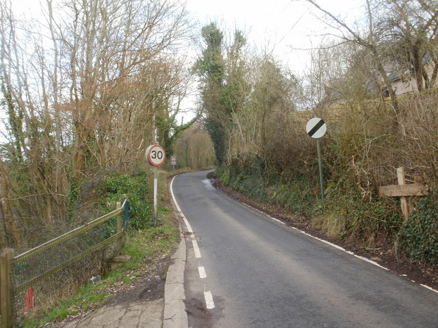
English: Speed limit confusion, Bulmore Road Bulmore Road heads away from houses at the eastern edge of The Village, into open country. The National Speed Limit should now apply, as shown by the sign on the right. But it is contradicted by the sign on the left.
I expected to find the reverse error in the opposite direction, but... https://www.geograph.org.uk/photo/1775614 |
| Date | |
| Source | From geograph.org.uk |
| Author | John Grayson |
| Camera location | | View this and other nearby images on: OpenStreetMap |
|---|
_heading:45.00&language=en)
| Object location | | View this and other nearby images on: OpenStreetMap |
|---|
_heading:45.00&language=en)
Licensing
[edit]

|
This image was taken from the Geograph project collection. See this photograph's page on the Geograph website for the photographer's contact details. The copyright on this image is owned by John Grayson and is licensed for reuse under the Creative Commons Attribution-ShareAlike 2.0 license.
|
This file is licensed under the Creative Commons Attribution-Share Alike 2.0 Generic license.
Attribution: John Grayson
- You are free:
- to share – to copy, distribute and transmit the work
- to remix – to adapt the work
- Under the following conditions:
- attribution – You must give appropriate credit, provide a link to the license, and indicate if changes were made. You may do so in any reasonable manner, but not in any way that suggests the licensor endorses you or your use.
- share alike – If you remix, transform, or build upon the material, you must distribute your contributions under the same or compatible license as the original.
File history
Click on a date/time to view the file as it appeared at that time.
| Date/Time | Thumbnail | Dimensions | User | Comment | |
|---|---|---|---|---|---|
| current | 13:33, 14 March 2011 | | 640 × 480 (110 KB) | GeographBot (talk | contribs) | == {{int:filedesc}} == {{Information |description={{en|1=Speed limit confusion, Bulmore Road Bulmore Road heads away from houses at the eastern edge of The Village, into open country. The National Speed Limit should now apply, as shown by the sign on the |
You cannot overwrite this file.
File usage on Commons
There are no pages that use this file.