File:Spain, Catalonia, Cruïlles (6).JPG
Jump to navigation
Jump to search
Size of this preview: 378 × 600 pixels. Other resolutions: 151 × 240 pixels | 302 × 480 pixels | 484 × 768 pixels | 645 × 1,024 pixels | 1,356 × 2,152 pixels.
Original file (1,356 × 2,152 pixels, file size: 754 KB, MIME type: image/jpeg)
Captions
Captions
Add a one-line explanation of what this file represents
This is a photo of a monument listed in the Catalan heritage register of Béns Culturals d'Interès Nacional and the Spanish heritage register of Bienes de Interés Cultural under the reference RI-51-0005880. |
Summary
[edit].JPG&action=edit§ion=1)
| Description |
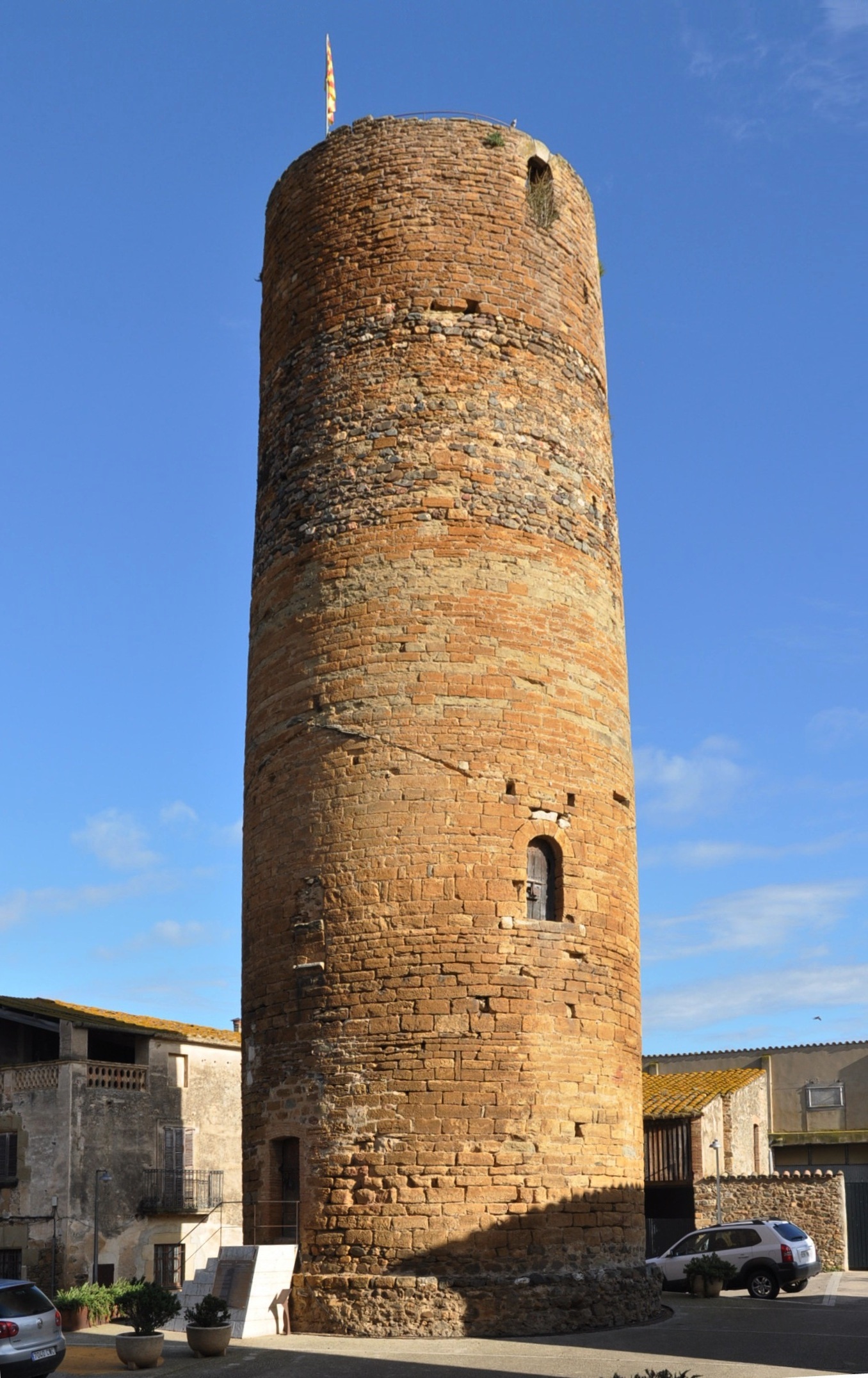
Nederlands: Middeleeuwse kasteeltoren uit de 11e-12e eeuw op het centrale plein in het vestingstadje Cruïlles (Baix Empordà, Catalonië, Spanje). Cruïlles ligt 2,8 km ten westen van La Bisbal d'Empordà.
English: Medieval castle tower from the 11th-12th century on Cruïlles' main square (County of Baix Empordà, Catalonia, Spain). The fortified village of Cruïlles lies 2.8 km west of La Bisbal d'Empordà.
Català: Torre de l'homenatge de l'antic castell de Cruïlles (Baix Empordà, Catalunya, Espanya). |
| Date | |
| Source | Own work |
| Author | Vincent van Zeijst |
The tower is located at:
| Camera location | | View this and other nearby images on: OpenStreetMap |
|---|
.JPG¶ms=041.956117_N_0003.011194_E_globe:Earth_type:camera_region:ES_&language=en)
Licensing
[edit].JPG&action=edit§ion=2)
I, the copyright holder of this work, hereby publish it under the following license:
This file is licensed under the Creative Commons Attribution-Share Alike 3.0 Unported license.
- You are free:
- to share – to copy, distribute and transmit the work
- to remix – to adapt the work
- Under the following conditions:
- attribution – You must give appropriate credit, provide a link to the license, and indicate if changes were made. You may do so in any reasonable manner, but not in any way that suggests the licensor endorses you or your use.
- share alike – If you remix, transform, or build upon the material, you must distribute your contributions under the same or compatible license as the original.
File history
Click on a date/time to view the file as it appeared at that time.
| Date/Time | Thumbnail | Dimensions | User | Comment | |
|---|---|---|---|---|---|
| current | 19:24, 19 April 2012 | | 1,356 × 2,152 (754 KB) | Loranchet (talk | contribs) | {{Information |Description ={{nl|1=Middeleeuwse kasteeltoren uit de 11e-12e eeuw op het centrale plein in het vestingstadje Cruïlles (Baix Empordà, Catalonië, Spanje). Cruïlles ligt 2,8 km ten westen van La Bisbal d'Empordà.}} {{en|1=Medieval c... |
You cannot overwrite this file.
File usage on Commons
There are no pages that use this file.
File usage on other wikis
The following other wikis use this file:
- Usage on ca.wikipedia.org
.JPG&oldid=567073279)