File:Southport Lanes, Prohibition Speakeasy & Brothel (50871238163).jpg

Original file (4,608 × 3,456 pixels, file size: 18.44 MB, MIME type: image/jpeg)
Captions
Captions
Summary
[edit].jpg&action=edit§ion=1)
| Description |
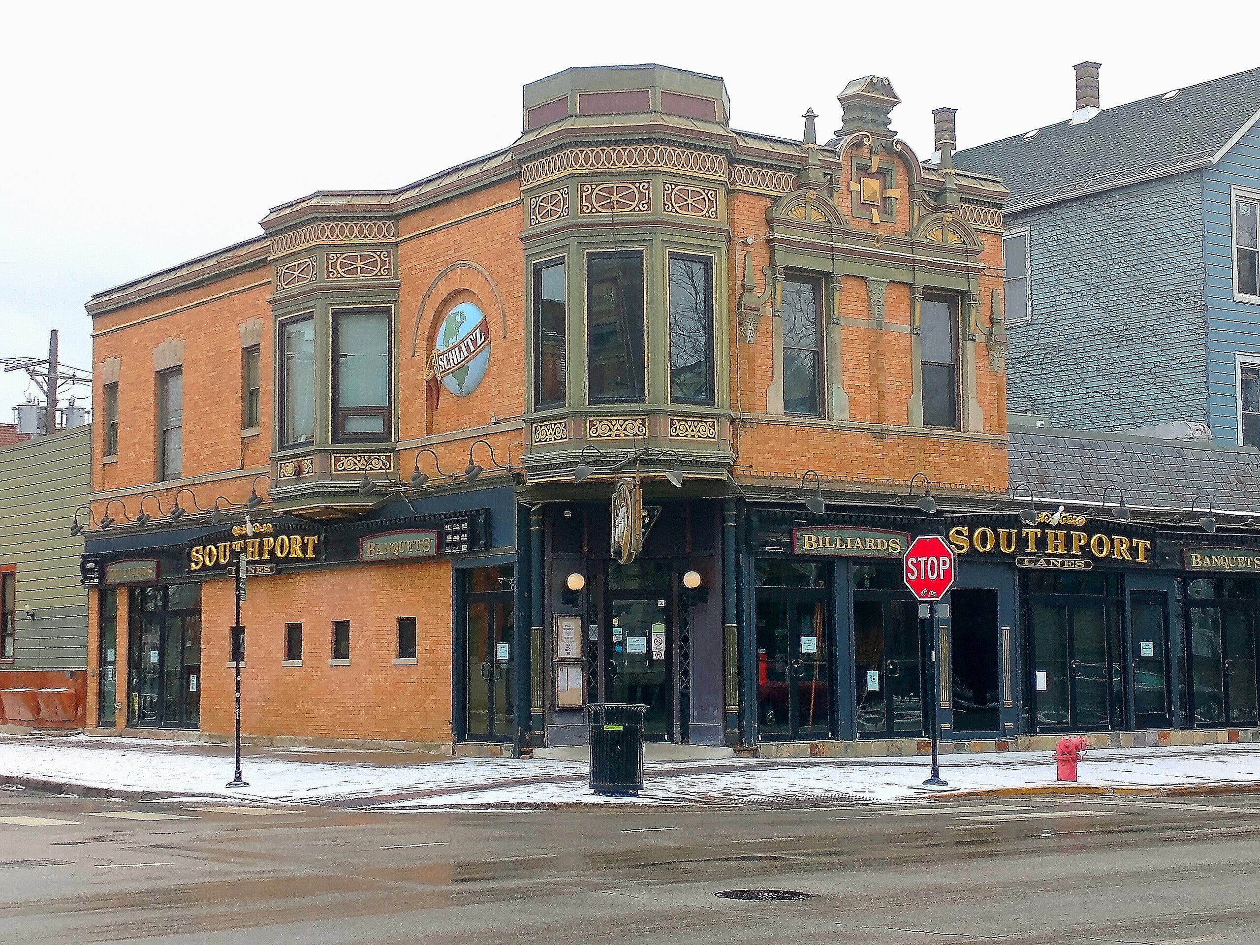
Built in 1900 as The Nook by the Schlitz Brewing Company, this bar was a Prohibition speakeasy, whorehouse, and gambling hall. In 1922 the name was changed to Southport Lanes when bowling lanes were added as brewers were banned from owning bars. A dumb waiter still exists which was used to shuttle illicit drinks to the prostitutes upstairs. When phone wires were pulled they discovered that the place had been used as an off-track betting parlor. A secret room was found where Mayor Anton Cermak used to play poker in the 1930s. The bar closed after 98 years in 2020 having withstood Spanish Flu and the Great Depression but not the COVID-19 lockdown. Located at 3325 N. Southport Ave. |
| Date | |
| Source | Southport Lanes, Prohibition Speakeasy & Brothel |
| Author | Stephen Hogan from Chicago, United States |
| Camera location | | View this and other nearby images on: OpenStreetMap |
|---|
.jpg¶ms=041.942566_N_-087.664131_E_globe:Earth_type:camera_source:Flickr_&language=en)
Licensing
[edit].jpg&action=edit§ion=2)
- You are free:
- to share – to copy, distribute and transmit the work
- to remix – to adapt the work
- Under the following conditions:
- attribution – You must give appropriate credit, provide a link to the license, and indicate if changes were made. You may do so in any reasonable manner, but not in any way that suggests the licensor endorses you or your use.
| This image was originally posted to Flickr by Chicago Crime Scenes at https://flickr.com/photos/39234220@N03/50871238163. It was reviewed on 25 January 2021 by FlickreviewR 2 and was confirmed to be licensed under the terms of the cc-by-2.0. |
File history
Click on a date/time to view the file as it appeared at that time.
| Date/Time | Thumbnail | Dimensions | User | Comment | |
|---|---|---|---|---|---|
| current | 18:09, 25 January 2021 | | 4,608 × 3,456 (18.44 MB) | TaurusEmerald (talk | contribs) | Transferred from Flickr via #flickr2commons |
You cannot overwrite this file.
File usage on Commons
There are no pages that use this file.
.jpg&oldid=886350346)