File:Southern slopes of the Diffwys ridge - geograph.org.uk - 1754969.jpg
Jump to navigation
Jump to search
Size of this preview: 800 × 600 pixels. Other resolutions: 320 × 240 pixels | 640 × 480 pixels | 1,024 × 768 pixels.
Original file (1,024 × 768 pixels, file size: 195 KB, MIME type: image/jpeg)
Captions
Captions
Add a one-line explanation of what this file represents
Summary
[edit]
| Description |
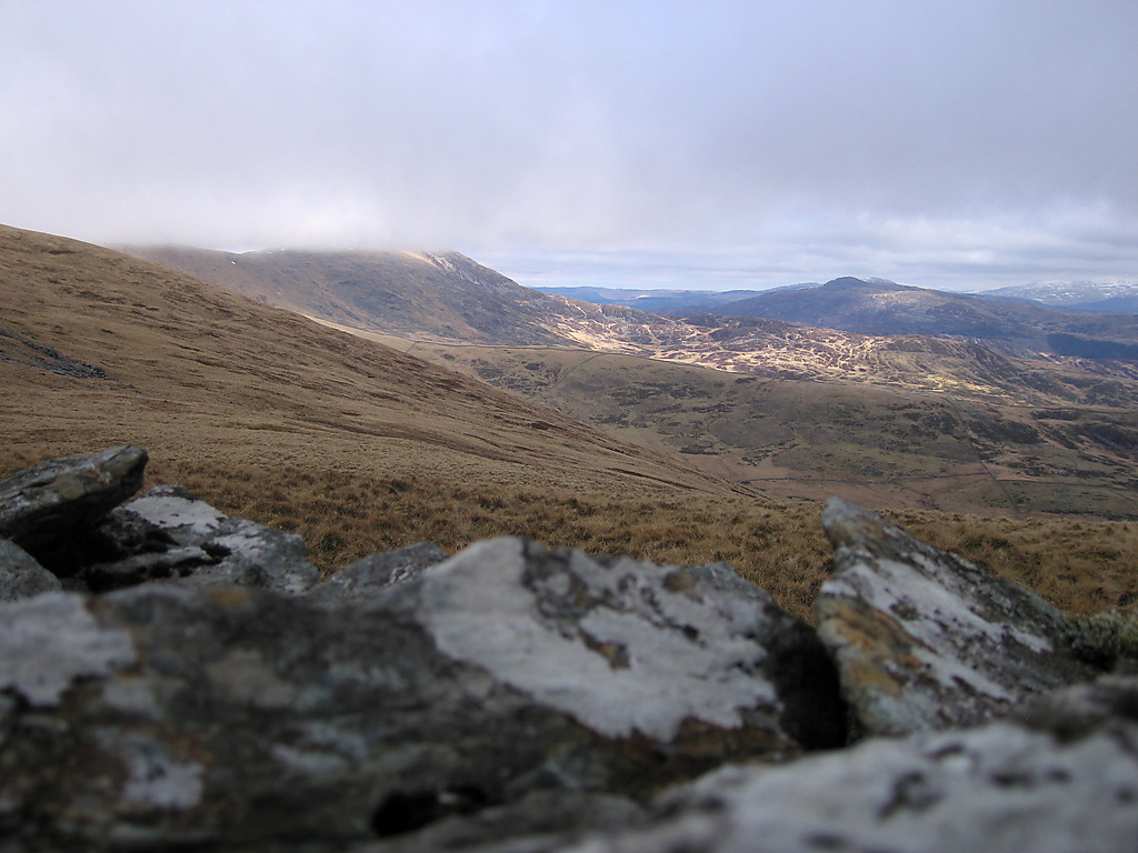
English: Southern slopes of the Diffwys ridge Diffwys itself is in cloud on the left, with the main ridge running up to it from the camera position. The southern appendages of the ridge are lined up: y Braich is the long grassy ridge across the foreground valley, Craig Aderyn the craggier and slightly higher one behind. The dome-shaped hill on the right is y Garn in SH7023. |
| Date | |
| Source | From geograph.org.uk |
| Author | Rudi Winter |
| Attribution (required by the license) | Rudi Winter / Southern slopes of the Diffwys ridge / |
| Camera location | | View this and other nearby images on: OpenStreetMap |
|---|
_heading:67.00&language=en)
| Object location | | View this and other nearby images on: OpenStreetMap |
|---|
_heading:67.00&language=en)
Licensing
[edit]

|
This image was taken from the Geograph project collection. See this photograph's page on the Geograph website for the photographer's contact details. The copyright on this image is owned by Rudi Winter and is licensed for reuse under the Creative Commons Attribution-ShareAlike 2.0 license.
|
This file is licensed under the Creative Commons Attribution-Share Alike 2.0 Generic license.
Attribution: Rudi Winter
- You are free:
- to share – to copy, distribute and transmit the work
- to remix – to adapt the work
- Under the following conditions:
- attribution – You must give appropriate credit, provide a link to the license, and indicate if changes were made. You may do so in any reasonable manner, but not in any way that suggests the licensor endorses you or your use.
- share alike – If you remix, transform, or build upon the material, you must distribute your contributions under the same or compatible license as the original.
File history
Click on a date/time to view the file as it appeared at that time.
| Date/Time | Thumbnail | Dimensions | User | Comment | |
|---|---|---|---|---|---|
| current | 00:26, 6 March 2011 | | 1,024 × 768 (195 KB) | GeographBot (talk | contribs) | == {{int:filedesc}} == {{Information |description={{en|1=Southern slopes of the Diffwys ridge Diffwys itself is in cloud on the left, with the main ridge running up to it from the camera position. The southern appendages of the ridge are lined up: y Brai |
You cannot overwrite this file.
File usage on Commons
There are no pages that use this file.