File:Southern end of the Pentridge bank barrow - geograph.org.uk - 673993.jpg
Jump to navigation
Jump to search
No higher resolution available.
Southern_end_of_the_Pentridge_bank_barrow_-_geograph.org.uk_-_673993.jpg (640 × 480 pixels, file size: 99 KB, MIME type: image/jpeg)
Captions
Captions
Add a one-line explanation of what this file represents
Summary
[edit]
| Description |
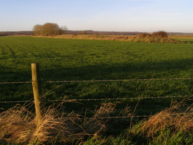
English: Southern end of the Pentridge bank barrow Looking from the bridleway to the bank barrow near the NE terminal of the Dorset Cursus.
The present day form of the barrow comprises two distinct parts: the taller narrower part (tree-covered) to the north-east and the wider flatter part (grass-covered) to the south-west. These parts are 50m and 90m long, respectively. Although they have been considered to be two cojoined long barrows, probing and aerial photography has revealed them to have a common continuous ditch (now ploughed out). Another suggestion is that the western part is a classic long barrow, with the eastern part as a tail that was added later: the presence of the Dorset Cursus terminal would have prevented expansion in the other direction. |
| Date | |
| Source | From geograph.org.uk |
| Author | Jim Champion |
| Attribution (required by the license) | Jim Champion / Southern end of the Pentridge bank barrow / |
| Camera location | | View this and other nearby images on: OpenStreetMap |
|---|
_heading:0.00&language=en)
| Object location | | View this and other nearby images on: OpenStreetMap |
|---|
_heading:0.00&language=en)
Licensing
[edit]

|
This image was taken from the Geograph project collection. See this photograph's page on the Geograph website for the photographer's contact details. The copyright on this image is owned by Jim Champion and is licensed for reuse under the Creative Commons Attribution-ShareAlike 2.0 license.
|
This file is licensed under the Creative Commons Attribution-Share Alike 2.0 Generic license.
Attribution: Jim Champion
- You are free:
- to share – to copy, distribute and transmit the work
- to remix – to adapt the work
- Under the following conditions:
- attribution – You must give appropriate credit, provide a link to the license, and indicate if changes were made. You may do so in any reasonable manner, but not in any way that suggests the licensor endorses you or your use.
- share alike – If you remix, transform, or build upon the material, you must distribute your contributions under the same or compatible license as the original.
- Remove redundant categories and try to put this image in the most specific category/categories
- Remove this template
- The location categories are based on information from this geonames tool and this OpenStreetMap tool combined with a database. You can also have a look at this tool from mysociety.
- The topic category from Geograph was Ancient mound (find similar images mound at Geograph)
File history
Click on a date/time to view the file as it appeared at that time.
| Date/Time | Thumbnail | Dimensions | User | Comment | |
|---|---|---|---|---|---|
| current | 23:18, 7 February 2011 | | 640 × 480 (99 KB) | GeographBot (talk | contribs) | == {{int:filedesc}} == {{Information |description={{en|1=Southern end of the Pentridge bank barrow Looking from the bridleway to the bank barrow near the NE terminal of the Dorset Cursus. The present day form of the barrow comprises two distinct parts: |
You cannot overwrite this file.
File usage on Commons
There are no pages that use this file.