File:Southern Illinois Trail of Tears map.jpg
Jump to navigation
Jump to search
No higher resolution available.
Southern_Illinois_Trail_of_Tears_map.jpg (757 × 349 pixels, file size: 69 KB, MIME type: image/jpeg)
Captions
Captions
Add a one-line explanation of what this file represents
Summary
[edit]
| Description |
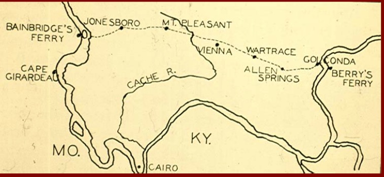
English: A Trail of Tears map of Southern Illinois from the USDA - US Forest Service |
| Date | |
| Source | http://www.fs.usda.gov/Internet/FSE_DOCUMENTS/stelprdb5156722.pdf |
| Author | USDA - US Forest Service |
Licensing
[edit]
This image is a work of the Forest Service of the United States Department of Agriculture. As a work of the U.S. federal government, the image is in the public domain.
|
File history
Click on a date/time to view the file as it appeared at that time.
| Date/Time | Thumbnail | Dimensions | User | Comment | |
|---|---|---|---|---|---|
| current | 04:32, 7 April 2015 | | 757 × 349 (69 KB) | TehSharp (talk | contribs) | User created page with UploadWizard |
You cannot overwrite this file.
File usage on Commons
There are no pages that use this file.
File usage on other wikis
The following other wikis use this file:
- Usage on en.wikipedia.org
- Usage on zh.wikipedia.org