File:South side of St Tudor's Church, Mynyddislwyn (geograph 4009533).jpg
Jump to navigation
Jump to search
No higher resolution available.
South_side_of_St_Tudor's_Church,_Mynyddislwyn_(geograph_4009533).jpg (800 × 600 pixels, file size: 108 KB, MIME type: image/jpeg)
Captions
Captions
Add a one-line explanation of what this file represents
Summary
[edit].jpg&action=edit§ion=1)
| Description |
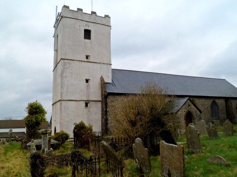
English: South side of St Tudor's Church, Mynyddislwyn. In a remote location between Wattsville and Blackwood, the church is in the Rectorial Benefice of Mynyddislwyn, part of the Church in Wales Diocese of Monmouth. Located on a 6th century site, the church building has 11th century origins. |
| Date | |
| Source | From geograph.org.uk |
| Author | Jaggery |
| Permission (Reusing this file) |
Creative Commons Attribution Share-alike license 2.0 |
| Attribution (required by the license) | Jaggery / South side of St Tudor's Church, Mynyddislwyn / |
| Camera location | | View this and other nearby images on: OpenStreetMap |
|---|
.jpg¶ms=051.638007_N_-003.167084_E_globe:Earth_type:camera_source:geograph-osgb36(ST19339389)_heading:0.00&language=en)
| Object location | | View this and other nearby images on: OpenStreetMap |
|---|
.jpg¶ms=051.638190_N_-003.167090_E_globe:Earth_class:object_type:object_source:geograph-osgb36(ST19339391)_heading:0.00&language=en)
Licensing
[edit].jpg&action=edit§ion=2)

|
This image was taken from the Geograph project collection. See this photograph's page on the Geograph website for the photographer's contact details. The copyright on this image is owned by Jaggery and is licensed for reuse under the Creative Commons Attribution-ShareAlike 2.0 license.
|
This file is licensed under the Creative Commons Attribution-Share Alike 2.0 Generic license.
Attribution: Jaggery
- You are free:
- to share – to copy, distribute and transmit the work
- to remix – to adapt the work
- Under the following conditions:
- attribution – You must give appropriate credit, provide a link to the license, and indicate if changes were made. You may do so in any reasonable manner, but not in any way that suggests the licensor endorses you or your use.
- share alike – If you remix, transform, or build upon the material, you must distribute your contributions under the same or compatible license as the original.
File history
Click on a date/time to view the file as it appeared at that time.
| Date/Time | Thumbnail | Dimensions | User | Comment | |
|---|---|---|---|---|---|
| current | 00:05, 19 July 2021 | | 800 × 600 (108 KB) | Salen9 (talk | contribs) | == {{int:filedesc}} == {{Information |Description={{en|1=South side of St Tudor's Church, Mynyddislwyn}} |Source=From [https://www.geograph.org.uk/photo/4009533 geograph.org.uk] |Date=2012-03-16 |Author=[https://www.geograph.org.uk/profile/39302 Jaggery] |Permission=Creative Commons Attribution Share-alike license 2.0 |Other fields={{Credit line |Author=Jaggery |License=[https://creativecommons.org/licenses/by-sa/2.0/ CC BY-SA 2.0] |Other=''South side of St Tudor's Church, Mynyddislwyn''... |
You cannot overwrite this file.
File usage on Commons
The following page uses this file:
File usage on other wikis
The following other wikis use this file:
- Usage on cy.wikipedia.org
- Usage on cy.wikisource.org
- Usage on www.wikidata.org
.jpg&oldid=915827832)