File:South of Birylevo dendropark - panoramio.jpg
From Wikimedia Commons, the free media repository
Jump to navigation
Jump to search
Size of this preview: 800 × 600 pixels. Other resolutions: 320 × 240 pixels | 640 × 480 pixels | 1,024 × 768 pixels | 1,280 × 960 pixels | 2,048 × 1,536 pixels.
Original file (2,048 × 1,536 pixels, file size: 689 KB, MIME type: image/jpeg)
File information
Structured data
Captions
Summary
[edit]DescriptionSouth of Birylevo dendropark - panoramio.jpg |
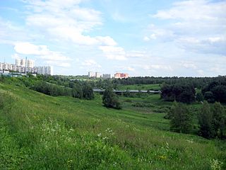
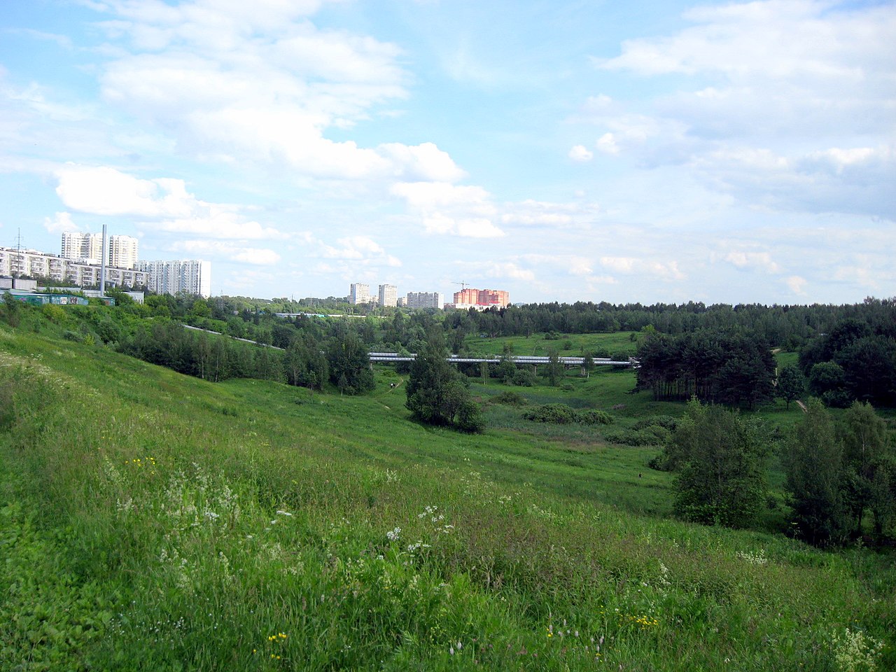
English: Moscow. South of Birylevo dendropark, the valley of Yazvenka Creek. Русский: Москва. Овраг ручья Язвенка - Юго-восточная окраина Бирюлёвского лесопарка (в черте района Орехово-Борисово-Южное) |
||
Date | 20 June 2010 (original upload date) | ||
Source | https://web.archive.org/web/20161014203931/http://www.panoramio.com/photo/36967990 | ||
Author | varnav | ||
Permission (Reusing this file) |
This file is licensed under the Creative Commons Attribution-Share Alike 3.0 Unported license. Attribution: varnav
|
||
Tags (from Panoramio photo page) InfoField | Moscow |
Camera location | 55° 35′ 59.1″ N, 37° 42′ 26.64″ E | View this and other nearby images on: OpenStreetMap | 55.599750; 37.707400 |
---|
Annotations InfoField | This image is annotated: View the annotations at Commons |
768
768
804
131
2048
1536
Линия центрального теплоснабжения ТЭЦ-26 «Южная» – Орехово-Борисово.
File history
Click on a date/time to view the file as it appeared at that time.
Date/Time | Thumbnail | Dimensions | User | Comment | |
---|---|---|---|---|---|
current | 02:54, 14 December 2016 | 2,048 × 1,536 (689 KB) | Panoramio upload bot (talk | contribs) | == {{int:filedesc}} == {{Information |description=South of Birylevo dendropark |date={{Original upload date|2010-06-20}} |source=http://www.panoramio.com/photo/36967990 |author=[http://www.panoramio.com/user/36839?with_photo_id=36967990 varnav] |permis... |
You cannot overwrite this file.
File usage on Commons
There are no pages that use this file.
Metadata
This file contains additional information such as Exif metadata which may have been added by the digital camera, scanner, or software program used to create or digitize it. If the file has been modified from its original state, some details such as the timestamp may not fully reflect those of the original file. The timestamp is only as accurate as the clock in the camera, and it may be completely wrong.
Camera manufacturer | Canon |
---|---|
Camera model | Canon PowerShot A560 |
Exposure time | 1/1,000 sec (0.001) |
F-number | f/7.1 |
ISO speed rating | 80 |
Date and time of data generation | 17:32, 19 June 2010 |
Lens focal length | 5.8 mm |
Latitude | 55° 35′ 59.1″ N |
Longitude | 37° 42′ 26.64″ E |
Altitude | 174.147 meters above sea level |
Orientation | 0 |
Horizontal resolution | 180 dpi |
Vertical resolution | 180 dpi |
Software used | Picasa 3.0 |
File change date and time | 17:32, 19 June 2010 |
Y and C positioning | Centered |
Exif version | 2.2 |
Date and time of digitizing | 17:32, 19 June 2010 |
Meaning of each component |
|
Image compression mode | 3 |
APEX shutter speed | 9.96875 |
APEX aperture | 5.65625 |
APEX exposure bias | 0 |
Maximum land aperture | 2.75 APEX (f/2.59) |
Metering mode | Pattern |
Flash | Flash did not fire, compulsory flash suppression |
Supported Flashpix version | 1 |
Color space | Uncalibrated |
Focal plane X resolution | 9,102.2222222222 |
Focal plane Y resolution | 9,088.7573964497 |
Focal plane resolution unit | inches |
Sensing method | One-chip color area sensor |
File source | Digital still camera |
Custom image processing | Normal process |
Exposure mode | Auto exposure |
White balance | Auto white balance |
Digital zoom ratio | 1 |
Scene capture type | Landscape |
Unique image ID | f2dafb2ed43b5151d2af1bd1281b40bf |
GPS time (atomic clock) | 13:32 |
Satellites used for measurement | 0 |
Geodetic survey data used | WGS-84 |
GPS date | 19 June 2010 |
GPS tag version | 0.0.2.2 |
Supported Flashpix version | 1 |
Image width | 2,048 px |
Image height | 1,536 px |
Compression scheme | JPEG (old) |