File:South Ruislip Station, exterior geograph-4010607-by-Ben-Brooksbank.jpg
Jump to navigation
Jump to search
Size of this preview: 800 × 478 pixels. Other resolutions: 320 × 191 pixels | 640 × 383 pixels | 1,024 × 612 pixels | 1,280 × 765 pixels | 2,329 × 1,392 pixels.
Original file (2,329 × 1,392 pixels, file size: 2.48 MB, MIME type: image/jpeg)
Captions
Captions
Add a one-line explanation of what this file represents
Summary
[edit]
| Description |
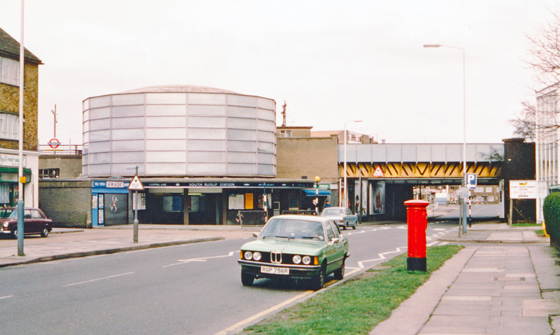
English: South Ruislip Station, exterior 1978. View NW on Station Approach Road, with the bridge carrying the Central Line (West Ruislip branch) nearest and the main lines from Marylebone (ex-GCR) and Paddington (ex-GWR) joining here (just to the right) to form (to the left) the ex-GW&GC Joint main line via High Wycombe and Princes Risborough to Birmingham etc. (GWR) and Leicester, Sheffield etc. (GCR). The station was called 'South Ruislip & Northolt Junction' 1932-1947, 'Northolt Junction' since built 5/1908; the London Underground station was opened 21/11/48. (My BMW 320 is prominent in the foreground |
| Date | |
| Source | From geograph.org.uk |
| Author | Ben Brooksbank |
| Permission (Reusing this file) |
Creative Commons Attribution Share-alike license 2.0 |
| Attribution (required by the license) | Ben Brooksbank / South Ruislip Station, exterior 1978 / |
| Camera location | | View this and other nearby images on: OpenStreetMap |
|---|
Licensing
[edit]

|
This image was taken from the Geograph project collection. See this photograph's page on the Geograph website for the photographer's contact details. The copyright on this image is owned by Ben Brooksbank and is licensed for reuse under the Creative Commons Attribution-ShareAlike 2.0 license.
|
This file is licensed under the Creative Commons Attribution-Share Alike 2.0 Generic license.
Attribution: Ben Brooksbank
- You are free:
- to share – to copy, distribute and transmit the work
- to remix – to adapt the work
- Under the following conditions:
- attribution – You must give appropriate credit, provide a link to the license, and indicate if changes were made. You may do so in any reasonable manner, but not in any way that suggests the licensor endorses you or your use.
- share alike – If you remix, transform, or build upon the material, you must distribute your contributions under the same or compatible license as the original.
File history
Click on a date/time to view the file as it appeared at that time.
| Date/Time | Thumbnail | Dimensions | User | Comment | |
|---|---|---|---|---|---|
| current | 06:10, 25 June 2014 | | 2,329 × 1,392 (2.48 MB) | Chevin (talk | contribs) | == {{int:filedesc}} == {{Information |Description={{en|1='''South Ruislip Station, exterior 1978.'''<br /> View NW on Station Approach Road, with the bridge carrying the Central Line (West Ruislip branch) nearest and the main lines from Marylebone (ex-... |
You cannot overwrite this file.
File usage on Commons
The following 2 pages use this file:
File usage on other wikis
The following other wikis use this file:
- Usage on fa.wikipedia.org