File:South Luconia Shoals retuschiert.jpg
Jump to navigation
Jump to search
Size of this preview: 800 × 480 pixels. Other resolutions: 320 × 192 pixels | 1,024 × 614 pixels | 1,600 × 960 pixels.
Original file (1,600 × 960 pixels, file size: 734 KB, MIME type: image/jpeg)
Captions
Captions
Add a one-line explanation of what this file represents
Summary
[edit]| Description |
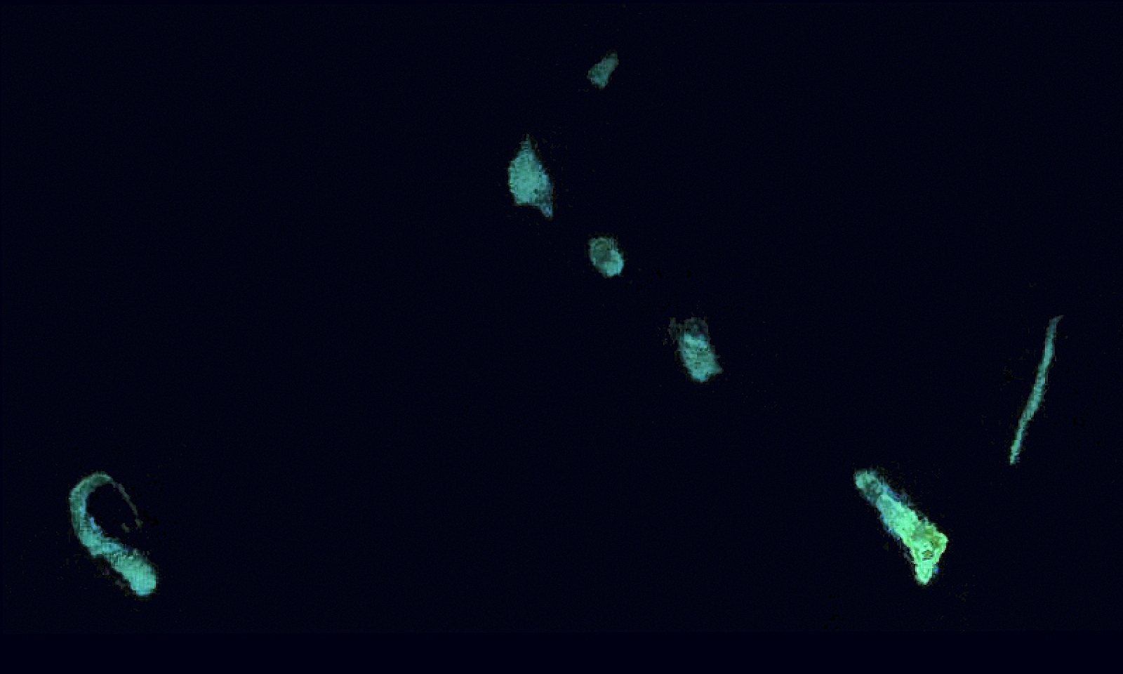
Deutsch: Landsat 7 Satellitenbild der südlichen Luconia-Untiefen (auch -Riffe, englisch South Luconia Shoals) im Südchinesische Meer südwestlich der Spratly-Inseln auf dem Festlandsockel vor dem malaysischen Bundesstaat Sarawak.
5°36′0.0″N 112°36′0.0″W / 5.6°N 112.6°W. |
| Date | |
| Source | https://web.archive.org/web/20120724041608/http://www.oceandots.com/pacific/luconia/ |
| Author | NASA |
| Other versions |
|


| This is a retouched picture, which means that it has been digitally altered from its original version. Modifications: Farbe und Kontrast verstärkt, Hintergrund stark abgedunkelt, Beschnitten. The original can be viewed here: South Luconia Shoals.jpg:
|
Licensing
[edit]
| This file is in the public domain in the United States because it was solely created by NASA. NASA copyright policy states that "NASA material is not protected by copyright unless noted". (See Template:PD-USGov, NASA copyright policy page or JPL Image Use Policy.) | ||
 |
Warnings:
|
File history
Click on a date/time to view the file as it appeared at that time.
| Date/Time | Thumbnail | Dimensions | User | Comment | |
|---|---|---|---|---|---|
| current | 16:03, 19 May 2015 | | 1,600 × 960 (734 KB) | Lämpel (talk | contribs) | =={{int:filedesc}}== {{Information |description={{de|1=Landsat 7 Satellitenbild der südlichen Luconia-Untiefen (auch -Riffe, englisch South Luconia Shoals) im Südchinesische Meer südwestlich der Spratly-Inseln auf dem Festlandsockel vor dem malaysis... |
You cannot overwrite this file.
File usage on Commons
There are no pages that use this file.
File usage on other wikis
The following other wikis use this file:
- Usage on de.wikipedia.org