File:South India 1899 Rand McNally.jpg
Jump to navigation
Jump to search

Size of this preview: 800 × 595 pixels. Other resolutions: 320 × 238 pixels | 640 × 476 pixels | 1,024 × 762 pixels | 1,280 × 953 pixels | 2,560 × 1,906 pixels | 3,184 × 2,370 pixels.
Original file (3,184 × 2,370 pixels, file size: 7.91 MB, MIME type: image/jpeg)
Captions
Captions
Add a one-line explanation of what this file represents
| Description |
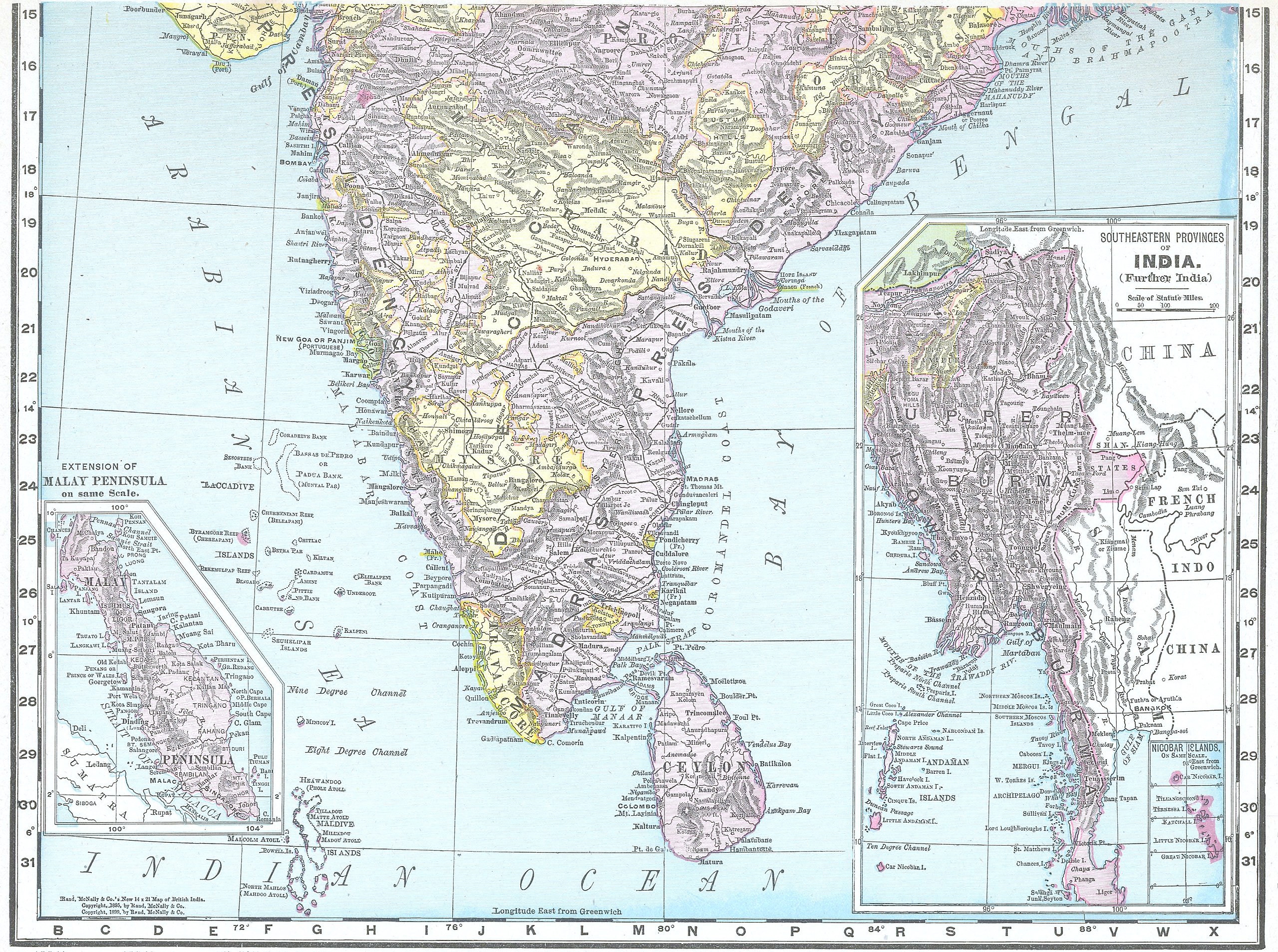
Rand, McNally & Co.'s new 14x21 map of Brtish India |
|||||||||
| Date | ||||||||||
| Source | Rand, McNally & Co.'s new 14x21 map of Brtish India | |||||||||
| Creator |
Rand, McNally & Co. |
|||||||||
| Permission (Reusing this file) |
|
|||||||||
| Geotemporal data | ||||||||||
| Bounding box |
|
|||||||||
| Georeferencing | ||||||||||
File history
Click on a date/time to view the file as it appeared at that time.
| Date/Time | Thumbnail | Dimensions | User | Comment | |
|---|---|---|---|---|---|
| current | 10:56, 10 January 2014 | | 3,184 × 2,370 (7.91 MB) | Shyamal (talk | contribs) | {{Information |Description=Rand, McNally & Co.'s new 14x21 map of Brtish India |Source=Rand, McNally & Co.'s new 14x21 map of Brtish India |Date=1899 |Author=Rand, McNally & Co. |Permission={{pd-1923}} |other_versions= }} [[Category:19th-century maps o... |
You cannot overwrite this file.
File usage on Commons
There are no pages that use this file.