File:Soufflerie de Chalais-Meudon.jpg
Jump to navigation
Jump to search
Size of this preview: 800 × 530 pixels. Other resolutions: 320 × 212 pixels | 640 × 424 pixels | 1,024 × 679 pixels | 1,280 × 848 pixels | 2,560 × 1,697 pixels | 3,276 × 2,171 pixels.
Original file (3,276 × 2,171 pixels, file size: 7.11 MB, MIME type: image/jpeg)
Captions
Captions
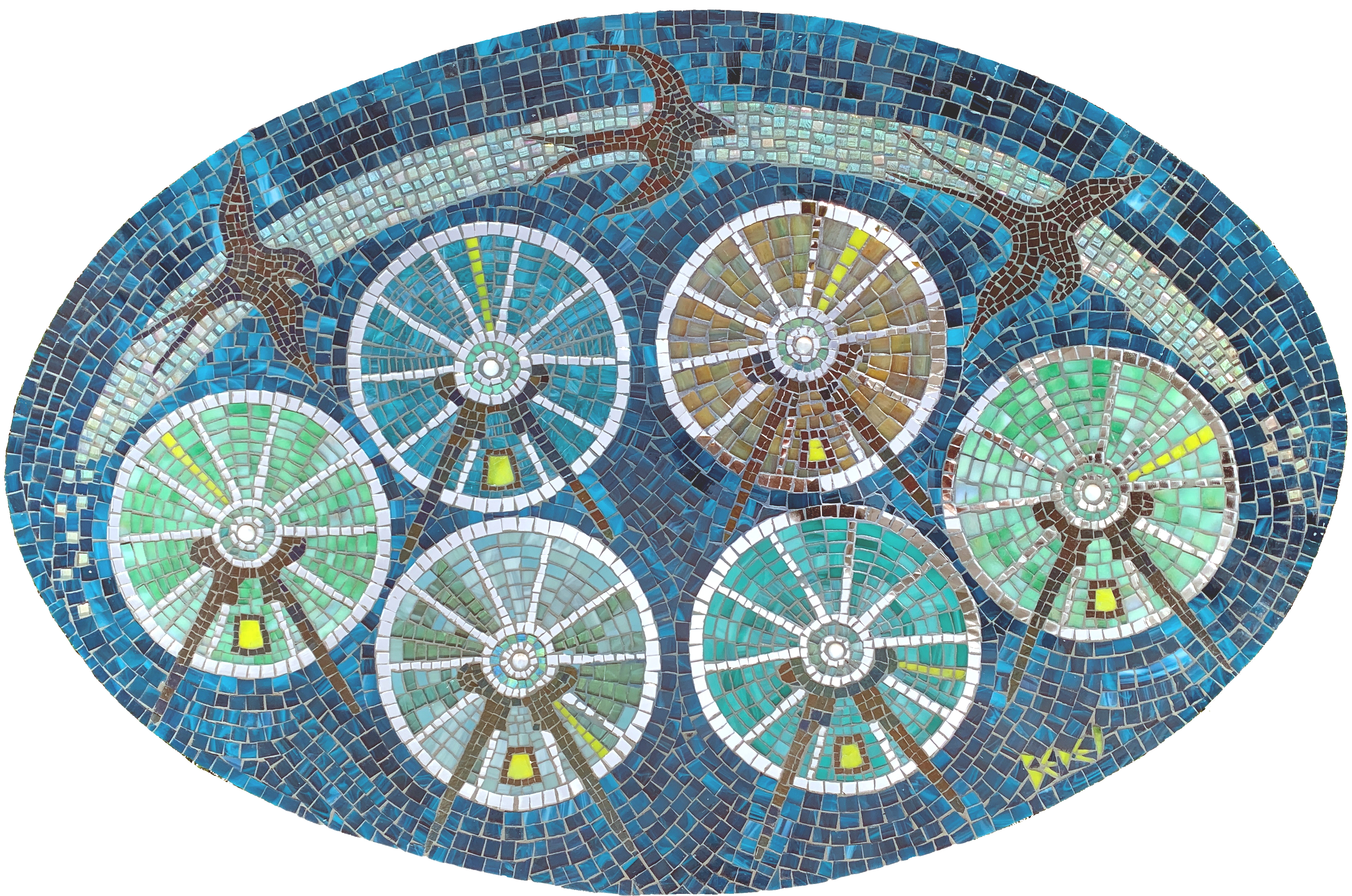
It was with my father in mind that I made this mosaic inspired by the Chalais-Meudon wind tunnel (ONERA) where my father worked. Artist: Anne BEDEL mosaist
Summary
[edit]
| Description |
Français : La construction de la soufflerie de l'ONERA à Chalais-Meudon a commencé le 1er juillet 1932 et mise en service le 1er octobre 1934.
La soufflerie est hors service depuis 1970 Hauteur 20 m - Largeur 40m - Longueur 68m 8 rue des Vertugadins 92190 MEUDON FRANCE Coordonnées: 48 ° 48 '1.58 "N 2 ° 14' 13.10"English: The blower has been out of service since 1970 Height 20 m - Width 40m - Length 68m 8 rue des Vertugadins 92190 MEUDON FRANCE
Coordinates: 48 ° 48 '1.58 "N 2 ° 14' 13.10" E Wind tunnel design: Antonin Lapresle The wind tunnel was used to test full-size aircraft. |
| Date | |
| Source | Own work |
| Author | Abedel |
| Camera location | | View this and other nearby images on: OpenStreetMap |
|---|
Mosaique de verre tifany sur bois. dimension 90 cm de large, 59 cm de haut et 1 cm d'épaisseur. poids 5 kilos.
Licensing
[edit]
I, the copyright holder of this work, hereby publish it under the following license:
This file is licensed under the Creative Commons Attribution-Share Alike 4.0 International license.
- You are free:
- to share – to copy, distribute and transmit the work
- to remix – to adapt the work
- Under the following conditions:
- attribution – You must give appropriate credit, provide a link to the license, and indicate if changes were made. You may do so in any reasonable manner, but not in any way that suggests the licensor endorses you or your use.
- share alike – If you remix, transform, or build upon the material, you must distribute your contributions under the same or compatible license as the original.
File history
Click on a date/time to view the file as it appeared at that time.
| Date/Time | Thumbnail | Dimensions | User | Comment | |
|---|---|---|---|---|---|
| current | 15:00, 5 May 2020 | | 3,276 × 2,171 (7.11 MB) | Abedel (talk | contribs) | Uploaded own work with UploadWizard |
You cannot overwrite this file.
File usage on Commons
The following page uses this file: