File:Soudelor 2015-08-04 0410Z.jpg
Jump to navigation
Jump to search

Size of this preview: 463 × 599 pixels. Other resolutions: 185 × 240 pixels | 371 × 480 pixels | 593 × 768 pixels | 791 × 1,024 pixels | 1,582 × 2,048 pixels | 6,800 × 8,800 pixels.
Original file (6,800 × 8,800 pixels, file size: 7.89 MB, MIME type: image/jpeg)
Captions
Captions
Add a one-line explanation of what this file represents
Summary
[edit]
| Description |
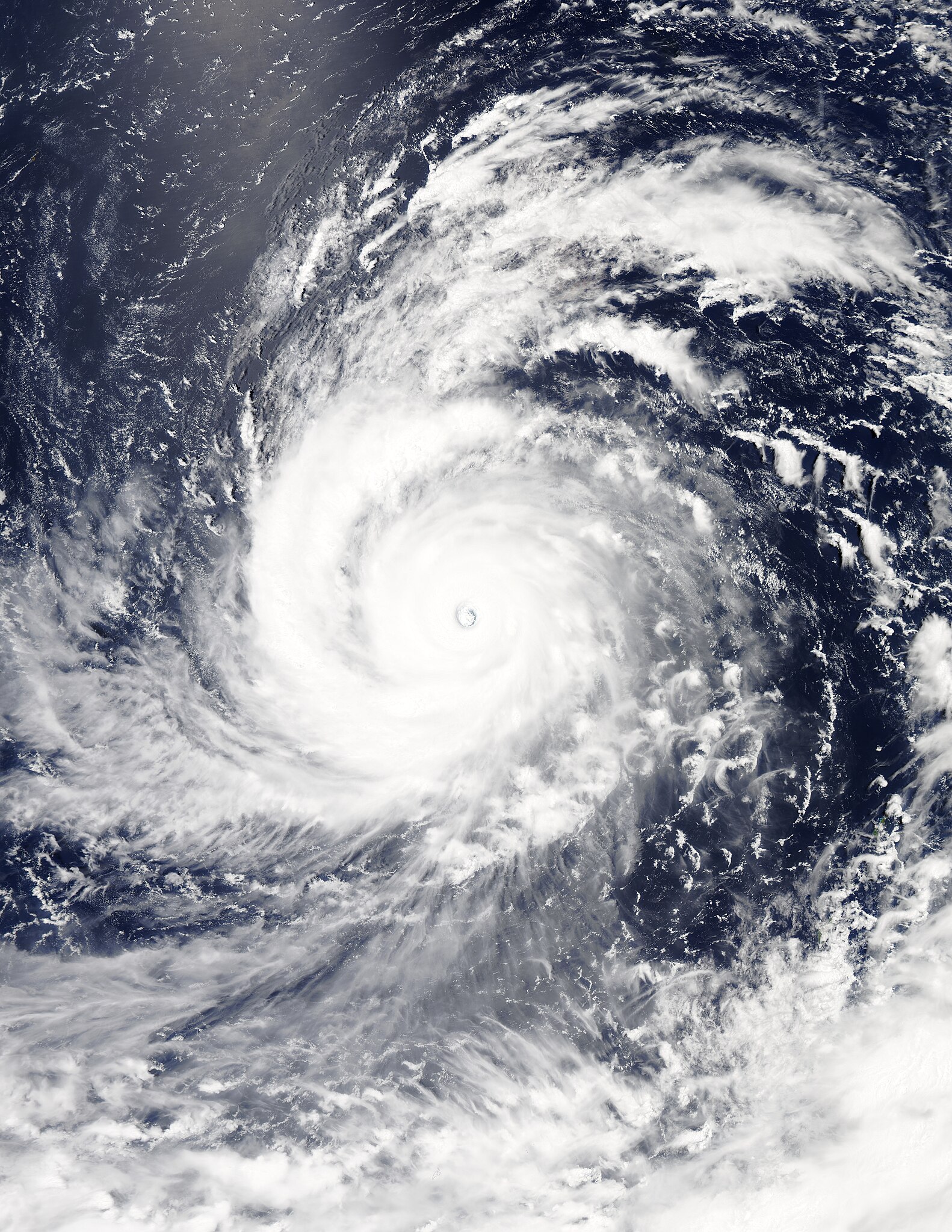
English: Typhoon Soudelor at peak intensity on August 4, 2015. |
| Date | |
| Source | Rapid Response - LANCE |
| Author | MODIS image captured by NASA’s Aqua satellite |
| Camera location | | View this and other nearby images on: OpenStreetMap |
|---|
Licensing
[edit]
| This file is in the public domain in the United States because it was solely created by NASA. NASA copyright policy states that "NASA material is not protected by copyright unless noted". (See Template:PD-USGov, NASA copyright policy page or JPL Image Use Policy.) | ||
 |
Warnings:
|
File history
Click on a date/time to view the file as it appeared at that time.
| Date/Time | Thumbnail | Dimensions | User | Comment | |
|---|---|---|---|---|---|
| current | 14:43, 5 September 2023 | | 6,800 × 8,800 (7.89 MB) | Nino Marakot (talk | contribs) | Reverted to version as of 11:35, 4 August 2015 (UTC) Such version already exists at File:Soudelor 2015-08-04 0405Z.jpg |
| 19:14, 17 August 2022 |  | 6,800 × 8,800 (26.96 MB) | TheWxResearcher (talk | contribs) | Tweaked Brightness so the structure of the storm would be more visible. | |
| 11:35, 4 August 2015 |  | 6,800 × 8,800 (7.89 MB) | Nino Marakot (talk | contribs) | Gallery | |
| 09:02, 4 August 2015 |  | 7,521 × 8,561 (6.17 MB) | Nino Marakot (talk | contribs) | User created page with UploadWizard |
You cannot overwrite this file.
File usage on Commons
The following 2 pages use this file:
- File:NASA Sees Soudelor Reach Category 5 Typhoon Status (19668877144).jpg (file redirect)
- File:Soudelor 2015-08-04 0500Z.jpg (file redirect)
.jpg&redirect=no)
File usage on other wikis
The following other wikis use this file:
- Usage on ar.wikipedia.org
- Usage on de.wikipedia.org
- Usage on diq.wikipedia.org
- Usage on en.wikipedia.org
- Usage on es.wikipedia.org
- Usage on fr.wikipedia.org
- Usage on id.wikipedia.org
- Usage on ja.wikipedia.org
- Usage on ko.wikipedia.org
- Usage on ms.wikipedia.org
- Usage on pt.wikipedia.org
- Usage on th.wikipedia.org
- Usage on tl.wikipedia.org
- Usage on uk.wikipedia.org
- Usage on vi.wikipedia.org
- Usage on zh.wikipedia.org