File:Sopo'aga waterfall - Samoa.jpg
Jump to navigation
Jump to search
Size of this preview: 800 × 429 pixels. Other resolutions: 320 × 172 pixels | 640 × 343 pixels | 1,024 × 549 pixels | 1,280 × 687 pixels | 2,560 × 1,374 pixels | 6,230 × 3,343 pixels.
Original file (6,230 × 3,343 pixels, file size: 3.2 MB, MIME type: image/jpeg)
Captions
Captions
Add a one-line explanation of what this file represents
| Description |
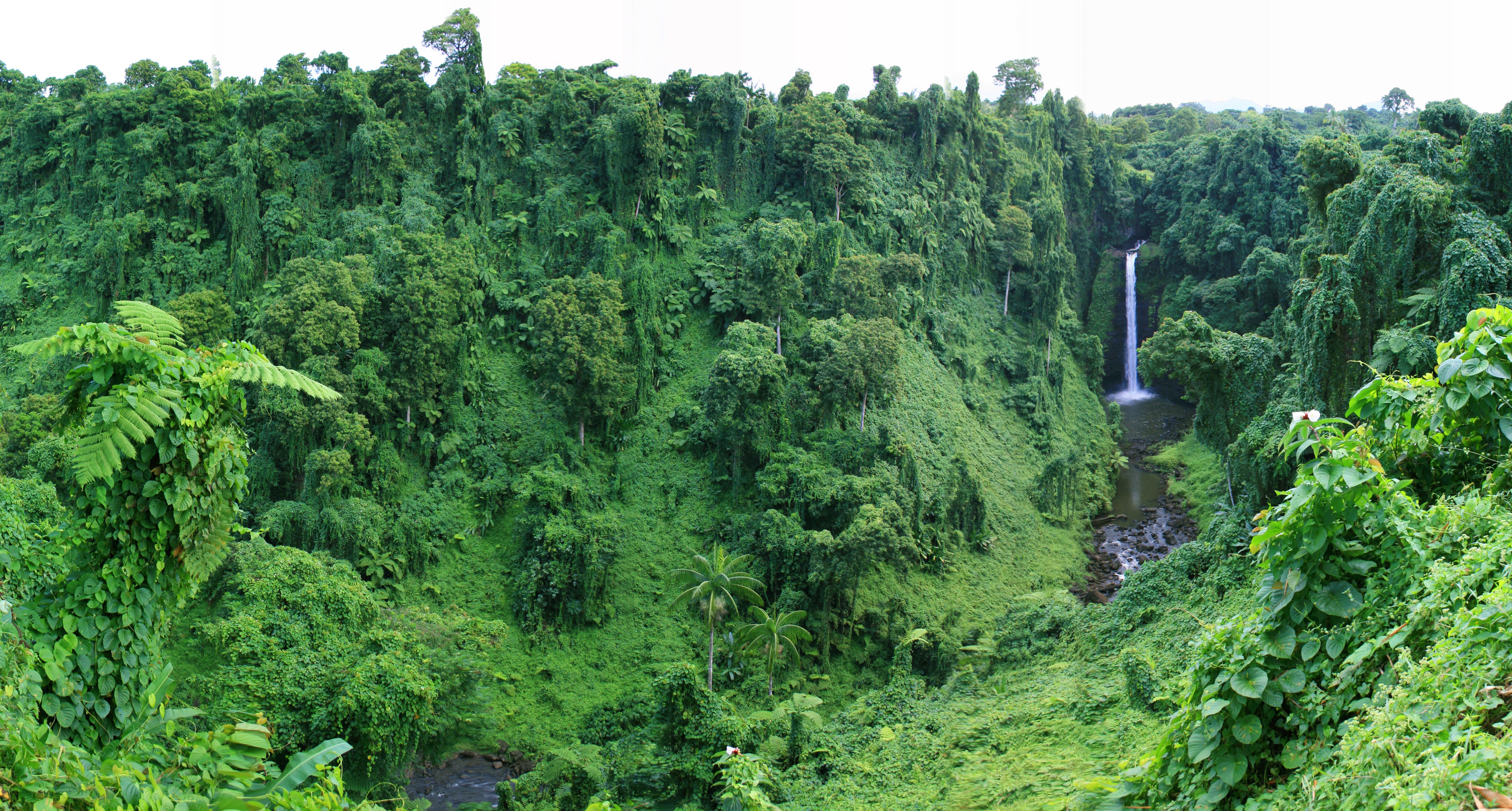
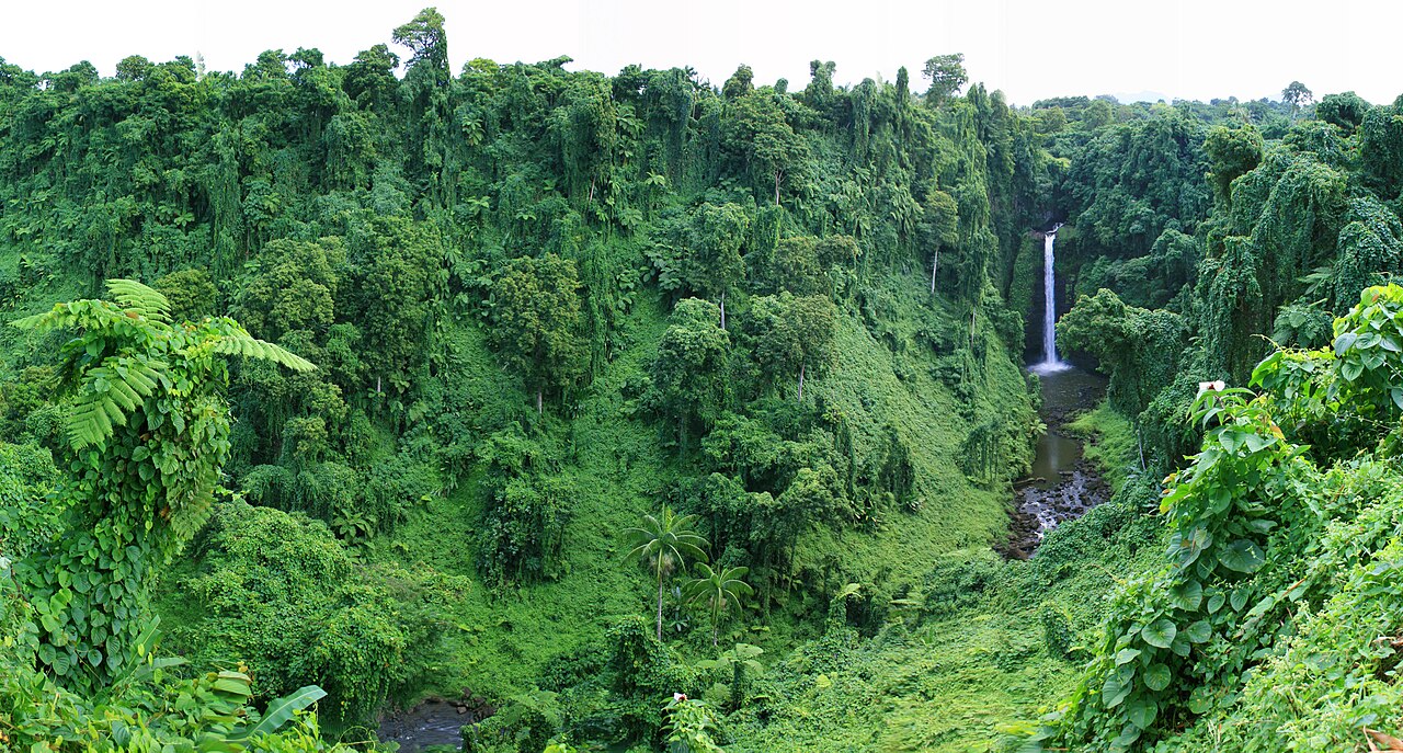
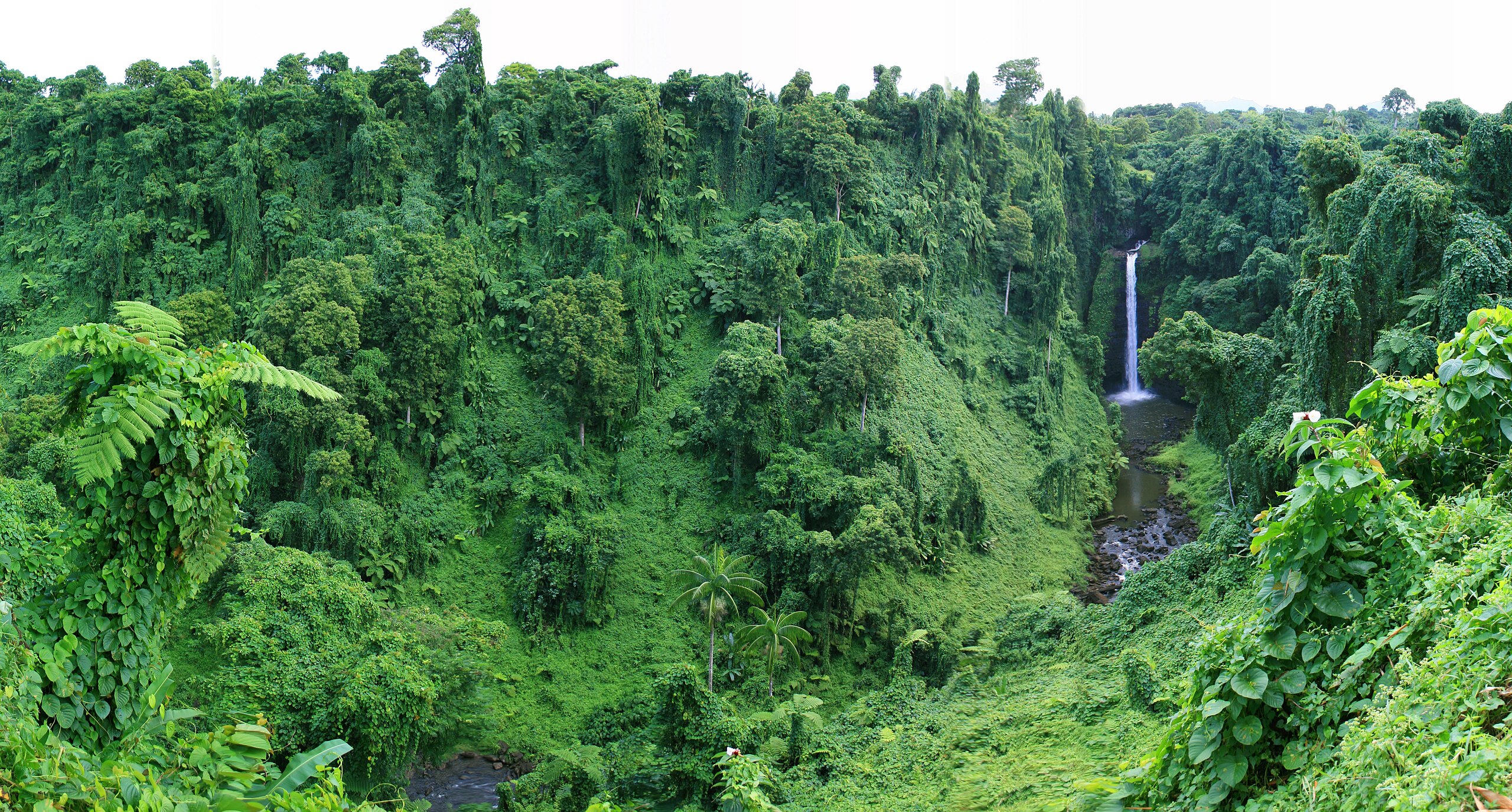
Sopo'aga waterfall at the east end of Upolu island in Samoa. Panorama of the valley |
||
| Date | |||
| Source | originally posted to Flickr as Sopo'aga Falls | ||
| Author | Neil | ||
| Permission (Reusing this file) |
This file is licensed under the Creative Commons Attribution 2.0 Generic license.
|
| Camera location | | View this and other nearby images on: OpenStreetMap |
|---|
File history
Click on a date/time to view the file as it appeared at that time.
| Date/Time | Thumbnail | Dimensions | User | Comment | |
|---|---|---|---|---|---|
| current | 04:31, 6 February 2010 | | 6,230 × 3,343 (3.2 MB) | Flickr upload bot (talk | contribs) | Uploaded from http://flickr.com/photo/21976354@N07/2348893041 using Flickr upload bot |
You cannot overwrite this file.
File usage on Commons
There are no pages that use this file.
File usage on other wikis
The following other wikis use this file:
- Usage on eo.wikipedia.org
- Usage on hu.wikipedia.org