File:Some Volcanoes of Guatemala in February 2017 - aerial view.png
Jump to navigation
Jump to search
Size of this preview: 800 × 496 pixels. Other resolutions: 320 × 198 pixels | 640 × 397 pixels | 1,024 × 635 pixels | 1,530 × 949 pixels.
Original file (1,530 × 949 pixels, file size: 1.18 MB, MIME type: image/png)
Captions
Captions
Add a one-line explanation of what this file represents
Summary
[edit]
| Description |
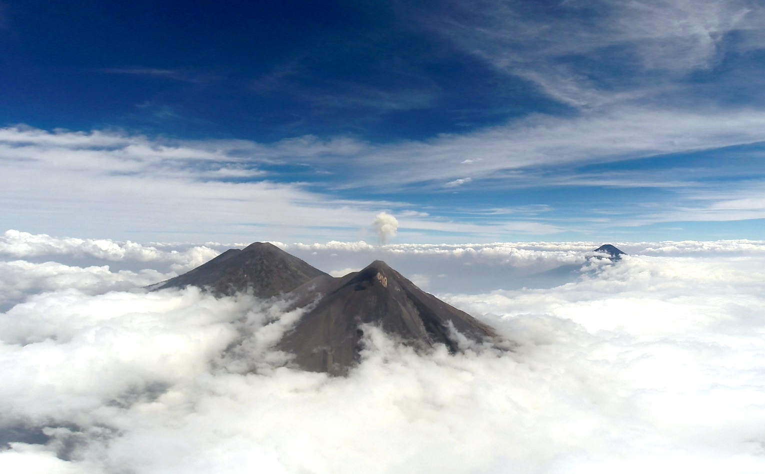
English: A shot taken from a drone flying towards Volcán de Fuego in Guatemala. The aim was to directly sample the plume gasses. In the image the plume of a recent eruption can be seen lingering above the summit. Also visible are the volcanoes Acatenango and Volcán de Agua. Credit: Kieran Wood (distributed via imaggeo.egu.eu). |
| Date | |
| Source | https://imaggeo.egu.eu/view/13020/ |
| Author | Kieran Wood (University of Bristol) (https://imaggeo.egu.eu/user/drkieranwood/) |
| Camera location | | View this and other nearby images on: OpenStreetMap |
|---|
Licensing
[edit]
This file is licensed under the Creative Commons Attribution-Share Alike 3.0 Unported license.
- You are free:
- to share – to copy, distribute and transmit the work
- to remix – to adapt the work
- Under the following conditions:
- attribution – You must give appropriate credit, provide a link to the license, and indicate if changes were made. You may do so in any reasonable manner, but not in any way that suggests the licensor endorses you or your use.
- share alike – If you remix, transform, or build upon the material, you must distribute your contributions under the same or compatible license as the original.
This file, which was originally posted to
https://imaggeo.egu.eu/view/13020/, was reviewed on 25 May 2018 by reviewer Leoboudv, who confirmed that it was available there under the stated license on that date.
|
| Annotations | This image is annotated: View the annotations at Commons |
File history
Click on a date/time to view the file as it appeared at that time.
| Date/Time | Thumbnail | Dimensions | User | Comment | |
|---|---|---|---|---|---|
| current | 15:20, 24 May 2018 | | 1,530 × 949 (1.18 MB) | GeoWriter (talk | contribs) | User created page with UploadWizard |
You cannot overwrite this file.
File usage on Commons
The following page uses this file: