File:Solapur district tehsils.svg
Jump to navigation
Jump to search

Size of this PNG preview of this SVG file: 728 × 600 pixels. Other resolutions: 292 × 240 pixels | 583 × 480 pixels | 933 × 768 pixels | 1,244 × 1,024 pixels | 2,487 × 2,048 pixels | 850 × 700 pixels.
Original file (SVG file, nominally 850 × 700 pixels, file size: 124 KB)
Captions
Captions
Add a one-line explanation of what this file represents
| Description |
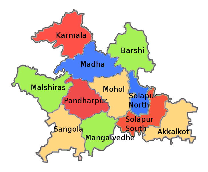
English: Tehsil map of Solapur district in the Indian state of Maharashtra. Created using this official map on Solapur district website: http://solapur.gov.in/map/smap6.html |
| Date | |
| Source | |
| Author |
|
| Other versions | Derivative works of this file: Solapur district tehsils Marathi.png |
| This is a retouched picture, which means that it has been digitally altered from its original version. The original can be viewed here: Solapur district blank map.svg:
|
I, the copyright holder of this work, hereby publish it under the following license:
This file is licensed under the Creative Commons Attribution-Share Alike 3.0 Unported license.
- You are free:
- to share – to copy, distribute and transmit the work
- to remix – to adapt the work
- Under the following conditions:
- attribution – You must give appropriate credit, provide a link to the license, and indicate if changes were made. You may do so in any reasonable manner, but not in any way that suggests the licensor endorses you or your use.
- share alike – If you remix, transform, or build upon the material, you must distribute your contributions under the same or compatible license as the original.
Original upload log
[edit]
This image is a derivative work of the following images:
- File:Solapur_district_blank_map.svg licensed with Cc-by-sa-3.0
- 2011-08-17T20:23:57Z Abhijitsathe 850x700 (34718 Bytes) '
Uploaded with derivativeFX
File history
Click on a date/time to view the file as it appeared at that time.
| Date/Time | Thumbnail | Dimensions | User | Comment | |
|---|---|---|---|---|---|
| current | 20:41, 17 August 2011 | | 850 × 700 (124 KB) | Abhijitsathe (talk | contribs) | {{Information |Description={{en|1=Tehsil map of Solapur district in the Indian state of Maharashtra. Created using this official map on Solapur district website: http://solapur.gov.in/map/smap6.html}} |date=2011-08-17 |Source=*[[:File:Solapur_dist |
You cannot overwrite this file.
File usage on Commons
The following page uses this file:
File usage on other wikis
The following other wikis use this file:
- Usage on bn.wikipedia.org
- Usage on en.wikipedia.org
- Usage on ka.wikipedia.org
- Usage on mr.wikipedia.org
- Usage on sat.wikipedia.org
- Usage on te.wikipedia.org