File:Soil map of Decatur County. - DPLA - 9b6f4d3a7c1a8df8f54e91fcd7f3d3fa.jpg
Jump to navigation
Jump to search
Size of this preview: 700 × 600 pixels. Other resolutions: 280 × 240 pixels | 560 × 480 pixels | 896 × 768 pixels | 1,195 × 1,024 pixels | 2,390 × 2,048 pixels | 3,055 × 2,618 pixels.
Original file (3,055 × 2,618 pixels, file size: 923 KB, MIME type: image/jpeg)
Captions
Captions
Add a one-line explanation of what this file represents
Summary
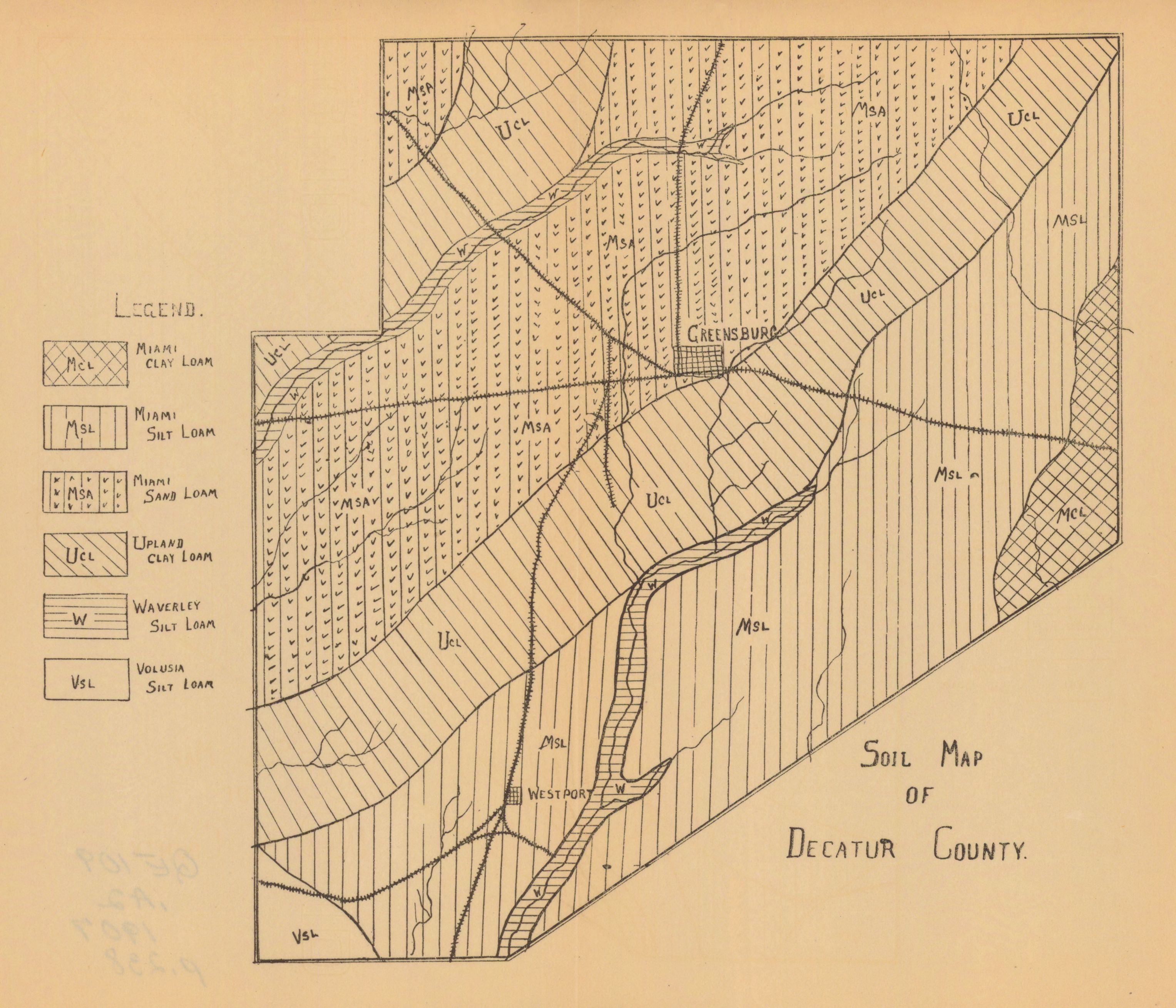
[edit]| Soil map of Decatur County.
( |
|||||||||||||||||
|---|---|---|---|---|---|---|---|---|---|---|---|---|---|---|---|---|---|
| Creator | |||||||||||||||||
| Title |
Soil map of Decatur County. |
||||||||||||||||
| Collection |
|
||||||||||||||||
| Source/Photographer |
|
||||||||||||||||
| Permission (Reusing this file) |
Copyright determination made by Indiana University Libraries ( Q58241552) using RightsStatements.org
|
||||||||||||||||


File history
Click on a date/time to view the file as it appeared at that time.
| Date/Time | Thumbnail | Dimensions | User | Comment | |
|---|---|---|---|---|---|
| current | 00:12, 9 April 2023 | | 3,055 × 2,618 (923 KB) | DPLA bot (talk | contribs) | Uploading DPLA ID dpla:9b6f4d3a7c1a8df8f54e91fcd7f3d3fa |
You cannot overwrite this file.
File usage on Commons
The following page uses this file: