File:Snow in the northeastern United States (MODIS 2017-03-20).jpg
Original file (6,400 × 5,000 pixels, file size: 7.16 MB, MIME type: image/jpeg)
Captions
Captions
Summary
[edit].jpg&action=edit§ion=1)
| Description |
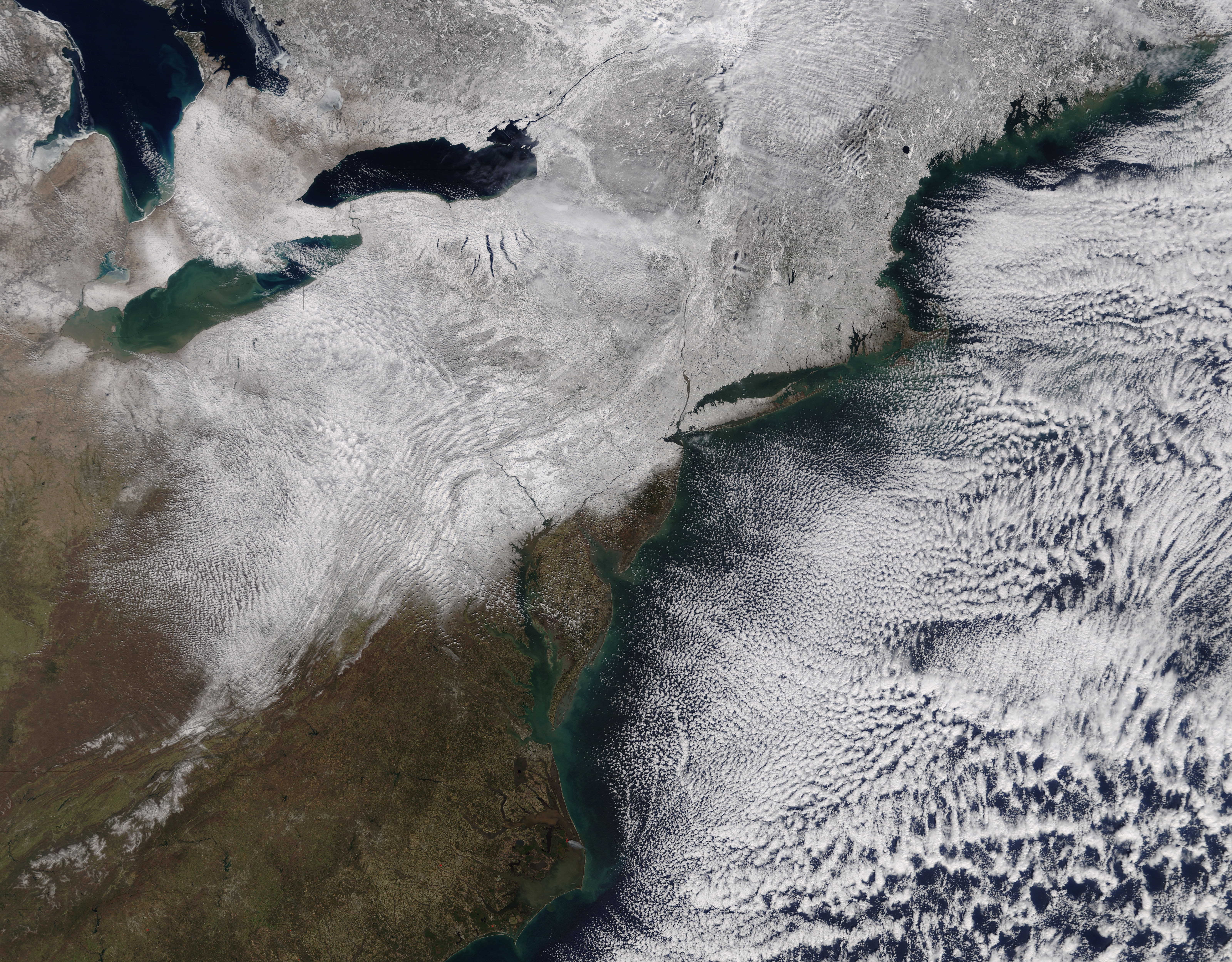
English: A late winter nor’easter pounded parts of the United States in mid-March 2017. The Moderate Resolution Imaging Spectroradiometer (MODIS) aboard NASA’s Terra satellite captured a true-color image of the aftermath of the storm on March 16.
On March 13, forecasters at the National Weather Service’s Weather Prediction Center (WPC) advised that a low pressure system crossing the Midwest states and Ohio Valley was set to merge with another low that was positioned off the southeast coast. As a result of this clash, they predicted “A powerful nor’easter will bring very heavy snow, ice, strong winds and dangerous travel conditions from the Middle Atlantic to New England…Strong winds could down trees and cause power outages”. On March 13, airlines that served the Mid-Atlantic region and Northeast began cancelling flights ahead of the storm. Stella’s fury began on March 14 with heavy icing in the southern part of the affected region. Baltimore airport reported ¼ inch (0.6 cm) of ice, while locations in New Jersey were hit with 0.4 inches (1 cm) of ice. Gusting winds combined with heavy ice downed powerlines and trees, and created dangerous driving conditions. Further north, Stella dumped record-breaking snowfall totals in some areas. According to The Weather Channel, the Bolton Valley Ski Area in the Green Mountains of northern Vermont reported a storm total of 58 inches on March 16. They also report that Stella was the heaviest snowstorm on record in Binghamton, New York, with 35.3 inches (89.7 cm) of snow dumped in just two days. This pushed this winter to the snowiest on record for the town, with 131.7 inches (334.5 cm) logged so far. A nor’easter takes its name from the northeasterly winds that blow in from the ocean ahead of the storm. Such storms form along the eastern of the coast as warm air blowing from the Atlantic Ocean clashes with frigid arctic air to the north and west. Nor’easters are most common in winter (September through April) and impact the northeastern part of the United States. |
||
| Date | Taken on 16 March 2017 | ||
| Source |
Snow in the northeastern United States (direct link)
|
||
| Author | Jeff Schmaltz, MODIS Land Rapid Response Team, NASA GSFC |
| This media is a product of the Terra mission Credit and attribution belongs to the mission team, if not already specified in the "author" row |
Licensing
[edit].jpg&action=edit§ion=2)
| This file is in the public domain in the United States because it was solely created by NASA. NASA copyright policy states that "NASA material is not protected by copyright unless noted". (See Template:PD-USGov, NASA copyright policy page or JPL Image Use Policy.) | ||
 |
Warnings:
|
File history
Click on a date/time to view the file as it appeared at that time.
| Date/Time | Thumbnail | Dimensions | User | Comment | |
|---|---|---|---|---|---|
| current | 18:59, 16 February 2024 | | 6,400 × 5,000 (7.16 MB) | OptimusPrimeBot (talk | contribs) | #Spacemedia - Upload of http://modis.gsfc.nasa.gov/gallery/images/image03202017_250m.jpg via Commons:Spacemedia |
You cannot overwrite this file.
File usage on Commons
There are no pages that use this file.
.jpg&oldid=852928070)