File:Snow in Afghanistan (MODIS 2020-01-16).jpg

Original file (5,823 × 4,619 pixels, file size: 3.56 MB, MIME type: image/jpeg)
Captions
Captions
Summary
[edit].jpg&action=edit§ion=1)
| Description |
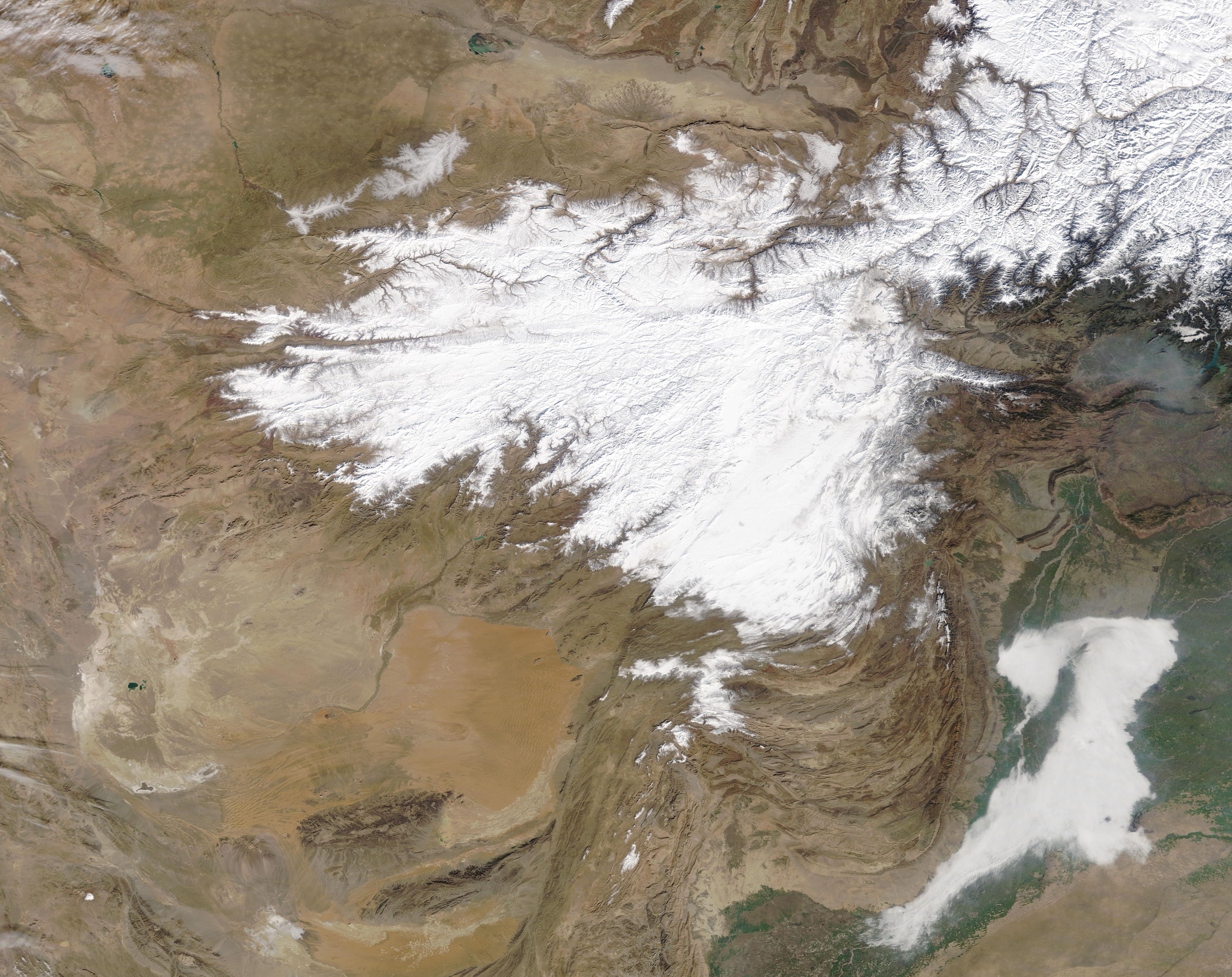
English: On January 9, 2020, the Moderate Resolution Imaging Spectroradiometer (MODIS) on board NASA’s Terra satellite acquired a true-color image of a thick blanket of bright white snow lying across the high elevations of Afghanistan (west) and Pakistan. In the southeast, fog (low cloud) hangs over the Indus River Valley along the border of Pakistan and India.
As wintery as this scene appears, only a few days later the region was pummeled by a severe winter storm. That storm swept across parts of the Middle East from January 10-14, bringing heavy rains, flash flooding, snow and even avalanches to a widespread area. While Pakistan and Afghanistan were hard hit by heavy snow and frigid temperatures, drenching rains fell on Saudi Arabia, Qatar, United Arab Emirates, northern Oman and southern Iran. According to Accuweather, the worst flooding occurred in Sistan-Baluchestan province, Iran, where 7.32 inches (186 mm) fell. The yearly average total rainfall reported is 4.69 (119 mm) for that region. The heavy snowfall caused roofs to collapse in parts of Pakistan and caused serious travel problems across the region. Temperatures plunged to -15°C (5°F) in Kabul, Afghanistan. Local and international media reports a number of people killed due to avalanches, cold, heavy snow and flooding. As of January 14, that number was listed as 126 people in Afghanistan and Pakistan alone. |
||
| Date | Taken on 9 January 2020 | ||
| Source |
Snow in Afghanistan (direct link)
|
||
| Author | MODIS Land Rapid Response Team, NASA GSFC |
| This media is a product of the Terra mission Credit and attribution belongs to the mission team, if not already specified in the "author" row |
Licensing
[edit].jpg&action=edit§ion=2)
| This file is in the public domain in the United States because it was solely created by NASA. NASA copyright policy states that "NASA material is not protected by copyright unless noted". (See Template:PD-USGov, NASA copyright policy page or JPL Image Use Policy.) | ||
 |
Warnings:
|
File history
Click on a date/time to view the file as it appeared at that time.
| Date/Time | Thumbnail | Dimensions | User | Comment | |
|---|---|---|---|---|---|
| current | 03:22, 17 February 2024 | | 5,823 × 4,619 (3.56 MB) | OptimusPrimeBot (talk | contribs) | #Spacemedia - Upload of http://modis.gsfc.nasa.gov/gallery/images/image01162020_250m.jpg via Commons:Spacemedia |
You cannot overwrite this file.
File usage on Commons
There are no pages that use this file.
.jpg&oldid=909380198)