File:Snaefell Mountain Course - Douglas area - West.svg
Jump to navigation
Jump to search

Size of this PNG preview of this SVG file: 800 × 554 pixels. Other resolutions: 320 × 222 pixels | 640 × 444 pixels | 1,024 × 710 pixels | 1,280 × 887 pixels | 2,560 × 1,774 pixels | 1,424 × 987 pixels.
Original file (SVG file, nominally 1,424 × 987 pixels, file size: 182 KB)
Captions
Captions
Add a one-line explanation of what this file represents
Summary
[edit]
| Description |
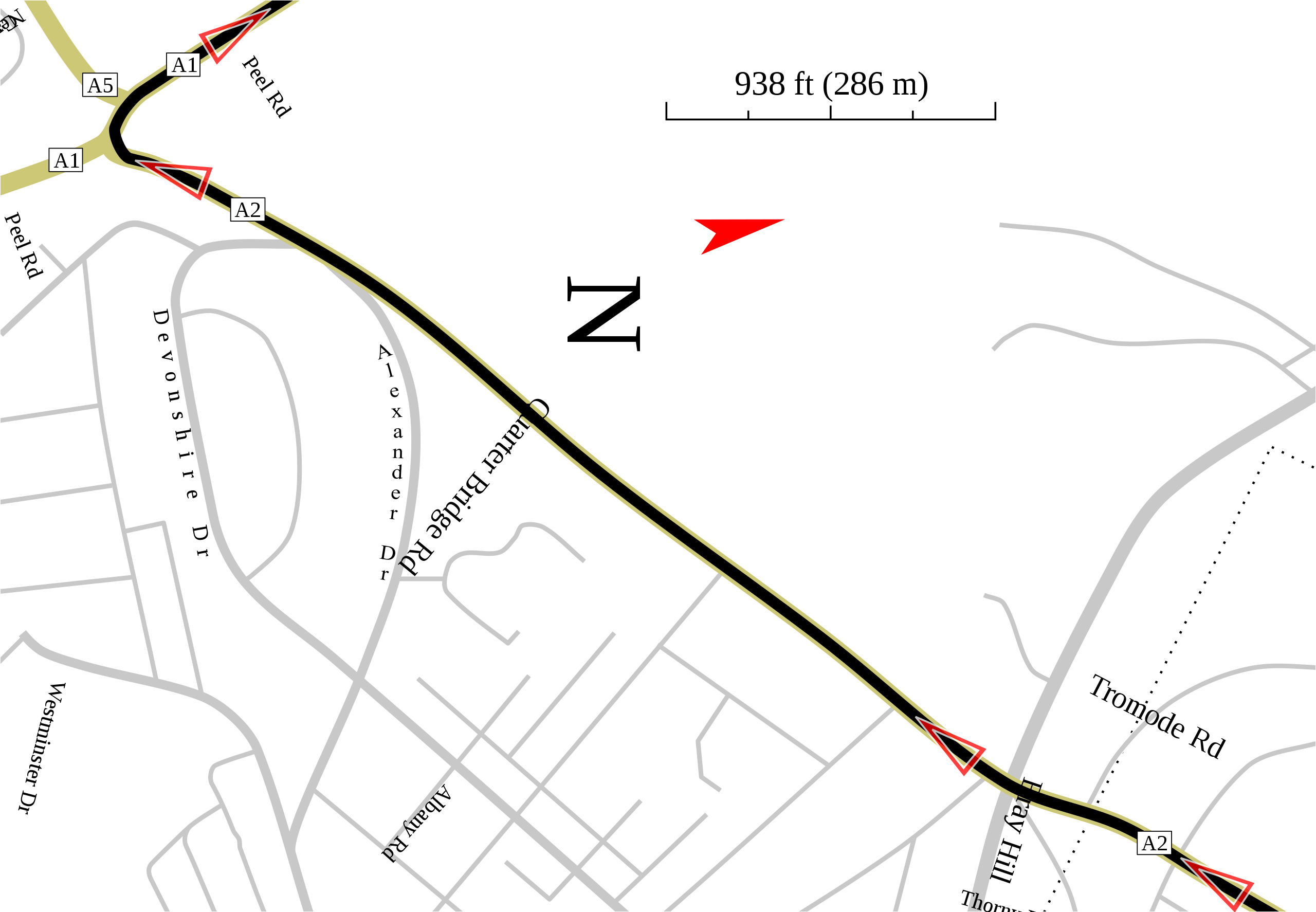
English: Track map of the Southwest portion of the Douglas area of the Snaefell Mountain Course on the Isle of Man. The rectangle made from dotted lines is a related map.
The text for "Alexander Dr" is backed up with an ID intended to make it easy to find in the Inkscape XML editor. That was needed as the Bend Path Effect (which I used on that object) works only on paths. So I had to convert the text object to a path. |
| Date | |
| Source | Own work |
| Author | Will Pittenger |
This W3C-unspecified vector image was created with Inkscape .
| Camera location | | View this and other nearby images on: OpenStreetMap |
|---|
Licensing
[edit]
I, the copyright holder of this work, hereby publish it under the following license:
This file is licensed under the Creative Commons Attribution-Share Alike 3.0 Unported license.
- You are free:
- to share – to copy, distribute and transmit the work
- to remix – to adapt the work
- Under the following conditions:
- attribution – You must give appropriate credit, provide a link to the license, and indicate if changes were made. You may do so in any reasonable manner, but not in any way that suggests the licensor endorses you or your use.
- share alike – If you remix, transform, or build upon the material, you must distribute your contributions under the same or compatible license as the original.
File history
Click on a date/time to view the file as it appeared at that time.
| Date/Time | Thumbnail | Dimensions | User | Comment | |
|---|---|---|---|---|---|
| current | 01:15, 25 October 2008 | | 1,424 × 987 (182 KB) | Will Pittenger (talk | contribs) | {{Information |Description={{en|1=Track map of the Southwest portion of the Douglas area of the Snaefell Mountain Course on the Isle of Man. The rectangle made from dotted lines is a related map. The text for "Alexander Dr" is backed up with an ID inten |
You cannot overwrite this file.
File usage on Commons
The following page uses this file:
File usage on other wikis
The following other wikis use this file:
- Usage on nl.wikipedia.org