File:Smoke and fires in southeastern United States (MODIS 2016-11-20).jpg
Original file (4,800 × 3,600 pixels, file size: 3.13 MB, MIME type: image/jpeg)
Captions
Captions
Summary
[edit].jpg&action=edit§ion=1)
| Description |
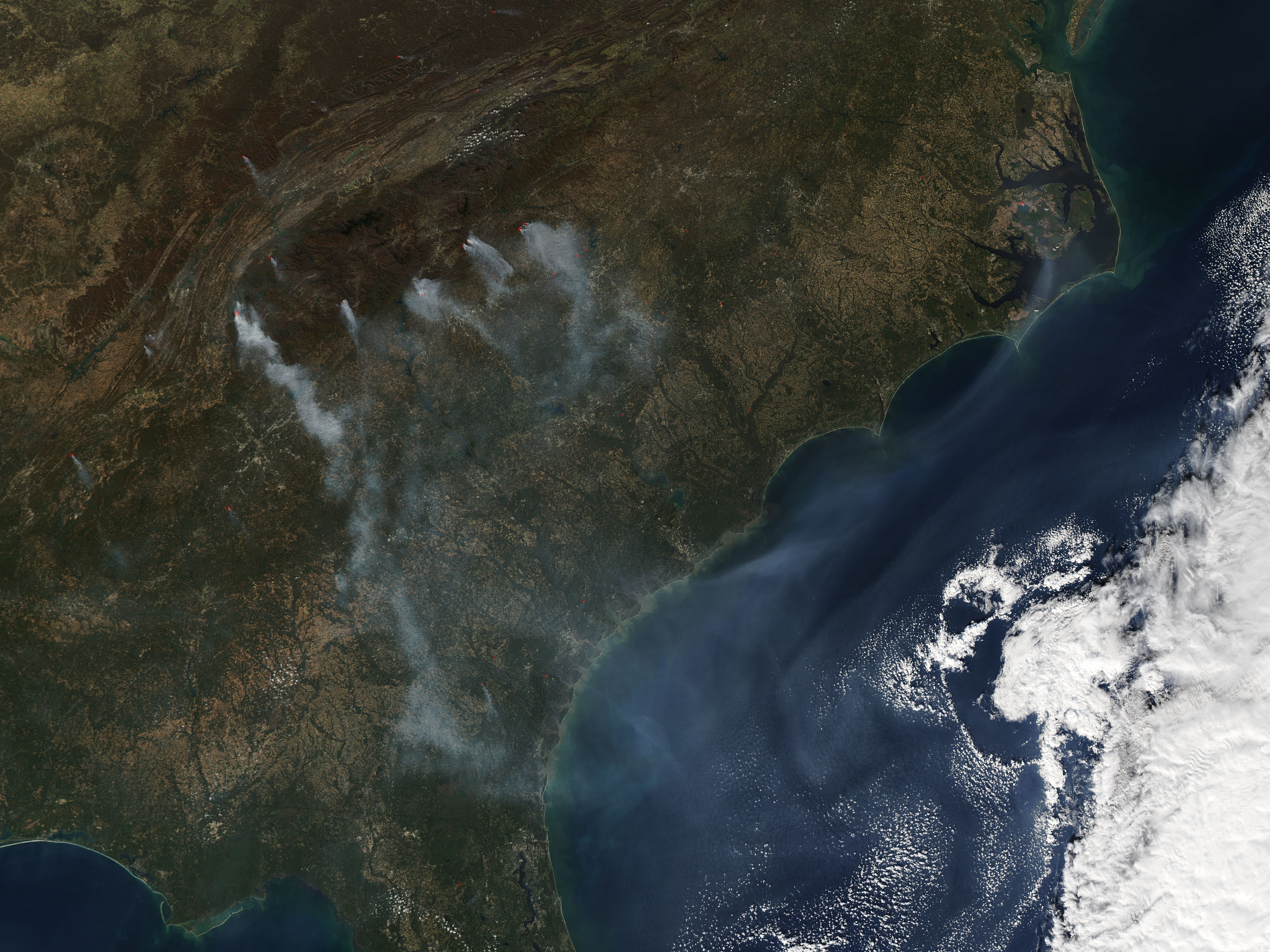
English: Fires continued to burn across the southeastern United States through mid-November 2016. The Moderate Resolution Imaging Spectroradiometer (MODIS) aboard NASA’s Aqua satellite captured this true-color image on November 16.
Red hotspots, each marking an area where the thermal bands on the MODIS instrument detected temperatures higher than background are scattered across the landscape. When accompanied by smoke, as in this image, such hotspots are diagnostic for actively burning fires. Only a few hotspots are seen in Kentucky, Virginia, and Tennessee, while multiple fires burn in North Carolina, South Carolina, and Georgia. A single hotspot can be seen in both Alabama and Florida. The fires which burn on the eastern foothills of the Appalachian Mountains are particularly smoky, with large plumes of gray smoke pouring to the southeast and creating an expansive haze, then covering the off-shore Atlantic Ocean. According to Inciweb, sixteen active fires continued to burn in North Carolina and three in Georgia as of November 19, which is a reduction in total incidents since this image was acquired. However, strong and gusting wind is predicted over much of the southwestern United States over the next several days as a strong cold front moves in from the northwest. According to Accuweather, the winds will help disperse the heavy smoke that had settled across the region, but may increase the risk of spread of the wildfires. |
||
| Date | Taken on 16 November 2016 | ||
| Source |
Smoke and fires in southeastern United States (direct link)
|
||
| Author | Jeff Schmaltz, MODIS Land Rapid Response Team, NASA GSFC |
| This media is a product of the Aqua mission Credit and attribution belongs to the mission team, if not already specified in the "author" row |
Licensing
[edit].jpg&action=edit§ion=2)
| This file is in the public domain in the United States because it was solely created by NASA. NASA copyright policy states that "NASA material is not protected by copyright unless noted". (See Template:PD-USGov, NASA copyright policy page or JPL Image Use Policy.) | ||
 |
Warnings:
|
File history
Click on a date/time to view the file as it appeared at that time.
| Date/Time | Thumbnail | Dimensions | User | Comment | |
|---|---|---|---|---|---|
| current | 19:13, 15 February 2024 | | 4,800 × 3,600 (3.13 MB) | OptimusPrimeBot (talk | contribs) | #Spacemedia - Upload of http://modis.gsfc.nasa.gov/gallery/images/image11202016_250m.jpg via Commons:Spacemedia |
You cannot overwrite this file.
File usage on Commons
There are no pages that use this file.
.jpg&oldid=852065278)