File:Smawthorne Swamps 1 - geograph.org.uk - 669909.jpg
Jump to navigation
Jump to search
Size of this preview: 445 × 600 pixels. Other resolutions: 178 × 240 pixels | 475 × 640 pixels.
Original file (475 × 640 pixels, file size: 136 KB, MIME type: image/jpeg)
Captions
Captions
Add a one-line explanation of what this file represents
Summary
[edit]
| Description |
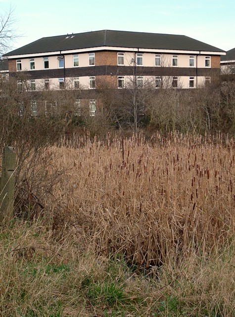
English: Smawthorne Swamps 1 Most of this area was originally allotments but subsidence made the land gradually wetter until all were abandoned by the end of the 1970s. Now it is a valuable urban nature reserve, a mix of impenetrable undergrowth, reedbeds and standing water, largely undisturbed by humans, with just a couple of paths through it. |
| Date | |
| Source | From geograph.org.uk |
| Author | David Pickersgill |
| Attribution (required by the license) | David Pickersgill / Smawthorne Swamps 1 / |
| Camera location | | View this and other nearby images on: OpenStreetMap |
|---|
_heading:22.00&language=en)
| Object location | | View this and other nearby images on: OpenStreetMap |
|---|
_heading:22.00&language=en)
Licensing
[edit]

|
This image was taken from the Geograph project collection. See this photograph's page on the Geograph website for the photographer's contact details. The copyright on this image is owned by David Pickersgill and is licensed for reuse under the Creative Commons Attribution-ShareAlike 2.0 license.
|
This file is licensed under the Creative Commons Attribution-Share Alike 2.0 Generic license.
Attribution: David Pickersgill
- You are free:
- to share – to copy, distribute and transmit the work
- to remix – to adapt the work
- Under the following conditions:
- attribution – You must give appropriate credit, provide a link to the license, and indicate if changes were made. You may do so in any reasonable manner, but not in any way that suggests the licensor endorses you or your use.
- share alike – If you remix, transform, or build upon the material, you must distribute your contributions under the same or compatible license as the original.
File history
Click on a date/time to view the file as it appeared at that time.
| Date/Time | Thumbnail | Dimensions | User | Comment | |
|---|---|---|---|---|---|
| current | 19:40, 7 February 2011 | | 475 × 640 (136 KB) | GeographBot (talk | contribs) | == {{int:filedesc}} == {{Information |description={{en|1=Smawthorne Swamps 1 Most of this area was originally allotments but subsidence made the land gradually wetter until all were abandoned by the end of the 1970s. Now it is a valuable urban nature res |
You cannot overwrite this file.
File usage on Commons
There are no pages that use this file.