File:Skallsjö.svg
Jump to navigation
Jump to search

Size of this PNG preview of this SVG file: 800 × 580 pixels. Other resolutions: 320 × 232 pixels | 640 × 464 pixels | 1,024 × 743 pixels | 1,280 × 929 pixels | 2,560 × 1,857 pixels | 3,762 × 2,729 pixels.
Original file (SVG file, nominally 3,762 × 2,729 pixels, file size: 284 KB)
Captions
Captions
Add a one-line explanation of what this file represents
| Description |
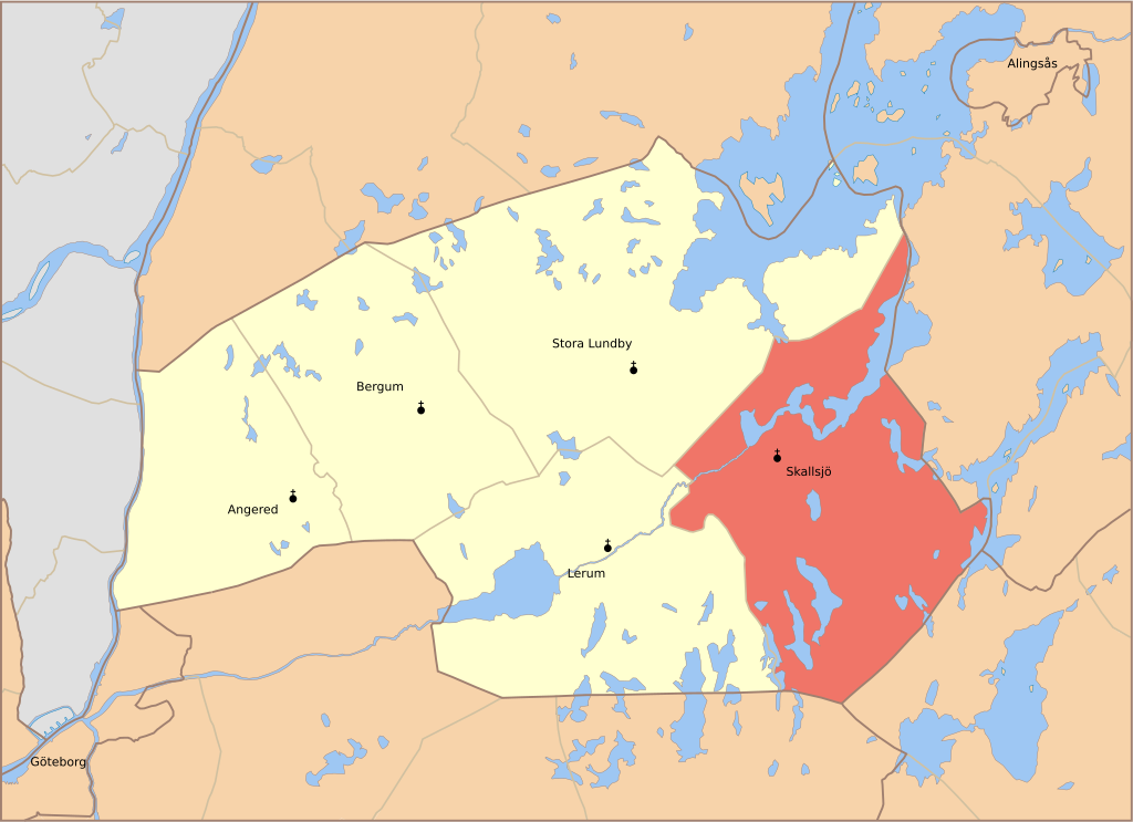
English: Map showing the borders of the civil parish of Skallsjö in the hundred of Vättle, Älvsborg County, Västergötland Region of Sweden. Circa 1850-1900. |
| Date | (1863 & 1869) |
| Source |
Own work English: Based on information from Topografiska Corpsens karta öfver Sverige, maps Borås (1869) and Göteborg (1863). |
| Author | Edaen |
| Permission (Reusing this file) |
This file is licensed under the Creative Commons Attribution 3.0 Unported license. Attribution: Edaen
|
File history
Click on a date/time to view the file as it appeared at that time.
| Date/Time | Thumbnail | Dimensions | User | Comment | |
|---|---|---|---|---|---|
| current | 07:31, 30 August 2010 | | 3,762 × 2,729 (284 KB) | Edaen (talk | contribs) | added frame |
| 07:08, 30 August 2010 |  | 3,761 × 2,726 (282 KB) | Edaen (talk | contribs) | removed churces outside area of interest | |
| 20:52, 29 August 2010 |  | 3,764 × 2,785 (294 KB) | Edaen (talk | contribs) | slightly improved | |
| 14:40, 26 August 2010 |  | 3,883 × 2,777 (474 KB) | Edaen (talk | contribs) | {{Information |Description={{en|1=Map of the parish ''Skallsjö'' in the hundred of ''Vättle'' in the region of ''Västergötland'' and the province ''Älvsborg''. Based on information from ''Topografiska Corpsens karta öfver Sverige'', maps ''Borås'' |
You cannot overwrite this file.
File usage on Commons
The following page uses this file:
File usage on other wikis
The following other wikis use this file:
- Usage on sv.wikipedia.org
- Usage on www.wikidata.org