File:Simcoe County Road map.svg
Jump to navigation
Jump to search

Size of this PNG preview of this SVG file: 319 × 453 pixels. Other resolutions: 169 × 240 pixels | 338 × 480 pixels | 541 × 768 pixels | 721 × 1,024 pixels | 1,442 × 2,048 pixels.
Original file (SVG file, nominally 319 × 453 pixels, file size: 92 KB)
Captions
Captions
Add a one-line explanation of what this file represents
Summary
[edit]
| Description |
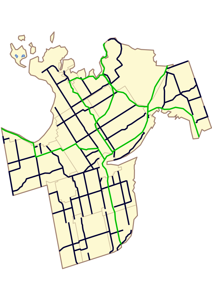
English: A locator map of Simcoe County. Use the X and Y co-ordinates to place a locator on the map in an infobox. Green represents Ontario highways, and blue represents Simcoe County Roads. |
| Date | |
| Source | Retraced and heavily modified from http://www.simcoe.ca/ws_cos/media/media/transportationengineeringfiles/county-roads.pdf. Created with Adobe Illustrator CS. |
| Author | Wikada |
Licensing
[edit]
| I, the copyright holder of this work, release this work into the public domain. This applies worldwide. In some countries this may not be legally possible; if so: I grant anyone the right to use this work for any purpose, without any conditions, unless such conditions are required by law. |
File history
Click on a date/time to view the file as it appeared at that time.
| Date/Time | Thumbnail | Dimensions | User | Comment | |
|---|---|---|---|---|---|
| current | 17:48, 1 September 2008 | | 319 × 453 (92 KB) | Wikada (talk | contribs) | {{Information |Description={{en|1=A locator map of Simcoe County. Use the X and Y co-ordinates to place a locator on the map in an infobox.}} |Source=Retraced and heavily modified from http://www.simcoe.ca/ws_cos/media/media/transportationengineeringfiles |
You cannot overwrite this file.
File usage on Commons
There are no pages that use this file.