File:Sierakowice (gmina) location map.png
Jump to navigation
Jump to search
Size of this preview: 769 × 600 pixels. Other resolutions: 308 × 240 pixels | 615 × 480 pixels | 923 × 720 pixels.
Original file (923 × 720 pixels, file size: 259 KB, MIME type: image/png)
Captions
Captions
Add a one-line explanation of what this file represents
| Description |
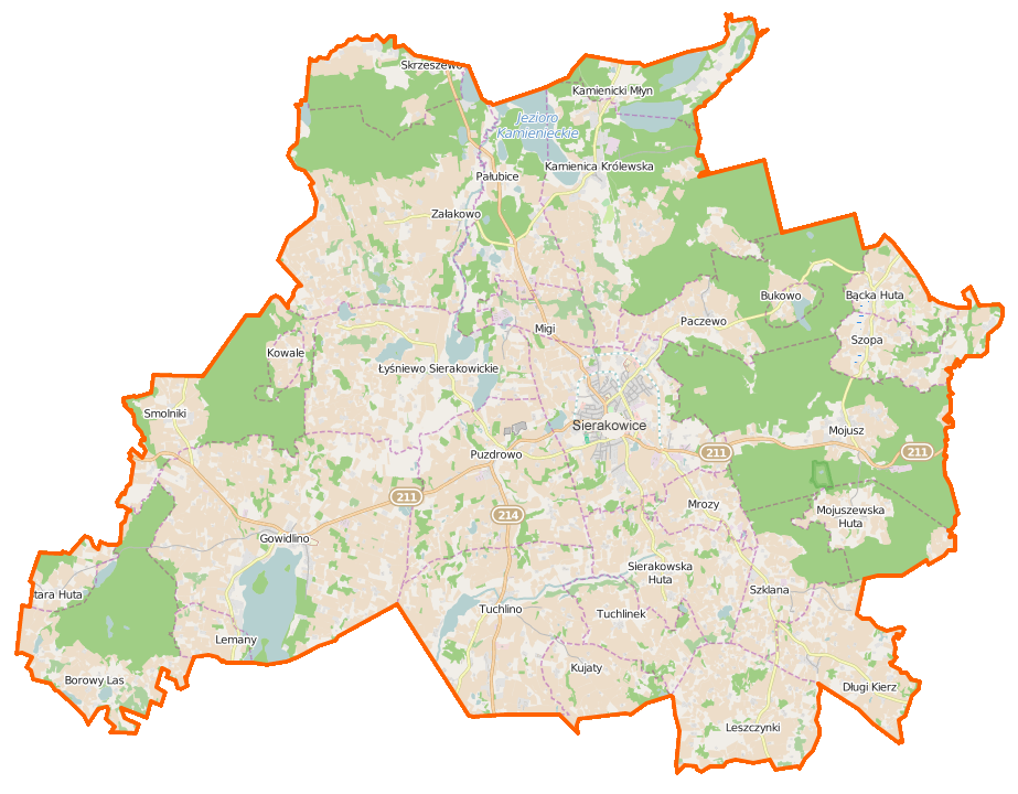
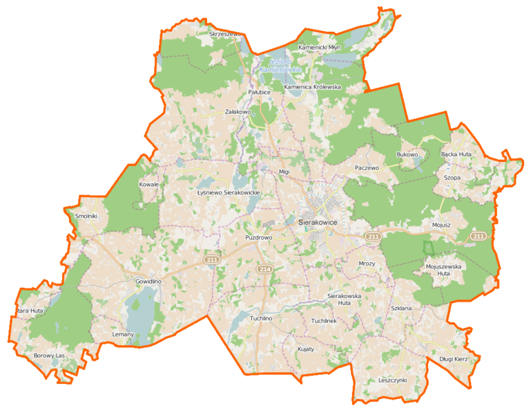
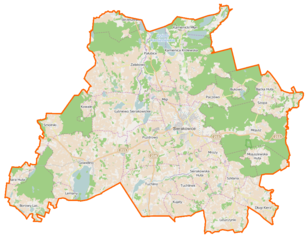
Polski: Mapa gminy Sierakowice, Polska
English: Map of Gmina Sierakowice, Poland |
|||||||||
| Date | ||||||||||
| Source | You may find a page on the OpenStreetMap wiki page for Sierakowice (gmina) | |||||||||
| Creator |
OpenStreetMap contributors OpenStreetMap contributors |
|||||||||
| Permission (Reusing this file) |
OpenStreetMap data is available under the Open Database License (details). Map tiles are licensed under the Creative Commons Attribution-ShareAlike 2.0 license (CC-BY-SA 2.0).
This file is licensed under the Creative Commons Attribution-Share Alike 2.0 Generic license.
|
|||||||||
| Geotemporal data | ||||||||||
| Bounding box |
|
|||||||||
| Georeferencing | If inappropriate please set warp_status = skip to hide. | |||||||||
File history
Click on a date/time to view the file as it appeared at that time.
| Date/Time | Thumbnail | Dimensions | User | Comment | |
|---|---|---|---|---|---|
| current | 06:27, 20 January 2015 | | 923 × 720 (259 KB) | VanWiel (talk | contribs) | {{OpenStreetMap | name = Sierakowice (gmina) | location = Sierakowice (gmina) | description = {{pl|Mapa gminy Sierakowice, Polska}} {{en|Map of Gmina Sierakowice, Poland}} | top = 54.4223 | bottom =... |
You cannot overwrite this file.
File usage on Commons
There are no pages that use this file.
File usage on other wikis
The following other wikis use this file:
- Usage on fr.wikipedia.org
- Ameryka (Kartuzy)
- Bącka Huta
- Bór (Poméranie)
- Borowy Las
- Bukowo (Kartuzy)
- Sierakowice (Poméranie)
- Ciechomie
- Dąbrowa Puzdrowska
- Długi Kierz
- Dolina Jadwigi
- Gowidlinko
- Gowidlino
- Gowidlino-Wybudowanie
- Jagodowo (Poméranie)
- Janowo (Kartuzy)
- Jelonko
- Kamienica Królewska
- Kamienicka Huta
- Kamienicki Młyn
- Kamionka Gowidlińska
- Karczewko (Poméranie)
- Karłowo (Poméranie)
- Karwacja
- Kokwino
- Koryta (Sierakowice)
- Kowale (Kartuzy)
- Kujaty
- Kukówka (Sierakowice)
- Łączki (Poméranie)
- Lemany (Poméranie)
- Leszczynki (Poméranie)
- Lisie Jamy (Poméranie)
- Łyśniewo Sierakowickie
- Migi
- Moczydło (Kartuzy)
- Mojusz
- Mojuszewska Huta
- Mrozy (Poméranie)
- Nowa Ameryka
- Nowalczysko
- Olszewko (Kartuzy)
- Paczewo
- Pałubice
- Patoki (Poméranie)
- Piekiełko (Sierakowice)
- Poljańska
- Poręby (Poméranie)
- Przylesie (Poméranie)
- Puzdrowo
- Puzdrowski Młyn
View more global usage of this file.
_location_map.png)
_location_map.png&oldid=453779634)