File:Siberia borders and administrative division.svg

Original file (SVG file, nominally 850 × 630 pixels, file size: 271 KB)
Captions
Captions
| Description |
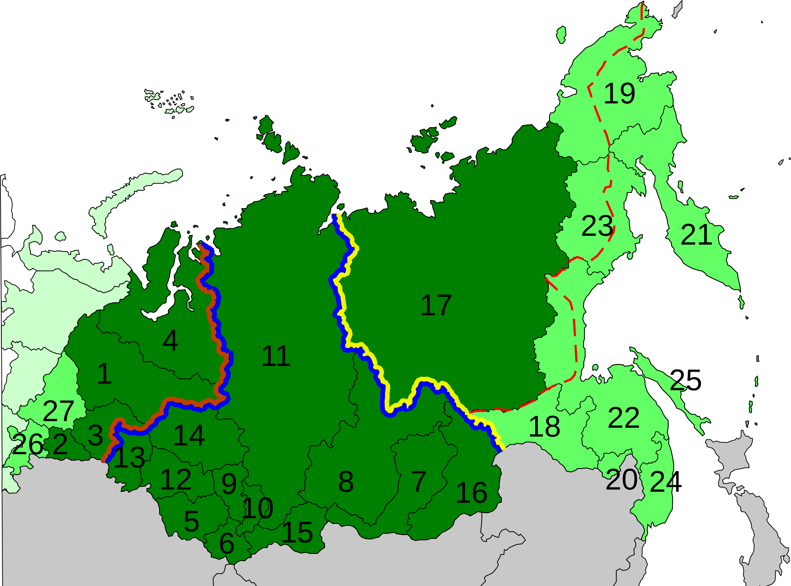
Subjects that are parts of Siberia. According to Great Soviet Encyclopedia (and many other Soviet and Russian sources) (dark green): Urals Federal District (brown border)
Siberian Federal District (blue border)
Far Eastern Federal District(yellow border)
Federal subjects of Siberia in wide sense—according to other sources (Britannica, etc.)(light green): Far Eastern Federal District:
Urals Federal District:
Red line is the Pacific-Arctic drainage divide (approximately) Based on the map of Russia with merged subjects (01.03.2008). |
| Date | (UTC) |
| Source | |
| Author |
|
| This is a retouched picture, which means that it has been digitally altered from its original version. The original can be viewed here: Siberia borders and administrative division.svg:
|
- You are free:
- to share – to copy, distribute and transmit the work
- to remix – to adapt the work
- Under the following conditions:
- attribution – You must give appropriate credit, provide a link to the license, and indicate if changes were made. You may do so in any reasonable manner, but not in any way that suggests the licensor endorses you or your use.
Original upload log
[edit]
This image is a derivative work of the following images:
- Image:Map of Russian subjects, 2008-03-01.svg licensed with Cc-by-2.5
- 2008-03-03T22:55:39Z Lokal Profil 1092x630 (296622 Bytes) Argh, updated using the wrong map. This is the 2008-03-01 map with federal district borders
- 2008-03-03T22:47:17Z Lokal Profil 1092x630 (295603 Bytes) Added thicker lines for Federal districts
- 2008-01-27T20:08:20Z Lokal Profil 1092x630 (227563 Bytes) Oupps... readded surrounding countries
- 2008-01-27T20:05:54Z Lokal Profil 1092x630 (191297 Bytes) Now also tagged by subject type
- 2008-01-26T23:00:44Z Lokal Profil 1092x630 (225978 Bytes) {{Information |Description=Map of Russia with merged subjects (01.03.2008, last merger [[w:en:Chita Oblast|Chita Oblast]]+[[w:en:Agin-Buryat Autonomous Okrug|Agin-Buryat Autonomous Okrug]] to form Zabaykalsky Krai.) The subje
Uploaded with derivativeFX
File history
Click on a date/time to view the file as it appeared at that time.
| Date/Time | Thumbnail | Dimensions | User | Comment | |
|---|---|---|---|---|---|
| current | 17:46, 4 June 2008 | | 850 × 630 (271 KB) | S .B. Odin (talk | contribs) | {{Information |Description=Part of the map of Russia displaying subjects that are parts of Siberia either according to Great Soviet Encyclopedia(and many other Soviet books) or according to other sources (Britannica, etc.) Based on the map of Russia with |
You cannot overwrite this file.
File usage on Commons
The following page uses this file: