File:Shropshire Way - geograph.org.uk - 1111789.jpg
Jump to navigation
Jump to search
No higher resolution available.
Shropshire_Way_-_geograph.org.uk_-_1111789.jpg (640 × 480 pixels, file size: 85 KB, MIME type: image/jpeg)
Captions
Captions
Add a one-line explanation of what this file represents
Summary
[edit]
| Description |
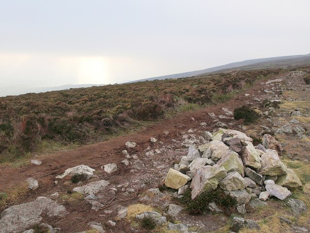
English: Shropshire Way From the point at which the Shropshire Way, having climbed from Bridges, reaches the Stiperstones ridge, here heading southwest from a crossroads of path and bridleways towards the main line of rocks. The path starts to get rough as irregular quartzite rocks form an increasing part of it. A teasing burst of sun southwards on a bitterly cold and cloudy day. |
| Date | |
| Source | From geograph.org.uk |
| Author | Derek Harper |
| Attribution (required by the license) | Derek Harper / Shropshire Way / |
| Camera location | | View this and other nearby images on: OpenStreetMap |
|---|
_heading:180.00&language=en)
| Object location | | View this and other nearby images on: OpenStreetMap |
|---|
_heading:180.00&language=en)
Licensing
[edit]

|
This image was taken from the Geograph project collection. See this photograph's page on the Geograph website for the photographer's contact details. The copyright on this image is owned by Derek Harper and is licensed for reuse under the Creative Commons Attribution-ShareAlike 2.0 license.
|
This file is licensed under the Creative Commons Attribution-Share Alike 2.0 Generic license.
Attribution: Derek Harper
- You are free:
- to share – to copy, distribute and transmit the work
- to remix – to adapt the work
- Under the following conditions:
- attribution – You must give appropriate credit, provide a link to the license, and indicate if changes were made. You may do so in any reasonable manner, but not in any way that suggests the licensor endorses you or your use.
- share alike – If you remix, transform, or build upon the material, you must distribute your contributions under the same or compatible license as the original.
File history
Click on a date/time to view the file as it appeared at that time.
| Date/Time | Thumbnail | Dimensions | User | Comment | |
|---|---|---|---|---|---|
| current | 22:14, 24 February 2011 | | 640 × 480 (85 KB) | GeographBot (talk | contribs) | == {{int:filedesc}} == {{Information |description={{en|1=Shropshire Way From the point at which the Shropshire Way, having climbed from Bridges, reaches the Stiperstones ridge, here heading southwest from a crossroads of path and bridleways towards the ma |
You cannot overwrite this file.
File usage on Commons
There are no pages that use this file.