File:Shire Hall, Warwick, geograph 5961090 by Alan Hughes.jpg
From Wikimedia Commons, the free media repository
Jump to navigation
Jump to search
Size of this preview: 800 × 523 pixels. Other resolutions: 320 × 209 pixels | 640 × 419 pixels | 1,024 × 670 pixels | 1,280 × 838 pixels | 2,560 × 1,675 pixels | 4,522 × 2,959 pixels.
Original file (4,522 × 2,959 pixels, file size: 2.69 MB, MIME type: image/jpeg)
File information
Structured data
Captions
Summary
[edit]DescriptionShire Hall, Warwick, geograph 5961090 by Alan Hughes.jpg |
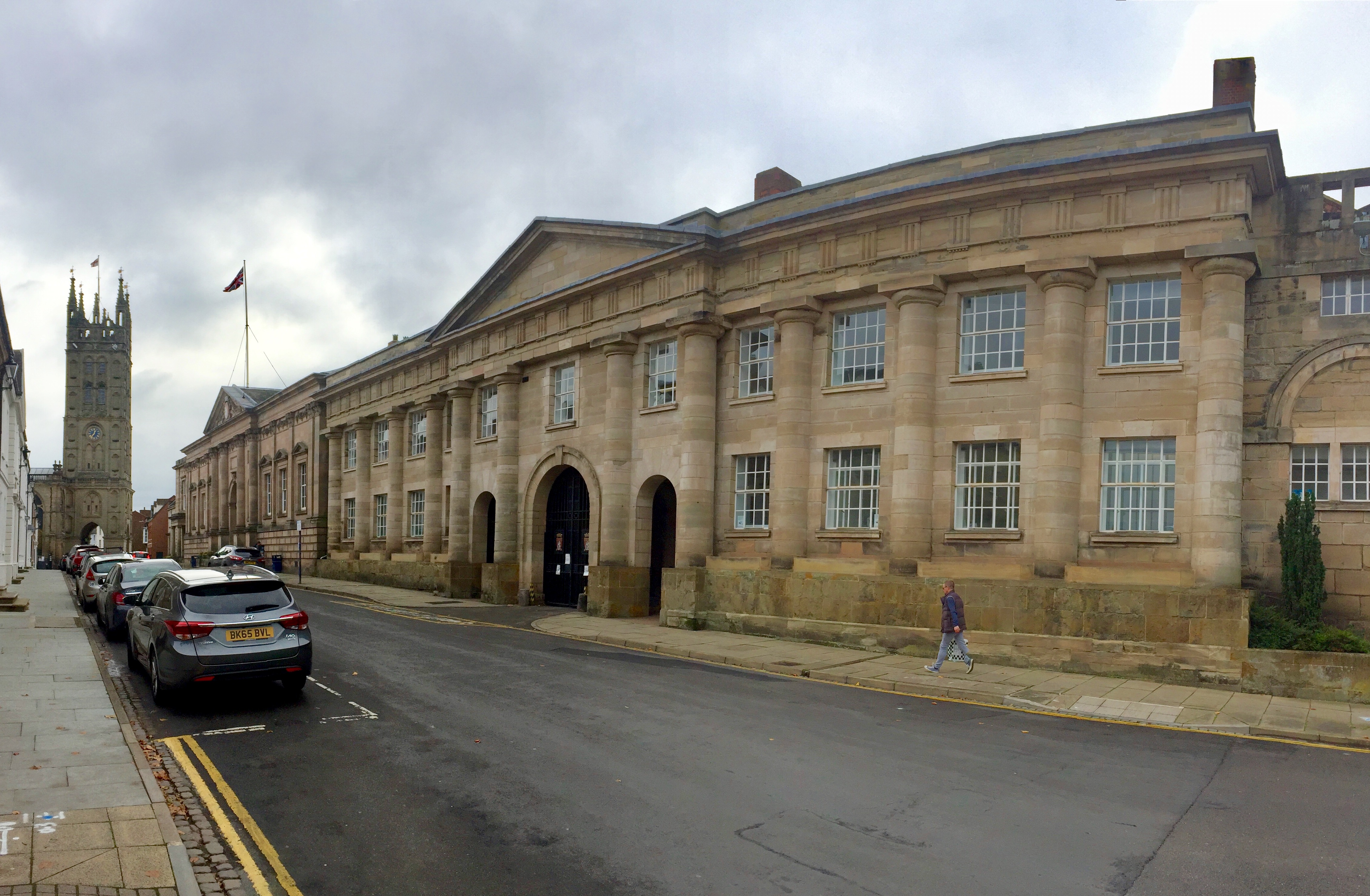
English: Shire Hall, Warwick
The Shire Hall at North Gate with the tower of St Mary's Church in the distance. |
||
Date | |||
Source | geograph.org.uk | ||
Author | Alan Hughes | ||
Permission (Reusing this file) |
This file is licensed under the Creative Commons Attribution-Share Alike 2.0 Generic license. Attribution: Alan Hughes
|
||
Attribution (required by the license) InfoField | Alan Hughes / Shire Hall, Warwick / | ||
InfoField | Alan Hughes / Shire Hall, Warwick |
Camera location | 52° 17′ 00.2″ N, 1° 35′ 20.66″ W | View this and other nearby images on: OpenStreetMap | 52.283389; -1.589072 |
---|
File history
Click on a date/time to view the file as it appeared at that time.
Date/Time | Thumbnail | Dimensions | User | Comment | |
---|---|---|---|---|---|
current | 03:17, 8 October 2021 | 4,522 × 2,959 (2.69 MB) | G-13114 (talk | contribs) | {{Information |description={{en|1=Shire Hall, Warwick The Shire Hall at North Gate with the tower of St Mary's Church in the distance.}} |date=2018-10-30 |source= [https://www.geograph.org.uk geograph.org.uk] |author= Alan Hughes |permission= {{Geograph|5961090|Alan Hughes}} |other_versions= |other fields= {{Credit line |Author = Alan Hughes |Other = ''Shire Hall, Warwick'' |License = CC-BY-SA-2.0 }} }} Category:Collegiate Church of St Mary, Warwick [[Category:October 2018 in Warwic... |
You cannot overwrite this file.
File usage on Commons
There are no pages that use this file.
File usage on other wikis
The following other wikis use this file:
- Usage on en.wikipedia.org
Metadata
This file contains additional information such as Exif metadata which may have been added by the digital camera, scanner, or software program used to create or digitize it. If the file has been modified from its original state, some details such as the timestamp may not fully reflect those of the original file. The timestamp is only as accurate as the clock in the camera, and it may be completely wrong.
Camera manufacturer | Apple |
---|---|
Camera model | iPhone 6 |
Exposure time | 1/1,364 sec (0.00073313782991202) |
F-number | f/2.2 |
ISO speed rating | 32 |
Date and time of data generation | 12:37, 30 October 2018 |
Lens focal length | 4.15 mm |
Latitude | 52° 17′ 0.2″ N |
Longitude | 1° 35′ 20.66″ W |
Altitude | 71.912 meters above sea level |
Horizontal resolution | 72 dpi |
Vertical resolution | 72 dpi |
Software used | 12.0.1 |
File change date and time | 12:37, 30 October 2018 |
Exif version | 2.21 |
Date and time of digitizing | 12:37, 30 October 2018 |
Meaning of each component |
|
APEX shutter speed | 10.4138996139 |
APEX aperture | 2.2750071245369 |
APEX brightness | 9.9156146179402 |
APEX exposure bias | 0 |
Metering mode | Pattern |
Flash | Flash did not fire |
DateTimeOriginal subseconds | 500 |
DateTimeDigitized subseconds | 500 |
Supported Flashpix version | 1 |
Color space | sRGB |
Sensing method | One-chip color area sensor |
Scene type | A directly photographed image |
Custom image processing | Panorama |
White balance | Auto white balance |
Focal length in 35 mm film | 29 mm |
Scene capture type | Standard |
GPS time (atomic clock) | 12:37 |
Speed unit | Kilometers per hour |
Speed of GPS receiver | 0 |
Reference for direction of image | True direction |
Direction of image | 273.13868613139 |
Reference for bearing of destination | True direction |
Bearing of destination | 273.13868613139 |
GPS date | 30 October 2018 |
Structured data
Items portrayed in this file
depicts
0.00073313782991202346 second
2.2
4.15 millimetre
image/jpeg
28b8ea191a9756a8007e69ca23145a567edd02ed
2,825,429 byte
2,959 pixel
4,522 pixel
52°17'0.200"N, 1°35'20.659"W
Hidden categories:
- CC-BY-SA-2.0
- Images from Geograph Britain and Ireland
- Images from Geograph Britain and Ireland missing SDC creator
- Images from Geograph Britain and Ireland missing SDC inception
- Images from Geograph Britain and Ireland missing SDC source of file
- Images from Geograph Britain and Ireland missing SDC coordinates of depicted place
- Information field template with formatting
- Files with coordinates missing SDC location of creation (52° N, 2° W)