File:Shepherds Bush tube station entrance geograph-4001128-by-Ben-Brooksbank.jpg
Jump to navigation
Jump to search

Size of this preview: 800 × 492 pixels. Other resolutions: 320 × 197 pixels | 640 × 393 pixels | 1,024 × 629 pixels | 1,280 × 787 pixels | 2,323 × 1,428 pixels.
Original file (2,323 × 1,428 pixels, file size: 3.47 MB, MIME type: image/jpeg)
Captions
Captions
Add a one-line explanation of what this file represents
Summary
[edit]
| Description |
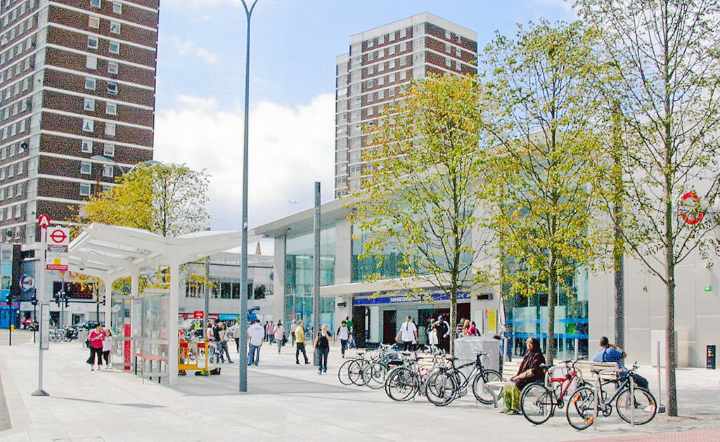
English: Entrance to Shepherds Bush station, London Underground Central Line. View southward on Shepherds Bush Place to the A4020 Uxbridge Road, the new Shepherds Bush Station on the Overground West London Line is off to the left, see TQ2379 : Northward by A3220 West Cross Road, outside new Shepherds Bush Market Station, 2009. This is the entrance to the 'Tube' Station on the Central Line: Epping/Hainault - Stratford - Oxford Circus (to left) - (to right) White City - North Acton - Ealing Broadway/West Ruislip. |
| Date | |
| Source | From geograph.org.uk |
| Author | Ben Brooksbank |
| Permission (Reusing this file) |
Creative Commons Attribution Share-alike license 2.0 |
| Attribution (required by the license) | Ben Brooksbank / Entrance to Shepherds Bush station, London Underground Central Line / |
| Camera location | | View this and other nearby images on: OpenStreetMap |
|---|
Licensing
[edit]

|
This image was taken from the Geograph project collection. See this photograph's page on the Geograph website for the photographer's contact details. The copyright on this image is owned by Ben Brooksbank and is licensed for reuse under the Creative Commons Attribution-ShareAlike 2.0 license.
|
This file is licensed under the Creative Commons Attribution-Share Alike 2.0 Generic license.
Attribution: Ben Brooksbank
- You are free:
- to share – to copy, distribute and transmit the work
- to remix – to adapt the work
- Under the following conditions:
- attribution – You must give appropriate credit, provide a link to the license, and indicate if changes were made. You may do so in any reasonable manner, but not in any way that suggests the licensor endorses you or your use.
- share alike – If you remix, transform, or build upon the material, you must distribute your contributions under the same or compatible license as the original.
File history
Click on a date/time to view the file as it appeared at that time.
| Date/Time | Thumbnail | Dimensions | User | Comment | |
|---|---|---|---|---|---|
| current | 06:55, 28 June 2014 | | 2,323 × 1,428 (3.47 MB) | Chevin (talk | contribs) | == {{int:filedesc}} == {{Information |Description={{en|1='''Entrance to Shepherds Bush station, London Underground Central Line.'''<br /> View southward on Shepherds Bush Place to the A4020 Uxbridge Road, the new Shepherds Bush Station on the Overgroun... |
You cannot overwrite this file.
File usage on Commons
The following page uses this file: