File:Shareshill 120237 0d90f4ac.jpg
Jump to navigation
Jump to search
No higher resolution available.
Shareshill_120237_0d90f4ac.jpg (540 × 360 pixels, file size: 49 KB, MIME type: image/jpeg)
Captions
Captions
Add a one-line explanation of what this file represents
Summary
[edit]
| Description |
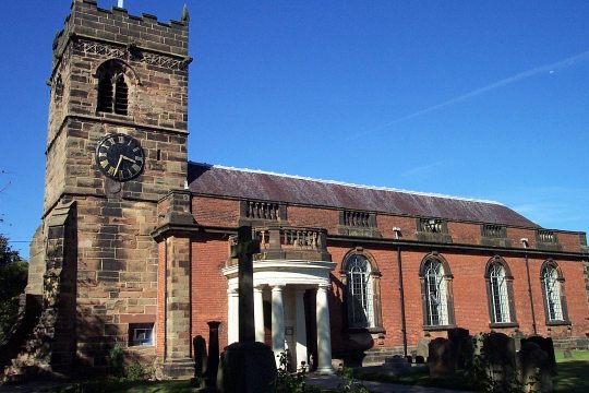
English: SS Mary and Luke parish church, Shareshill, Staffordshire, seen from the south |
| Date | 2006-09-13T17:56:53+00:00 |
| Source | From geograph.org.uk |
| Author | Geoff Pick |
| Permission (Reusing this file) |
Creative Commons Attribution Share-alike license 2.0 |
| Object location | | View this and other nearby images on: OpenStreetMap |
|---|
_region:GB-EAW_&language=en)
OSGB36: geotagged! SJ 94 06 [1000m precision] WGS84: 52:39.3718N 2:4.9646W
Licensing
[edit]

|
This image was taken from the Geograph project collection. See this photograph's page on the Geograph website for the photographer's contact details. The copyright on this image is owned by Geoff Pick and is licensed for reuse under the Creative Commons Attribution-ShareAlike 2.0 license.
|
This file is licensed under the Creative Commons Attribution-Share Alike 2.0 Generic license.
Attribution: Geoff Pick
- You are free:
- to share – to copy, distribute and transmit the work
- to remix – to adapt the work
- Under the following conditions:
- attribution – You must give appropriate credit, provide a link to the license, and indicate if changes were made. You may do so in any reasonable manner, but not in any way that suggests the licensor endorses you or your use.
- share alike – If you remix, transform, or build upon the material, you must distribute your contributions under the same or compatible license as the original.
File history
Click on a date/time to view the file as it appeared at that time.
| Date/Time | Thumbnail | Dimensions | User | Comment | |
|---|---|---|---|---|---|
| current | 19:38, 28 April 2008 | | 540 × 360 (49 KB) | Victuallers (talk | contribs) | {{Information |Description=St. Mary & St. Luke, Shareshill near to Shareshill, Staffordshire, Great Britain. OSGB36: geotagged! SJ 94 06 [1000m precision] WGS84: 52:39.3718N 2:4.9646W |Source=From [http://www.geograph.org.uk/photo/120237 geograph.org.uk] |
You cannot overwrite this file.
File usage on Commons
The following page uses this file:
File usage on other wikis
The following other wikis use this file:
- Usage on en.wikipedia.org
- Usage on es.wikipedia.org
- Usage on nl.wikipedia.org
- Usage on www.wikidata.org