File:Share Marsh, Near Oulton Broad - geograph.org.uk - 40549.jpg
Jump to navigation
Jump to search

Size of this preview: 625 × 600 pixels. Other resolutions: 250 × 240 pixels | 500 × 480 pixels | 640 × 614 pixels.
Original file (640 × 614 pixels, file size: 145 KB, MIME type: image/jpeg)
Captions
Captions
Add a one-line explanation of what this file represents
Summary
[edit]
| Description |
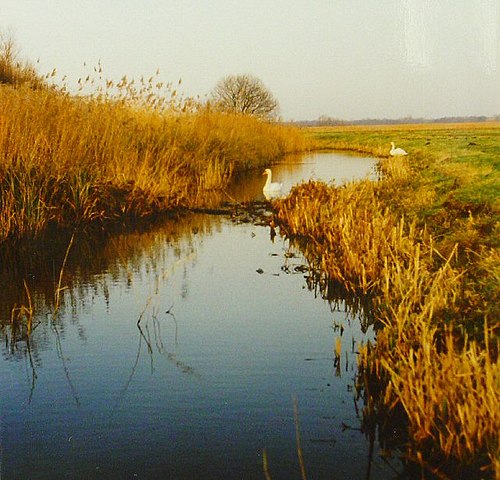
English: Share Marsh, Near Oulton Broad. Share Marsh is typical of much of the low lying ground in the Waveney Valley. A network of dykes and water pumps keeps the land dry enough for cattle grazing (but not suitable for crops). The view shows one of the smaller dykes with a pair of swans (which are quite common in this area). |
| Date | |
| Source | From geograph.org.uk |
| Author | Pete Chapman |
| Attribution (required by the license) | Pete Chapman / Share Marsh, Near Oulton Broad / |
| Object location | | View this and other nearby images on: OpenStreetMap |
|---|
_&language=en)
Licensing
[edit]

|
This image was taken from the Geograph project collection. See this photograph's page on the Geograph website for the photographer's contact details. The copyright on this image is owned by Pete Chapman and is licensed for reuse under the Creative Commons Attribution-ShareAlike 2.0 license.
|
This file is licensed under the Creative Commons Attribution-Share Alike 2.0 Generic license.
Attribution: Pete Chapman
- You are free:
- to share – to copy, distribute and transmit the work
- to remix – to adapt the work
- Under the following conditions:
- attribution – You must give appropriate credit, provide a link to the license, and indicate if changes were made. You may do so in any reasonable manner, but not in any way that suggests the licensor endorses you or your use.
- share alike – If you remix, transform, or build upon the material, you must distribute your contributions under the same or compatible license as the original.
File history
Click on a date/time to view the file as it appeared at that time.
| Date/Time | Thumbnail | Dimensions | User | Comment | |
|---|---|---|---|---|---|
| current | 18:25, 30 January 2010 | | 640 × 614 (145 KB) | GeographBot (talk | contribs) | == {{int:filedesc}} == {{Information |description={{en|1=Share Marsh, Near Oulton Broad. Share Marsh is typical of much of the low lying ground in the Waveney Valley. A network of dykes and water pumps keeps the land dry enough for cattle grazing (but not |
You cannot overwrite this file.
File usage on Commons
There are no pages that use this file.