File:Shahrak-e Namak Abrud (19).jpg
Jump to navigation
Jump to search
Size of this preview: 800 × 600 pixels. Other resolutions: 320 × 240 pixels | 640 × 480 pixels | 1,024 × 768 pixels | 1,280 × 960 pixels | 2,560 × 1,920 pixels | 3,000 × 2,250 pixels.
Original file (3,000 × 2,250 pixels, file size: 5.57 MB, MIME type: image/jpeg)
Captions
Captions
Add a one-line explanation of what this file represents
Summary
[edit]| Description |
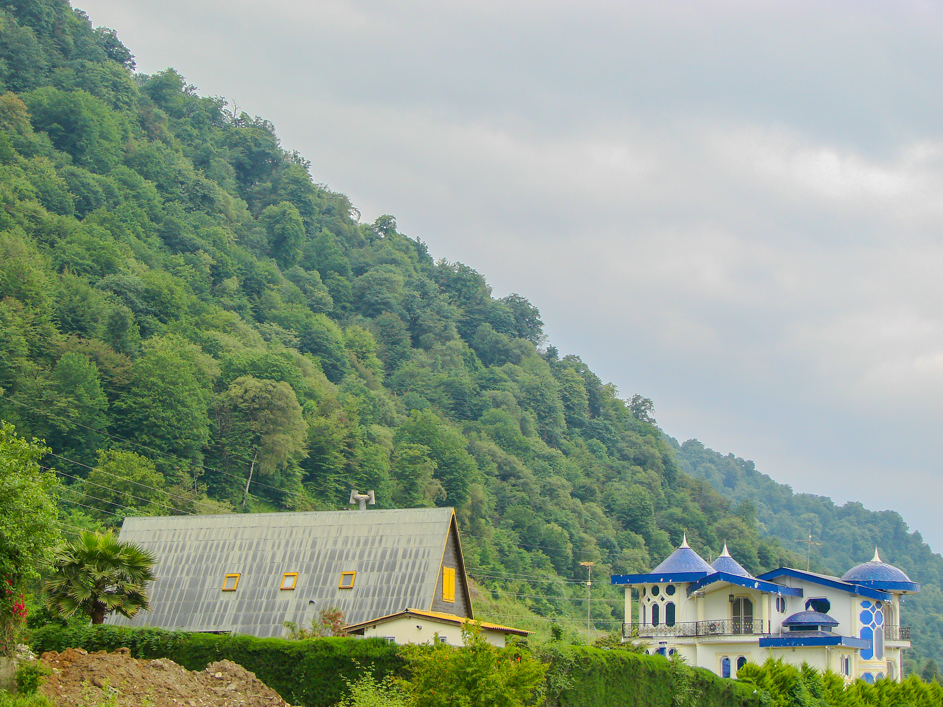
English: Shahrak-e Namak Abrud is a touristic village and has an aerial tramway which starts at the sea level near the shores of the Caspian Sea and ends on the top of the Alborz heights crossing dense forest area of northern Iran. There are numerous villa cities around it which form a vacation region for the people of Tehran.
فارسی: نمکآبرود شهرکی گردشگری و ویلایی است در استان مازندران ایران. این شهرک دارای دو خط تلهکابینی به نام تلهکابین نمکآبرود است.
شهرک نمک آبرود بین راه چالوس به تنکابن در ۱۲ کیلومتری چالوس قرار دارد.
Français : Namakabrood est situé à 12 km à l’est de Chalus et s’ettend sur une superficie de 650 hectares, avec la mer Caspienne au nord et Madoban (Alborz) au sud. Avec les parcs de violettes et la forêt dense de Madoban cette région offre des paysages splendides.
العربية: نمكآبرود (مقاطعة تشالوس) (بالإنجليزية: Shahrak-e Namak Abrud) هي مستوطنة تقع في Kelarestaq-e Gharbi Rural District في إيران.[1] يقدر عدد سكانها بـ 354 نسمة . |
| Date | |
| Source | Own work |
| Author | Mostafameraji |
| Other versions |

.jpg&action=edit§ion=1)
| Camera location | | View this and other nearby images on: OpenStreetMap |
|---|
.jpg¶ms=036.663961_N_0051.306605_E_globe:Earth_type:camera__&language=en)
Licensing
[edit].jpg&action=edit§ion=2)
I, the copyright holder of this work, hereby publish it under the following license:
| This file is made available under the Creative Commons CC0 1.0 Universal Public Domain Dedication. | |
| The person who associated a work with this deed has dedicated the work to the public domain by waiving all of their rights to the work worldwide under copyright law, including all related and neighboring rights, to the extent allowed by law. You can copy, modify, distribute and perform the work, even for commercial purposes, all without asking permission.
|
| Annotations | This image is annotated: View the annotations at Commons |
.jpg)
File history
Click on a date/time to view the file as it appeared at that time.
| Date/Time | Thumbnail | Dimensions | User | Comment | |
|---|---|---|---|---|---|
| current | 05:48, 8 January 2017 | | 3,000 × 2,250 (5.57 MB) | Mostafameraji (talk | contribs) | User created page with UploadWizard |
You cannot overwrite this file.
File usage on Commons
The following page uses this file:
File usage on other wikis
The following other wikis use this file:
- Usage on br.wikipedia.org
- Usage on fa.wikipedia.org
.jpg&oldid=912151132)