File:Sentinel-1A detects slick ESA360678.jpg
Jump to navigation
Jump to search
Size of this preview: 800 × 593 pixels. Other resolutions: 320 × 237 pixels | 640 × 475 pixels | 1,024 × 759 pixels | 1,280 × 949 pixels | 1,625 × 1,205 pixels.
Original file (1,625 × 1,205 pixels, file size: 536 KB, MIME type: image/jpeg)
Captions
Captions
Add a one-line explanation of what this file represents
Summary
[edit]
| Description |
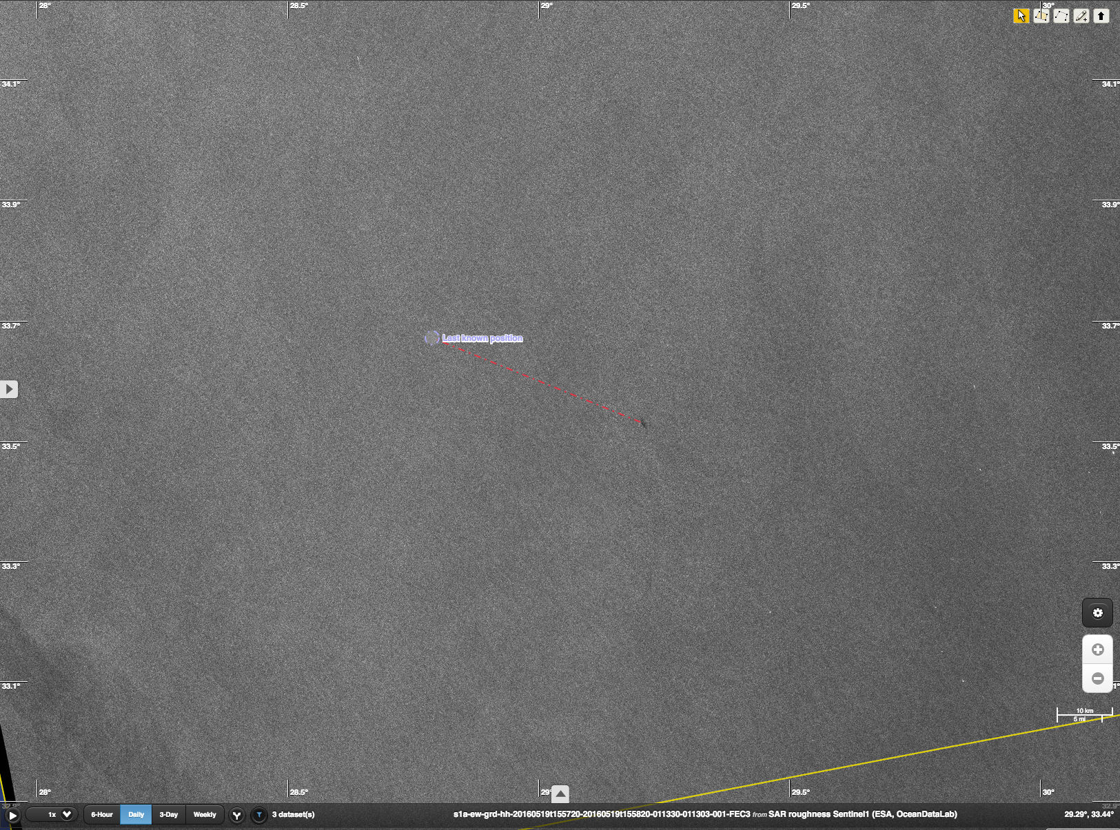
English: The Sentinel-1A radar satellite detected a slick in the eastern Mediterranean Sea – in the same area that EgyptAir flight MS804 disappeared early morning of 19 May 2016 on its way from Paris to Cairo. Sentinel-1A acquired this image later in the day at 16:00 GMT (18:00 CEST) in ‘extra-wide swath mode’ of 400 km with horizontal polarisation. ESA provided it to the relevant authorities to support the search operations. The 2 km-long slick is located at 33°32' N / 29°13' E – about 40 km southeast of the last known location of the aircraft. Although there is no guarantee that the slick is from the missing airplane, this information could be helpful for the search.
Read full article |
| Date | |
| Source | http://www.esa.int/spaceinimages/Images/2016/05/Sentinel-1A_detects_slick |
| Author | European Space Agency |
| Permission (Reusing this file) |
contains modified Copernicus Sentinel data [2016], processed by ESA & Sentinel-1 Mission Performance Centre,CC BY-SA 3.0 IGO |
| Title | Sentinel-1A detects slick |
| Mission | Sentinel-1 |
| Activity | Observing the Earth |
Licensing
[edit]
This file is licensed under the Creative Commons Attribution-ShareAlike 3.0 IGO license.
- You are free:
- to share – to copy, distribute and transmit the work
- to remix – to adapt the work
- Under the following conditions:
- attribution – You must give appropriate credit, provide a link to the license, and indicate if changes were made. You may do so in any reasonable manner, but not in any way that suggests the licensor endorses you or your use.
- share alike – If you remix, transform, or build upon the material, you must distribute your contributions under the same or compatible license as the original.
File history
Click on a date/time to view the file as it appeared at that time.
| Date/Time | Thumbnail | Dimensions | User | Comment | |
|---|---|---|---|---|---|
| current | 15:57, 6 May 2017 | | 1,625 × 1,205 (536 KB) | Fæ (talk | contribs) | == {{int:filedesc}} == {{information | description = {{en|1=The Sentinel-1A radar satellite detected a slick in the eastern Mediterranean Sea – in the same area that EgyptAir flight MS804 disappeared early morning of 19 May 2016 on its way from Paris... |
You cannot overwrite this file.
File usage on Commons
The following page uses this file: