File:Sentier GR5 au Plan de la Grassaz direction Tignes (août 2023).JPG
Jump to navigation
Jump to search

Size of this preview: 800 × 596 pixels. Other resolutions: 320 × 239 pixels | 640 × 477 pixels | 1,024 × 763 pixels | 1,280 × 954 pixels | 2,560 × 1,908 pixels | 3,204 × 2,388 pixels.
Original file (3,204 × 2,388 pixels, file size: 2.74 MB, MIME type: image/jpeg)
Captions
Captions
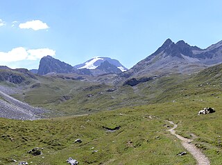
Sight of GR 5 hiking trail crossing Plan de la Grassaz locality towards Col du Palet pass and Tignes, in Vanoise national park, Savoie, France.
Summary
[edit].JPG&action=edit§ion=1)
| Description |
English: Sight of GR 5 hiking trail crossing Plan de la Grassaz locality towards Col du Palet pass and Tignes, in Vanoise national park, Savoie, France.
Français : Vue du sentier GR 5 traversant l'alpage du Plan de la Grassaz en direction du col du Palet et de Tignes, dans la parc national de la Vanoise, en Savoie. |
| Date | |
| Source | Own work |
| Author | Florian Pépellin |
| Permission (Reusing this file) |
CC-BY-SA 4.0 |
| Camera location | | View this and other nearby images on: OpenStreetMap |
|---|
.JPG¶ms=045.478912_N_0006.849985_E_globe:Earth_type:camera_heading:160.00&language=en)
Licensing
[edit].JPG&action=edit§ion=2)
I, the copyright holder of this work, hereby publish it under the following license:
This file is licensed under the Creative Commons Attribution-Share Alike 4.0 International license.
- You are free:
- to share – to copy, distribute and transmit the work
- to remix – to adapt the work
- Under the following conditions:
- attribution – You must give appropriate credit, provide a link to the license, and indicate if changes were made. You may do so in any reasonable manner, but not in any way that suggests the licensor endorses you or your use.
- share alike – If you remix, transform, or build upon the material, you must distribute your contributions under the same or compatible license as the original.
| Annotations | This image is annotated: View the annotations at Commons |
.JPG)
File history
Click on a date/time to view the file as it appeared at that time.
| Date/Time | Thumbnail | Dimensions | User | Comment | |
|---|---|---|---|---|---|
| current | 18:34, 4 September 2023 | | 3,204 × 2,388 (2.74 MB) | Floflo (talk | contribs) | {{Information |Description={{en|1=Sight of ''GR 5'' hiking trail crossing ''Plan de la Grassaz'' locality towards ''Col du Palet'' pass and ''Tignes'', in ''Vanoise'' national park, Savoie, France.}} {{fr|1=Vue du sentier ''GR 5'' traversant l'alpage du ''Plan de la Grassaz'' en direction du ''col du Palet'' et de ''Tignes'', dans la parc national de la ''Vanoise'', en Savoie.}} |Source={{own}} |Date=2023-08-19 |Author=Florian Pépellin |Permission=CC-BY-SA 4.0 }} Category:GR 5... |
You cannot overwrite this file.
File usage on Commons
There are no pages that use this file.
.JPG&oldid=885150581)