File:Seattle - North Central Waterfront and Queen Anne Hill from the water.jpg
Jump to navigation
Jump to search
Size of this preview: 800 × 533 pixels. Other resolutions: 320 × 213 pixels | 640 × 427 pixels | 1,024 × 683 pixels | 1,280 × 853 pixels | 2,560 × 1,707 pixels | 6,000 × 4,000 pixels.
Original file (6,000 × 4,000 pixels, file size: 10.89 MB, MIME type: image/jpeg)
Captions
Captions
Add a one-line explanation of what this file represents
Summary
[edit]
| Description |
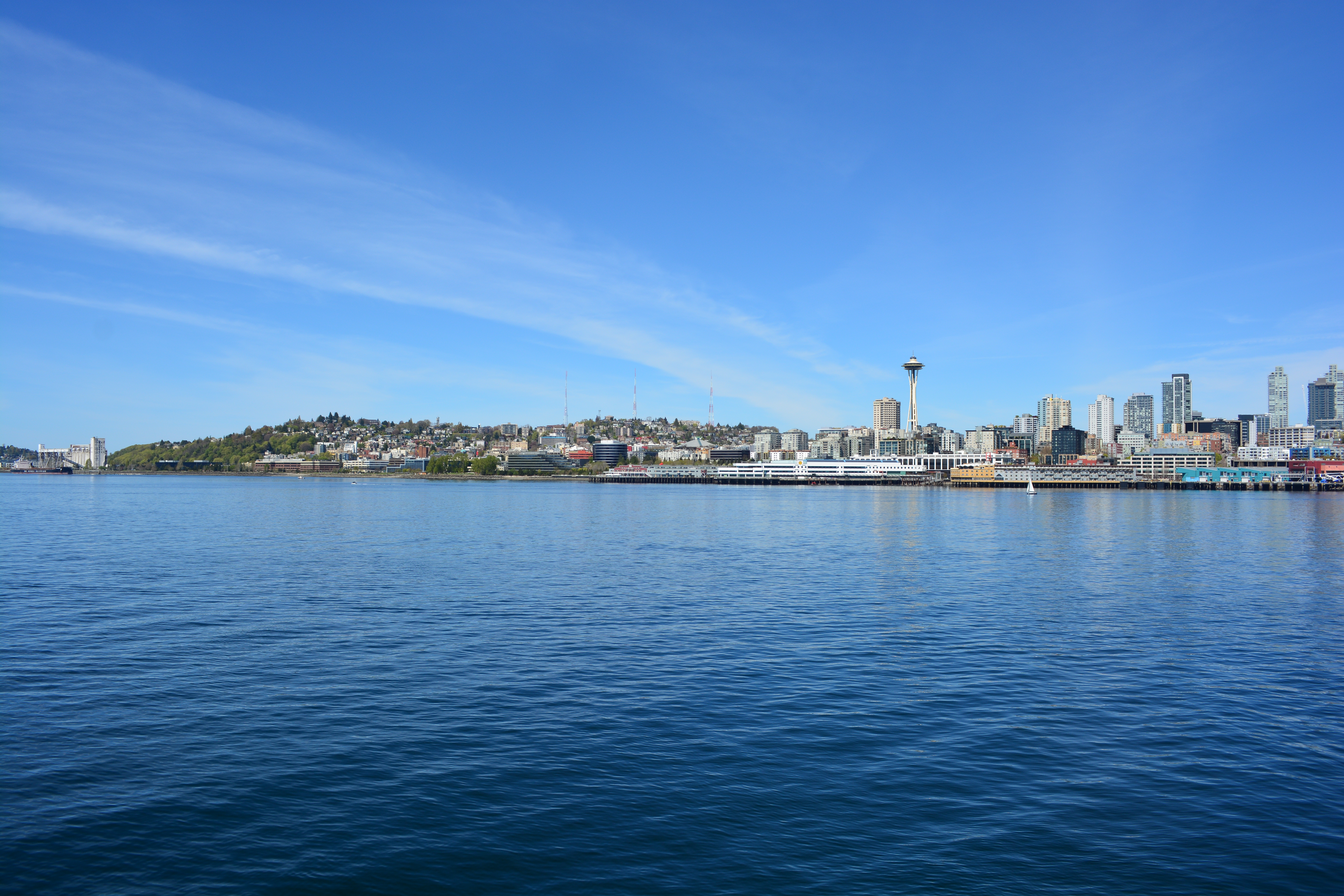
English: North Central Waterfront, Seattle, Washington, from a Washington State Ferry on Elliott Bay. Queen Anne Hill (at left), Belltown (at right)in the background. The Space Needle just right of center. Along the water at extreme left, Terminal 86 (grain terminal); then Myrtle Edwards Park and (behind that) the businesses on Elliot Ave W.; Pier 70, Pier 69 (Port of Seattle cruise ship terminal), The Edgewater (formerly Edgewater Inn), and part of Pier 66. |
| Date | Taken on 14 April 2024 |
| Source | Photograph by Joe Mabel |
| Author | Joe Mabel |
| Permission (Reusing this file) |
Joe Mabel, the copyright holder of this work, hereby publishes it under the following license: This file is licensed under the Creative Commons Attribution-Share Alike 4.0 International license. Attribution: Joe Mabel
|
File history
Click on a date/time to view the file as it appeared at that time.
| Date/Time | Thumbnail | Dimensions | User | Comment | |
|---|---|---|---|---|---|
| current | 18:45, 16 May 2024 | | 6,000 × 4,000 (10.89 MB) | Jmabel (talk | contribs) | == {{int:filedesc}} == {{Information | Description = {{en|North Central Waterfront, Seattle, Washington, from a Washington State Ferry on Elliott Bay. Queen Anne Hill (at left), Belltown (at right)in the background. The Space Needle just right of center. Along the water at extreme left, Terminal 86 (grain terminal); then Myrtle Edwards Park and (behind that) the businesses on Elliot Ave W.; Pier 70, Pier 69 (Port of Seattle cruise ship terminal), The Edgewater (formerly Edgewater Inn), and pa... |
You cannot overwrite this file.
File usage on Commons
There are no pages that use this file.