File:Seaton Sluice Harbour - geograph.org.uk - 11901.jpg
Jump to navigation
Jump to search
No higher resolution available.
Seaton_Sluice_Harbour_-_geograph.org.uk_-_11901.jpg (640 × 480 pixels, file size: 175 KB, MIME type: image/jpeg)
Captions
Captions
Add a one-line explanation of what this file represents
Summary
[edit]
| Description |
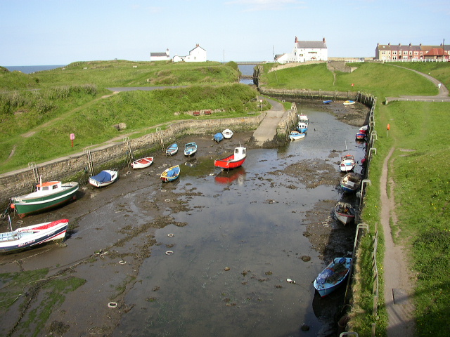
English: Seaton Sluice Harbour. From a natural rill at the beginning of the 17th century, the harbour of Seaton Sluice was transformed by Sir Ralph Delaval between 1660 and l690 to satisfy an increasing demand for Hartley coal. Stone walls were raised, piers were built at the north entrance to the harbour and an ingenious system of sluice gates installed, which enabled the tidal waves to scour the bottom of the channel to remove sand and silt which continually built up in the harbour entrance. |
| Date | |
| Source | From geograph.org.uk |
| Author | Ken Brown |
| Attribution (required by the license) | Ken Brown / Seaton Sluice Harbour / |
| Object location | | View this and other nearby images on: OpenStreetMap |
|---|
_&language=en)
Licensing
[edit]

|
This image was taken from the Geograph project collection. See this photograph's page on the Geograph website for the photographer's contact details. The copyright on this image is owned by Ken Brown and is licensed for reuse under the Creative Commons Attribution-ShareAlike 2.0 license.
|
This file is licensed under the Creative Commons Attribution-Share Alike 2.0 Generic license.
Attribution: Ken Brown
- You are free:
- to share – to copy, distribute and transmit the work
- to remix – to adapt the work
- Under the following conditions:
- attribution – You must give appropriate credit, provide a link to the license, and indicate if changes were made. You may do so in any reasonable manner, but not in any way that suggests the licensor endorses you or your use.
- share alike – If you remix, transform, or build upon the material, you must distribute your contributions under the same or compatible license as the original.
File history
Click on a date/time to view the file as it appeared at that time.
| Date/Time | Thumbnail | Dimensions | User | Comment | |
|---|---|---|---|---|---|
| current | 04:57, 30 January 2010 | | 640 × 480 (175 KB) | GeographBot (talk | contribs) | == {{int:filedesc}} == {{Information |description={{en|1=Seaton Sluice Harbour. From a natural rill at the beginning of the 17th century, the harbour of Seaton Sluice was transformed by Sir Ralph Delaval between 1660 and l690 to satisfy an increasing dema |
You cannot overwrite this file.
File usage on Commons
There are no pages that use this file.