File:Seat of operations during the Civil War, 1861-1865. LOC 99447173.jpg
Jump to navigation
Jump to search
Size of this preview: 800 × 455 pixels. Other resolutions: 320 × 182 pixels | 640 × 364 pixels | 1,024 × 583 pixels | 1,280 × 728 pixels | 3,150 × 1,792 pixels.
Original file (3,150 × 1,792 pixels, file size: 1.05 MB, MIME type: image/jpeg)
Captions
Captions
Add a one-line explanation of what this file represents
Summary
[edit]| Description |
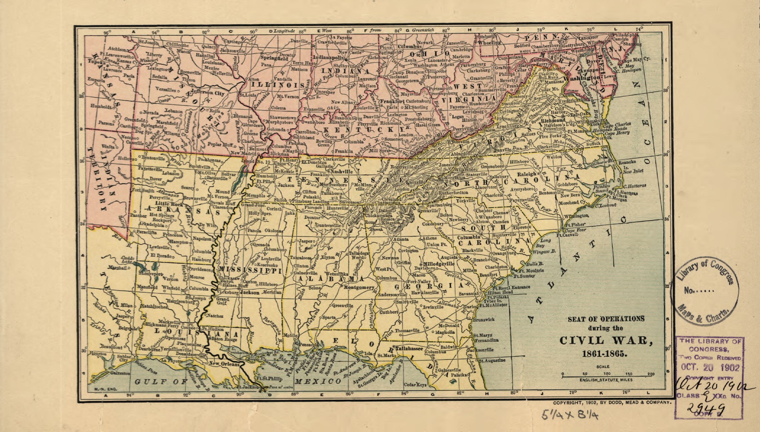
English: Scale ca. 1:10,500,000. LC Civil War Maps (2nd ed.), 63.5 Copyright, 1902, by Dodd, Mead & Company. General map of the southern states. Description derived from published bibliography. Available also through the Library of Congress web site as raster image. |
||
| Title | Seat of operations during the Civil War, 1861-1865. | ||
| Shelf ID | G3701.S5 1902 .D6 | ||
| Date | |||
| Source | https://www.loc.gov/item/99447173/ | ||
| Author | Dodd, Mead & Company | ||
| Permission (Reusing this file) |
|
||
| Other versions |
|
||
| Location | United States | ||
| Part of | Military Battles And Campaigns · American Memory · Civil War Maps · Catalog · Geography And Map Division | ||
| Subject | United States · Maps · Civil War · History |


Licensing
[edit]
|
This is a faithful photographic reproduction of a two-dimensional, public domain work of art. The work of art itself is in the public domain for the following reason:
The official position taken by the Wikimedia Foundation is that "faithful reproductions of two-dimensional public domain works of art are public domain".
This photographic reproduction is therefore also considered to be in the public domain in the United States. In other jurisdictions, re-use of this content may be restricted; see Reuse of PD-Art photographs for details. | ||||
File history
Click on a date/time to view the file as it appeared at that time.
| Date/Time | Thumbnail | Dimensions | User | Comment | |
|---|---|---|---|---|---|
| current | 10:50, 12 June 2018 | | 3,150 × 1,792 (1.05 MB) | Fæ (talk | contribs) | LOC Maps https://www.loc.gov/item/99447173/ #12914 |
You cannot overwrite this file.
File usage on Commons
The following page uses this file: