File:Sea Ice off Newfoundland and Labrador, Canada (MODIS 2020-01-17).jpg

Original file (2,719 × 2,134 pixels, file size: 1.15 MB, MIME type: image/jpeg)
Captions
Captions
Summary
[edit].jpg&action=edit§ion=1)
| Description |
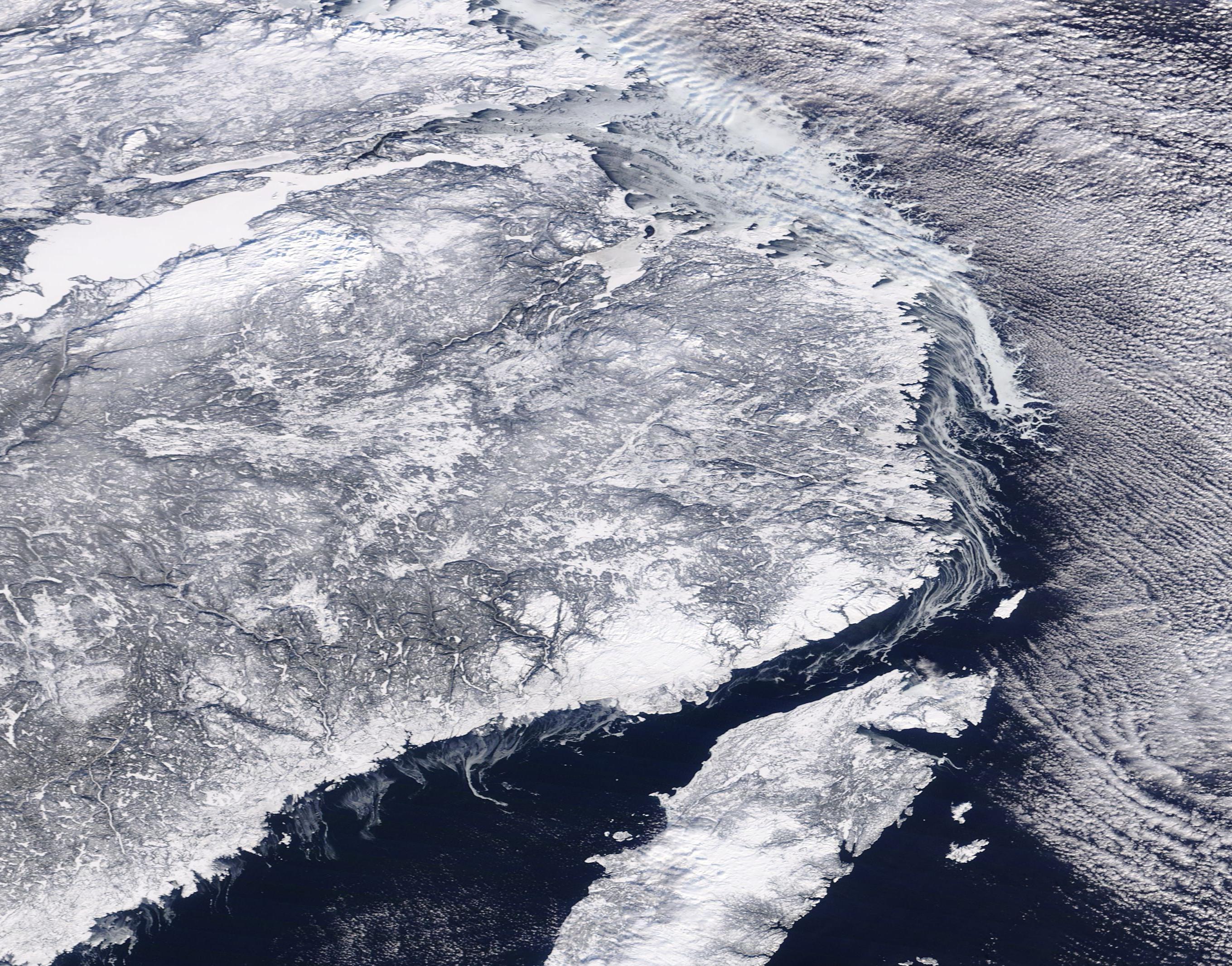
English: A relatively narrow shelf of sea ice clung to the coasts of Newfoundland and Labrador, Canada, as clouds covered the sky in mid-January, 2020. The Moderate Resolution Imaging Spectroradiometer (MODIS) on board NASA’s Terra satellite acquired a true-color image of the wintery scene on January 14.
The sea ice appears bright white, often with curving filigrees off the edge. These filigrees are created by the underlying currents in the Labrador Sea. Finer filigrees of forming sea ice curl off the coast along the Gulf of St. Lawrence, which separates the mainland and the island of Newfoundland. Environment Canada reports that on January 15, sea ice thicknesses in Newfoundland and Canada ranged from merely bergy water (floating chunks of ice) over the Belle Island Bank and the South Labrador Sea to consolidated first-year ice covering Lake Melville. Lake Melville appears as the large area of very bright white in the northwest section of this image. Cloud cover also appears white, but the clouds are aligned in long, parallel rows which flow above the ice and water. These rows are called “cloud streets” and are formed through nature’s attempt to balance differences in energy. As frigid air moves over relatively warmer water, columns of warmer air, called thermals, rise into the atmosphere, moving warmth away from the sea surface. The air masses rise until they hit a warmer layer of air (temperature inversion). This layer acts like a lid, causing the rising thermals to roll and loop back on themselves, forming parallel cylinders of rotating air. On the upper side of the cylinders (rising air), clouds form. Along the downward side (descending air), skies are clear. |
||
| Date | Taken on 14 January 2020 | ||
| Source |
Sea Ice off Newfoundland and Labrador, Canada (direct link)
|
||
| Author | MODIS Land Rapid Response Team, NASA GSFC |
| This media is a product of the Terra mission Credit and attribution belongs to the mission team, if not already specified in the "author" row |
Licensing
[edit].jpg&action=edit§ion=2)
| This file is in the public domain in the United States because it was solely created by NASA. NASA copyright policy states that "NASA material is not protected by copyright unless noted". (See Template:PD-USGov, NASA copyright policy page or JPL Image Use Policy.) | ||
 |
Warnings:
|
File history
Click on a date/time to view the file as it appeared at that time.
| Date/Time | Thumbnail | Dimensions | User | Comment | |
|---|---|---|---|---|---|
| current | 03:22, 17 February 2024 | | 2,719 × 2,134 (1.15 MB) | OptimusPrimeBot (talk | contribs) | #Spacemedia - Upload of http://modis.gsfc.nasa.gov/gallery/images/image01172020_250m.jpg via Commons:Spacemedia |
You cannot overwrite this file.
File usage on Commons
There are no pages that use this file.
.jpg&oldid=909380868)