File:Sea Basins South Ossetia.svg
Jump to navigation
Jump to search

Size of this PNG preview of this SVG file: 675 × 600 pixels. Other resolutions: 270 × 240 pixels | 540 × 480 pixels | 864 × 768 pixels | 1,153 × 1,024 pixels | 2,305 × 2,048 pixels | 6,082 × 5,404 pixels.
Original file (SVG file, nominally 6,082 × 5,404 pixels, file size: 549 KB)
Captions
Captions
Add a one-line explanation of what this file represents
Summary
[edit]
| Description |
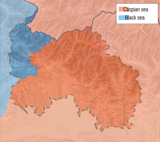
English: Map of Drainage Basins in South Ossetia — by Sea. |
| Date | |
| Source | Own work |
| Author | Bouron |
Licensing
[edit]
I, the copyright holder of this work, hereby publish it under the following licenses:
This file is licensed under the Creative Commons Attribution-Share Alike 3.0 Unported license.
- You are free:
- to share – to copy, distribute and transmit the work
- to remix – to adapt the work
- Under the following conditions:
- attribution – You must give appropriate credit, provide a link to the license, and indicate if changes were made. You may do so in any reasonable manner, but not in any way that suggests the licensor endorses you or your use.
- share alike – If you remix, transform, or build upon the material, you must distribute your contributions under the same or compatible license as the original.

|
Permission is granted to copy, distribute and/or modify this document under the terms of the GNU Free Documentation License, Version 1.2 or any later version published by the Free Software Foundation; with no Invariant Sections, no Front-Cover Texts, and no Back-Cover Texts. A copy of the license is included in the section entitled GNU Free Documentation License. |
You may select the license of your choice.
File history
Click on a date/time to view the file as it appeared at that time.
| Date/Time | Thumbnail | Dimensions | User | Comment | |
|---|---|---|---|---|---|
| current | 09:03, 13 May 2023 | | 6,082 × 5,404 (549 KB) | Iktsokh (talk | contribs) | A partially recognized state with disputed legal status, on internationally recognized Georgian territory. |
| 09:30, 26 February 2015 |  | 6,082 × 5,404 (549 KB) | Insider (talk | contribs) | Reverted to version as of 19:43, 18 June 2010 | |
| 18:16, 14 February 2015 |  | 6,082 × 5,404 (549 KB) | Giorgi Balakhadze (talk | contribs) | Fixing border | |
| 19:43, 18 June 2010 |  | 6,082 × 5,404 (549 KB) | Bouron (talk | contribs) | text fixed | |
| 19:36, 18 June 2010 |  | 6,082 × 5,404 (549 KB) | Bouron (talk | contribs) | +legend | |
| 19:34, 18 June 2010 |  | 6,082 × 5,404 (546 KB) | Bouron (talk | contribs) | fixed | |
| 19:32, 18 June 2010 |  | 6,082 × 5,404 (550 KB) | Bouron (talk | contribs) | fixed | |
| 19:28, 18 June 2010 |  | 6,082 × 5,404 (551 KB) | Bouron (talk | contribs) | == {{int:filedesc}} == {{Information |Description={{en|1=Location map of South Ossetia}} |Source={{own}} |Author=Soslanx |Date=2009-11-22 |Permission= |other_versions=File:RSOLocatorMap.png }} Category:Maps of South Ossetia == {{int: |
You cannot overwrite this file.
File usage on Commons
The following page uses this file:
File usage on other wikis
The following other wikis use this file:
- Usage on ru.wikipedia.org